Aruba is an island country located in the heart of the Southern Caribbean. It is a constituent country of the Dutch Kingdom and part of the three westernmost islands of the Leeward Antilles. The country is a top tourist destination receiving over 2 million tourists annually. So, how big is Aruba in miles and square miles?
Aruba covers an area of approximately 69.5 square miles. It is longest at its northwestern and southeastern points, measuring 20 miles and 6 miles across at its widest point.
As a small island, Aruba does not have a huge population but has a wonderful landscape and several cities. And don’t bounce because
Table of Contents- 1. Wariruri
- 2. Urirama
- 3. Arashi
- 4. Manchebo Beach
- 5. Dos Playa
- 6. Andicuri
- 7. Dunes/Dooms
- 8. Rodgers Beach
- 9. Druif
- Surfing In Aruba: What To Pack?
- Your Surfboard (optional)
- GoPro Surfboard Mount
- Quick Dry Clothes
- Aruba Surfing FAQs
- Are there lifeguards on Aruba beaches?
- Can I learn to surf in Aruba?
- What beach in Aruba has waves?
- Can you buy a surfboard in Aruba?
- How big are the waves in Aruba?
- Final Thoughts on Aruba Surfing
What is Aruba’s Geography?
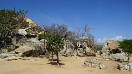
Aruba is generally flat, with the landscape consisting of igneous rock, limestone, and quartz diorite. The island’s highest point is Mount Jamanota, at an altitude of 617 feet. You will also find several steep-sided hills across the island, like Hooiberg, reaching a height of 560 feet.
Other notable features on the island include stacked monolithic boulders such as the Ayo and Casibari Rock formations.
The island also had a natural arch formed from limestone arch, measuring 100 feet long and 25 feet high, but this collapsed in September 2005. Aruba’s famous white sandy beaches are in the south and west, where the island comes alive with resorts, shopping centers, and casinos.
The island’s north comprises a rugged coastline and limestone cliffs, resulting from strong ocean currents and continuous wind. You will also find dunes as you travel further inland, making the area ideal for Aruba’s adventure tours.
How Many People Live in Aruba?
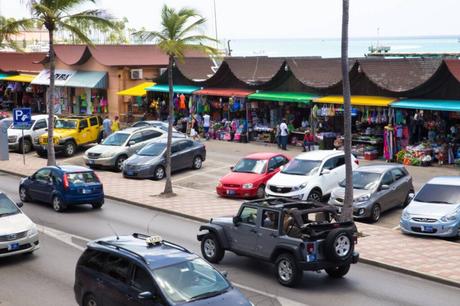
According to the 2020 census, Aruba has a population of 108,166. Around 75% of the population is Mestizo (mixed European/ Amerindian descent), 15% is black, and the remaining 10% is other ethnicities.
The main languages on the island are Papiamento at 69.4%, Spanish at 13.7%, English at 7.1 %, Dutch at 6.1 %, and Chinese at 1.5%.
Most of the Aruban population is multi-lingual, making it easier for tourists to communicate when vacationing on the island.
The island also welcomes refugees from neighboring countries like Venezuela, with a population estimate of 17,000, around 15% of the island’s population, as of 2019.
Most Arubans are Roman Catholics accounting for about 75.3% of the population. The most significant houses of worship are the St Ann’s Church, Chapel of Alto Vista, and Church of San Nicolas.
How Many Cities are in Aruba?
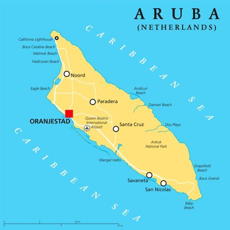
Unlike other Caribbean destinations, Aruba has no major cities. It comprises six districts, with most of the island’s population residing in Oranjestad and San Nicolaas. Here is an overview of each district.
1. Oranjestad
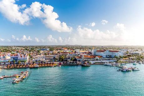
The district is on the southern coast of the island. It is the capital of Aruba and is the largest of all districts. Oranjestad is divided into two districts for census purposes and has a population of 29,998.
The city is also the island’s main entry point, hosting the Queen Beatrix International Airport, Paardenbai, the largest port for cruise ships, and Bacadera, the main cargo port. The city has also been expanding due to land reclamation efforts resulting in tourist attractions like the Renaissance Marketplace and Queen Wilhemina Park.
Other attractions near the city are Renaissance Island, a 40-acre barrier reef island of the coast and home to Aruba’s only private beaches. There is also an offshore diving site created by the deliberate sinking of a Convair 400 and a Beechcraft 18. Flamingoes are also present on Renaissance Island but are not native to Aruba.
2. San Nicolaas
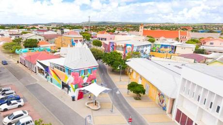 Source: bugbog.com
This is the second largest city in Aruba and lies 12 miles southeast of Oranjestad. It saw major development in 1924, thanks to the establishment of an oil refinery by the Lago Oil and Transport Company.
As per the 2020 census, the city’s population is 15,283, most of which originates from the rest of the Caribbean and British Caribbean. There is also a huge number of Afro-Aruban descendants whose ancestors settled in the area when the oil refinery was operational.
San Nicolaas has a vibrant art scene, with most buildings featuring hand-painted murals portraying the island’s culture, museums, art galleries, and souvenir shops lining the city’s promenade. The main tourist hotspot is Baby Beach, located in the south of the city, famous for its calm water and good snorkeling sites.
3. Noord
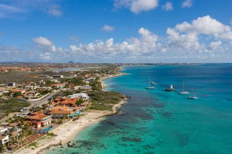 Source: realestatearuba.aw
Noord is the second largest district by population, with an estimate of about 21,945 inhabitants. It features several hotels, beaches, restaurants, and malls. It is also home to some of the island’s most notable attractions, including an ancient Amerindian Settlement of the Caquetio people and Cas Tin Tin, a pristine rural house from the early 20th century, open for public viewing.
4. Paradera
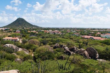
This small town near the northeast end of Aruba is a census region of the island. It covers an area of approximately 7.88 square miles and has a population of 12,024. Settlements and neighborhoods within the census region include Ayo, Shiribana, and Piedra Plat.
5. Santa Cruz
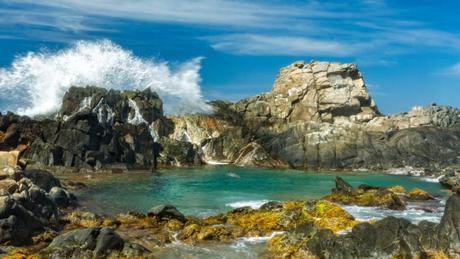
The Santa Cruz district is located in central Aruba and is home to Arikok National Park, which covers nearly 18% of Aruba’s total landmass. The total area of Santa Cruz is 15.85 square miles, with a population of 12,870.
6. Savaneta
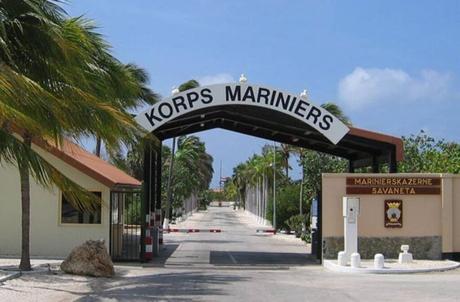 Source: newsarchive.visitaruba.com
Savaneta lies in the southeastern region of Aruba, occupying an area of 10.72 square miles and is home to approximately 11,518 inhabitants. The district was Aruba’s capital during the Spanish occupation in the 16th century. Once the Dutch conquered the island, the governor lived in Commander’s Bay but moved the government to Paardenbaai, now Oranjestad, in 1797.
Commander’s Bay now serves as a base for the Aruban Military, the Netherlands Marine Corps, The Netherlands Coastguard, and Royal Netherlands Navy. It is also known as the Marine Barracks Savaneta.

