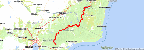
 Australian Alps Walking Track map on HiiKER
Located in the Central Highlands and Alpine regions of Victoria, the Australian Alps Walking Track is considered to be one of the most difficult long-distance bushwalking trails. The full hiking trail is 429 miles (690km), has over 27,000 metres (88,582ft) of ascents and descents, and can take anywhere between 5-8 weeks to complete. Using a trail app like Hiiker can make your adventure easier. If you ever lose your bearings you can just whip out your phone and make sure you’re still on the trail.

As this is one of Australia’s most difficult trails it is recommended for experienced hikers only and a lot of careful planning is needed if looking to complete the full trail as a thru-hike.
A few highlights of the Trail
There are a few key points along this trail that really stuck out to us. These sections are absolute must-visits even if you don’t intend to take on the full 690km trail.

The Bogong High Plains
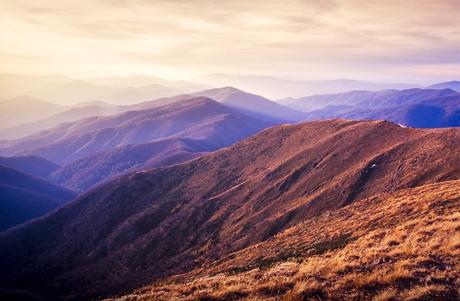
With so much to see here, you would be mad not to spend some time exploring the area. The highest peak in Victoria, Mount Bogong, is located here and we highly recommend summiting the 1,986 meter (6,515 feet) tall mountain. It’s not an easy hike as you have to tackle tall peppermint and stunted snow gum forest, but once you make it to the top you will be treated to the most magnificent 360-degree views of the alpine landscape.
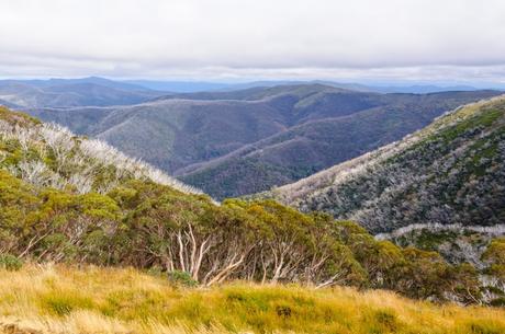
If the highest peak in Victoria wasn’t enough for you, you will also come across high alpine ridgelines with breathtaking panoramic views and some very unique birdlife around the wetlands. There really is something for every type of hiker in this area.

Macalister Springs to Mount Howitt
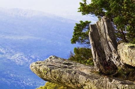
Once you’ve reached the infamous Macalister Springs, home to the memorial Vallejo Gantner Hut, it is only a short 1.85 miles (3km) trek to the summit of this mighty Australian peak. You will start off by following a terrifyingly narrow ridge with sheer drops and breathtakingly beautiful views into the headwaters of the Macalister River and the Wonnangatta River.
The views from the summit of Mount Howitt and Howitt West are considered to be some of the best along the Australian Alps Walking Track. With a gorgeous unsheltered rolling summit, Mount Howitt offers views of the nearby Mount Speculation, the Razor, and the jagged Cross Cut Saw. The 1,735 meter (5,692ft) peak also offers views of mountains way off in the distance including Mount Feathertop, Mount Buffalo, and Mount Buller. Hopefully, these views will give you inspiration for your next hike in the Australian Alps.
Kiandra to Tharwa
Kiandra is the perfect area to take in some fascinating cultural hikes and walks before you set out on the last 62 miles (100km) of the full Australian Alps Walking Track. Take in the beautiful grassy plains and forest-covered mountains as you make your way across one of the most beautiful sections of this full trail.
Keep an eye out for the diverse wildlife that thrives in the grasslands of this section. You can come into contact with anything from kangaroos to dingos along the pleasant flatland areas.

The Main Range
The Main Range is the dominating section of the Australian Alps Walking Track. Many of the peaks here surpass 2,000 metres (6,562ft) and it includes Mount Kosciuszko, Australia’s highest mountain. As well as all the mountain peaks dominating the skyline, the Main Range is also home to beautiful wildflowers and glistening glacial lakes. We highly recommend hiking this section in the summer when the wildflowers are in full bloom.

