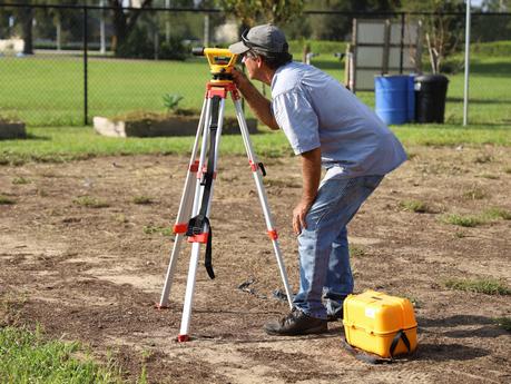
The discussion shall commence with what is meant by contour surveying. Contouring in surveying indicates determining the elevations of different points on the land and fixing all these points of the same horizontal positions in the contour map.
A contour, in the land property arena, is the outline of a landmass. The prime objective to conduct contour surveys is for identifying any noticeable difference in the existing land's elevation. A contour map, in land surveying, is an illustrated map with contour lines, like a topographic map showing the hills, valleys, gentleness of slopes and slope steepness.
So, What Are the Specific Purposes of Contouring?
A contour map is extremely useful as it provides a lot of valuable information related to the land. are done at the beginning of the engineering projects for the railways, roads, dams, canals, buildings and more.
The Two Distinct Contour Surveying Methods
The surveyors take up contour surveying in two different methods -
I. Direct Method of Contour Surveying
The contours to be located in this method are directly traced out in the ground - the surveyors locate and make a number of points on each contour. Then, they survey these points and plot the plan from the effect of the contours drawn through them. Although very slow, tedious and time-consuming yet direct method of contour surveying is extremely accurate. A lot of time has to be invested to search the points of the same elevation for the contours. Wherever great accuracy is needed, a direct method of contour surveying is best suitable for those areas.
II. Indirect Contour Surveying Methods
In Indirect Contour Surveying methods, the surveyors take the levels at some selected points and then reduce their levels. By this method, they establish the horizontal control first and then find the levels of those points. As they are done tracing the points on the plan, they mark the reduced levels and next interpolate the contour lines between the selected points.
The Marked Uses of Contour Surveying
- Contour surveying depicts different landforms' slopes and sizes on the map.
- These provide the land's clear and complete image along with the surrounding area.
- Just by reading contour intervals, sorting out the different elevations of the landscape becomes easy.
- Contouring is the basis for the colouring method.
Through contour surveys, it is easy to understand the visual vertical and horizontal shape, that is the land topography. You need to understand the land contours to easily visualize and map water flows across and through the property during rainfall, where will it be collected, where the soil could be eroded away and more such vital water flow characteristics. It is from this simple base, that water flow models can be developed, maps streamed and the best places for creating dams and silt traps determined.
