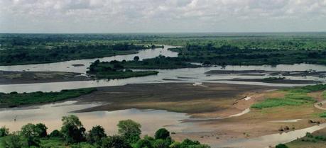
 An aerial photograph of the flooded Tana River which is in the Rift Valley area during Joint Task Force Kenya, operation Noble Response.
The largest share of Kenya’s electricity supply comes from hydroelectric stations at the dams along the upper Tana River, as well as the Turkwel Gorge Dam in the west. And to keep the lights on, Kenyan authorities want to know how much water they can expect in upcoming rainy seasons. A multi-university research team have developed a computer model to help manage the hydropower in Kenya.
Fifty-eight percent of Kenya’s power supply stems from the country’s hydropower system in the Tana River basin. That system will shut down if the basin’s reservoirs don’t have enough water.
Sankar Arumugam, a hydro-climate modeling researcher at NC State, led a multi-university team of scholars who developed a suite of computer modeling tools to predict seasonal rainfall and streamflow in the Tana River basin, so that water managers can make informed decisions about how to manage their reservoirs.
The research team pulled together a collection of climate forecast models and models that predict seasonal streamflow, which is the volume of water that flows into a water body from all of its tributaries. They also modeled the Masinga dam reservoir, which is the linchpin of the Tana River basin’s hydropower system.
“We use the climate models to predict rainfall, and then use that data to predict streamflow,” Arumugam says. “We then plug those findings into the model of the Masinga dam reservoir—and that tells us how much water can be released by the dam without endangering the hydropower operation.”
It’s a problem that Arumugam has been collaborating with Kenyan researchers on for more than a decade. He began doing research in Kenya while working as a researcher at Columbia University in the early 00s, and kept returning to the issue after coming to NC State in 2005.
“The goal is to provide Kenya with a reliable power supply while also meeting other water use demands, such as irrigation and ecosystem needs,” Arumugam says. And being able to predict rainfall and streamflow can make a huge difference for water managers.
The climate of Kenya varies by location, from tropical along the coast to temperate inland to arid in the north and northeast parts of the country. The “long rains” season occurs from March/April to May/June. The “short rains” season occurs from October to November/December. The rainfall is sometimes heavy and often falls in the afternoons and evenings. The temperature remains high throughout these months of tropical rain. The hottest period is February and March, leading into the season of the long rains, and the coldest is in July and August.If water managers know it is likely to be a wet season, they can release more water from the dam reservoirs. This allows them to create more electricity and helps them prevent possible flooding in the future. If the models predict a dry season, water managers can release the water more slowly, to ensure there is enough water to generate power in the months to come. Predictions of a dry season can also help government officials determine what other resources, such as fossil fuels, will be necessary to help meet the country’s power needs.
“Because we are using multiple models, our results are 10 percent more reliable than previous techniques that use only single models,” Arumugam says.
“We are now using this approach to develop similar tools for other water systems,” Arumugam says, “including systems in North Carolina.”
Oludhe C. , Sinha T., Devineni N., Lall U. (2013). The Role of Multimodel Climate Forecasts in Improving Water and Energy Management over the Tana River Basin, Kenya Journal of Applied Meteorology and Climatology DOI: 10.1175/JAMC-D-12-0300.1
