 GR: As extreme weather events become more common, they will become more extreme, guaranteeing more exciting weather news cycles than ever before.
“Earlier this week something rather interesting and disturbing happened to the Jet Stream.
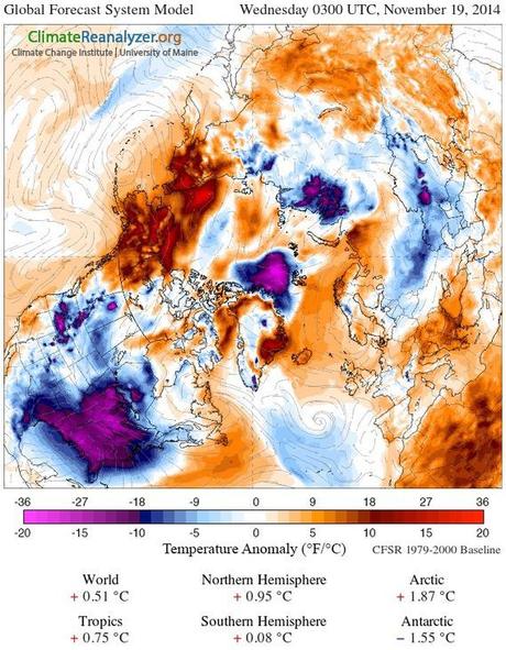
“In the extreme northwest, a large heat pool over Alaska and the Beaufort Sea in the Arctic Ocean kept temperatures in the range of 10 to 36 degrees Fahrenheit above average. To the south, a powerful super typhoon, gorged on Pacific Ocean waters ranging from 1-2 C hotter than normal, raced into the extratropical region of the Central and Northern Pacific. And to the north and east, the cold core that normally resides over the North Pole began slipping south.
“As the supertyphoon’s remnants hit the warm weakness in the Jet Stream near Alaska, it bombed out into a monster extra-tropical low. This kicked warm air even further north, causing a whiplash in the Jet and driving the cold air core south over Canada.
“Cold air rocketed down over the relatively warm waters of the Great Lakes. These waters, having soaked up the heat of yet another hotter than average American summer, squeezed an epic amount of moisture and storm feeding energy out into the air. Over the past two days, the result was as kind of thundersnow storm that parked itself in one location, dumping foot after foot of snow. By the time the final tally was counted this morning, as much as 8 feet had fallen over Buffalo New York. A record amount never before seen in so short a time span and yet so far ahead of winter.”
Source: robertscribbler.wordpress.com
Read the full article to see why flooding is expected early next week.

