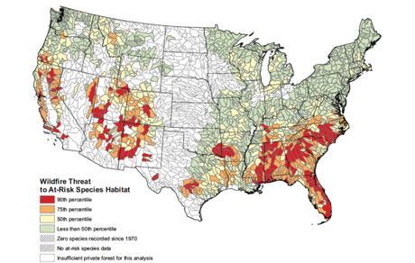
“Maps are great tool for locating wildlands and wilderness areas we might want to visit, but they can also tell us much more. Maps can shed light on much larger stories about our changing country and our disappearing wilderness.
“In the past century, American has undergone rapid change – from technology to population growth to energy development- and these changes of modernity are also transforming American lands. Some of these changes become quite visible when a map is the storytelling device. We’ve worked to bring some of those to light in this collection of maps that demonstrate how truly fragile our wildlands are.”
The first map shows how much pavement we’ve placed over once living soils.
- Proliferating pavement
“It’s hard to imagine America without its gorgeous mountains and graceful rivers but that’s exactly what is shown in this map of only roads created by Boston-based design firm Fathom. The four million miles of roads (shown in black) that cover the U.S. have a powerful impact on us, from pollution runoff to floods to heat islands. When near wildlands, they also create barriers for migrating wildlife and interrupt other ecological processes. That’s why we support conserving roadless areas.” Source: wilderness.org
GR: These maps illustrate some of the consequences of all the things our presence does to our environment. For many, the changes are unimportant, but for others the changes are a gut-wrenching ruin of so many of our favorite places. Take a look.

