As I tried to find more information on this canyon, I encountered one big problem: it doesn't have an official name... nothing on the USGS quads or any of the topo maps that I own. That made finding information on it difficult. I speculated that at least the head of the canyon was accessible but had no idea whether its length would be traversable. All I knew was that the starting elevation was about 6200 feet with the Gunnison River at 4725ft. This elevation was lost over roughly six miles of canyon. I was looking at a twelve mile round-trip with a 1500ft climb on the way out. It didn't sound too bad. Based on what I could see on Google Earth, there weren't any big drops in the canyon. Sure, it tightened up in places and looked to be filled with boulders, but I figured I had a shot to make it.
So, on Tuesday, March 27th, I set out. To access the area, I traveled south on US 50 from Grand Junction and then followed Colorado 141 out of Whitewater. Cactus Park can be reached by K 2/10 Road, which I initially blew by. The road is roughest right off the highway but then becomes more manageable in the park. I had thought to check out a small slot canyon in the park but couldn't find it easily and decided I'd try again if I had time on the way out.
The weather was warm for late in March. Highs were close to 70ºF, if I recall. Eventually, I came to a locked gate which marks the Cactus Park trailhead. It was late morning and the sun was shining with thin patches of cirrostratus.
As I set out on the trail, I quickly crossed the wash which eventually carves the canyon that I planned on exploring. So, I followed the wash and left the trail. I noticed immediately that the area had interesting geology. The wash seemed to fan out on big plates of a blue-green shale which I believe are in the Morrison Formation, possibly the Brushy Basin Member (see this map of geology in the area: - the drainage just north of Triangle Mesa)
The Morrison Formation is not known as the most scenic geologic layer to look at unless you're into dinosaur bones. For the most part, the first portions of the canyon were highly-reflective light colored sandstones and shales lined with sparse Piñon-Juniper wood. I also noticed another set of footprints in the gravel and sand that lined the wash. The footprints soon disappeared, however, leading me to believe that someone had thought to explore the wash a little but then had turned back or left the canyon into the surrounding hills.
Just over a mile and a half into my hike, the wash became more difficult to navigate. The canyon seemed to be filled with boulders and small drops which I had to climb over and find ways down. I then came across a flat area, where I paused for a moment.
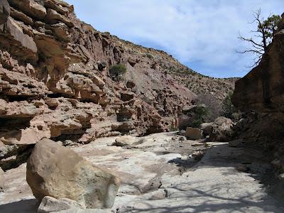
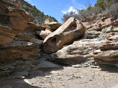 Looking back up-canyon at some of the obstacles that required more hands-on hiking.
Getting going again, I soon realized I might be at the end of my hike. I came upon a huge drop... perhaps forty or fifty feet high with sheer ledges on both sides. The view down the canyon nice, but I realized that even if I did make it down, I'd get the pleasure of climbing through the boulder-strewn canyon below.
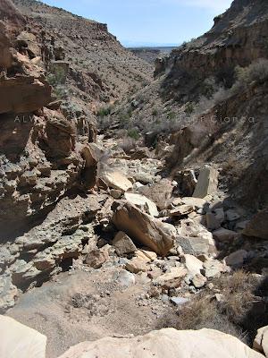 Looking down the *first* big drop.
I paced the ledge for a while like a caged tiger before deciding that if I cut through some bushes on the right, I could probably climb down a broken slope there. I wasn't about to be conquered, so I made my way through the bushes and gingerly down the slope, deciding it would be possible to return that way as well.
As I speculated, the path below was also treacherous. Climbing over boulders for a little while is fun, but when your entire path is paved in them, it becomes taxing.
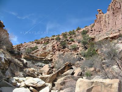 Terrain below the first big drop.
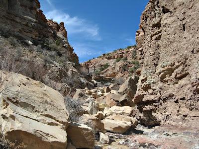 Looking back to the first big drop.
Eventually, the boulders became less impeding and the wash opened back up again. After a while, I noticed the familiar colors of the Entrada Sandstone making their appearance along the cut of the wash.
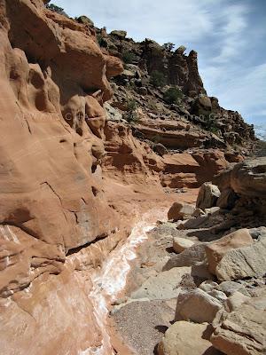 Enter Entrada
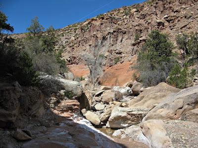
The Entrada certainly added a lot of color to the canyon and with it, water seemed to seep out of the porous material and pool in places. The water, of course, attracts wildlife so it was no surprise that I would suddenly hear movement nearby.
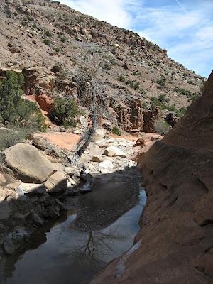 Pooling of water along the Entrada Sandstone
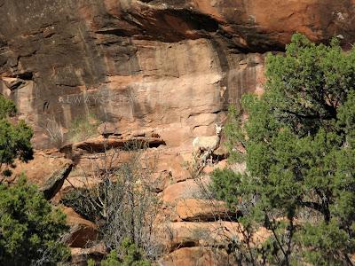
I watched as several desert bighorn scrambled up out of the side of the canyon. I was intent on not distressing them too much the BLM likes to remind the humans not to disturb the sheep.
After they had made their escape, I continued on, spooking a yet unseen sheep. She jumped out of the shadows on one side of the canyon, topping a tall boulder in its middle and then bounding to the other side. The entire feat was extremely impressive. It's hard to imagine an animal with such small feet could have such traction. I'm still amazed to this day.
I had a few anxieties about the hike concerning my ability to make it all the way to the river through unknown obstacles, but I was really starting to enjoy myself.
Yet another obstacle arrived, however, when I came across a second big drop. This one was a deep slot, cut into the Entrada with no easily observable route into the inner canyon. So, I took the long way around and ascended a bit to the south to a relatively wide slope that was covered in Piñon-Juniper. Here, I took time to observe the patina of the sandstone wall, looking for petroglyphs. It looked like a good place to carve, but I was unable to find any.
Eventually, I found a way down and took a moment to snap a photo of the drop with my cell phone. I forgot to with my real camera.
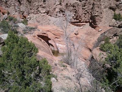 Cell phone pic of the second drop and its pool.
Onward I went. The next interesting feature was a shallow alcove which the wash cut into the Entrada. It was certainly nothing compared to the alcoves in Hunter and Mee Canyons, but nonetheless offered a bit of shade.
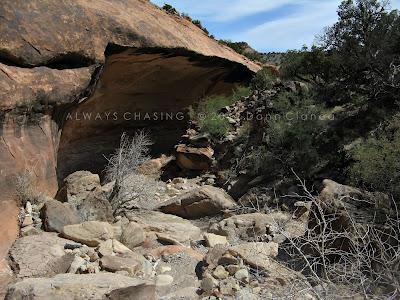
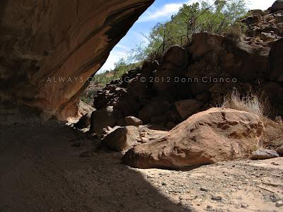
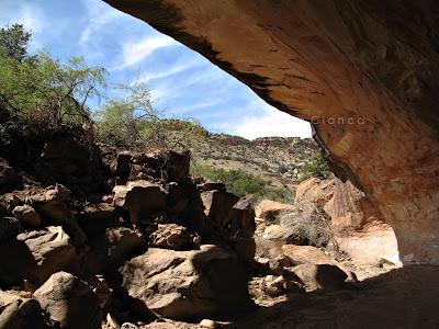
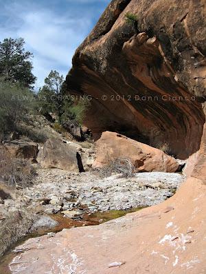
The wash seemed to trail on forever. I was occasionally impeded by boulders which filled the canyon and other small drops. But there were neat things to see as well, like these hoodoos which to me resembled a sand castle.
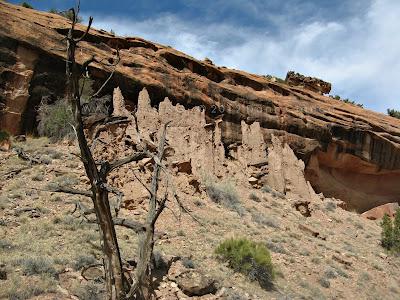
And another group, just a little ways down...
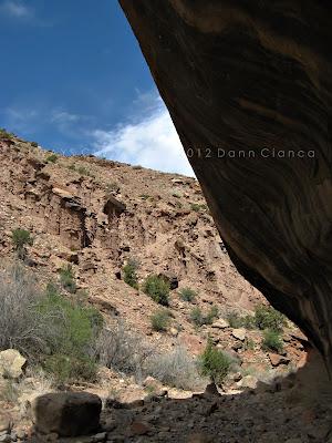
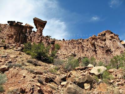
At this point, I came across a third, big drop... which I neglected to take any pictures of. Suffice it to say that it was a big one and filled with boulders. I was unable to climb straight down the 30 to 40 foot plunge, so I had to climb up on the side of the canyon and around, dropping back into a thicket of cottonwood and other shade trees. There was no direct trail or route, so it certainly required a bit of path finding. At the bottom, I reflected a little bit about how there were no footprints or trails anywhere; just the wash and the canyon to navigate. Though I know many have probably trodden through the area, it felt more personal and private than any other place I have visited on the Western Slope.
Just a few moments later, as I continued on, I caught my toe and fell face-first into the gravel of the wash. The chances of me tripping on this flat area with a soft landing compared to all of the other terrain I had already traversed was pretty low, so I feel pretty lucky that this was the place I had chosen to fall. Aside from a couple of pokes into the palm of my hand, I came away unscathed.
The canyon seemed to meander a bit below the third drop and it even tightened up into a narrow corridor. I really enjoy exploring the narrower canyons and this was no exception.
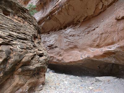
The canyon had carved down through the Kayenta and Wingate layers and opened up with steep Wingate sides. The travel was easier here; less boulder and more gravelly wash.
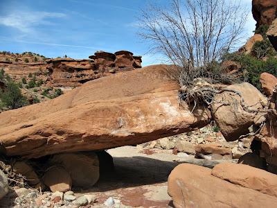 Low bridge!
I did sit down for five minutes for a water break and also pulled my phone out to see if I could get a GPS location. I had a very weak signal but after a few minutes, it seemed to narrow down to once place which made sense based on my surroundings. I realized that though it has seemed I had traveled far, I still had a good haul ahead of me!
This portion of the canyon is reasonably uneventful, however, so there's not much detail to entertain. I did find a deceased bighorn lamb under a rock but not predated. I'm unsure how it died, but I supposed that the fact that it had not been consumed spoke to a lack of a scavenging predator like a lion in the canyon. I could be wrong, however.
As far as the geology, the wash cut through the Wingate into the Chinle below and that's about as deep as it got. Though it continued to lose elevation, the rock strata actually started to rise a bit again toward the river.
As I finally approached the river, I knew that the wash actually entered private land before the confluence. I feared that this might impede my progress and sure enough, I came to a poorly constructed fence.
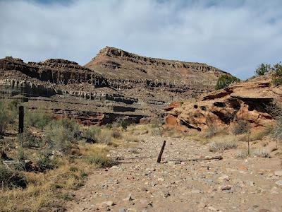
Even though I could hear the river in the distance, I elected to respect the private landowner and go around. Luckily, there was a trail to the left of the wash (going downstream), which followed the fenceline over a few hills to a corner. I now had direct access to the river across a cow-patty covered field of alluvium. I made haste to the river's edge where I enjoyed a few moments of peace.
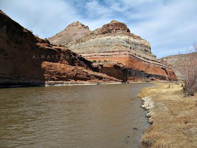 The Gunnison River and Tunnel Point
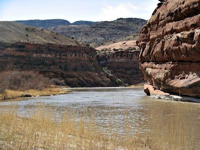 Looking downstream on the Gunnison
I stopped for a few minutes and sat on a log in the willows, taking a moment to drink some water and eat a protein bar. It had taken me roughly three and a half hours to cover the six mile distance down the canyon and it was already 3:30 in the afternoon. I knew that I'd be pushing daylight, so I quickly hit the trail again... honestly, already exhausted.
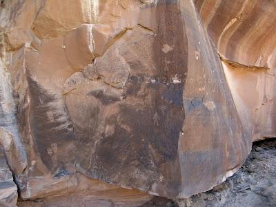
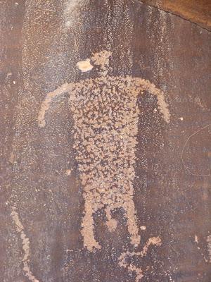
A short way up the canyon, I found myself absolutely startled to look up and see an amazing panel of petroglyphs.
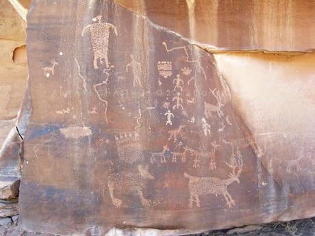
I was excited! Jumping up and down excited. It literally gave me chills, almost like discovering a new waterfall or seeing a tornado touchdown. It really had that kind of impact on me. I was really hoping to see something new and amazing on this journey and this really did it for me. The panel is obviously not unknown, but most of the dated graffiti is pre-1950. The river bottom had been previously utilized for peach orchards but is mostly just for grazing now. This isn't a canyon that is easily accessible from the river, so it's likely not overly explored. I would speculate that it is only visited by the occasional hiker and the nearby ranchers who drive cattle into the canyon's lower reaches.
Here are a few more pics from the panel...
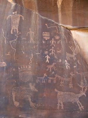
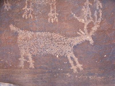
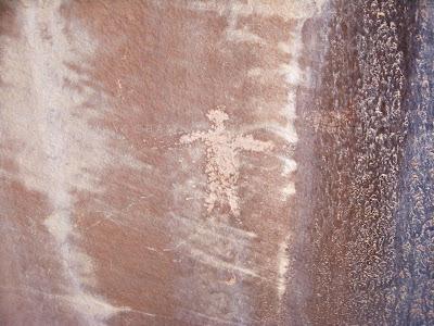
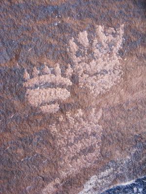
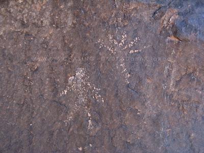
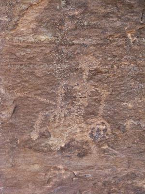
 ... and even a few more around the corner.
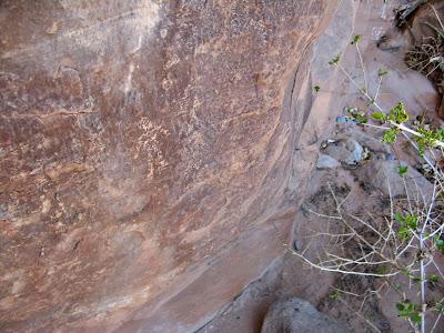
Behind a bush, I found a small canine etched into the rock as well. I'm unsure if it is a dog or coyote or perhaps something else.
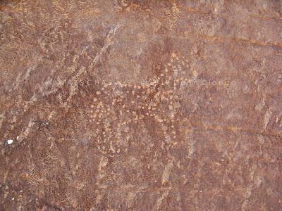
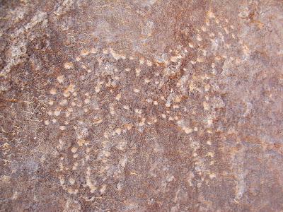
The panel is much more easily visible heading upstream than down, which is why I had missed it. I also found a panel of more modern etchings on the rock dividing the two main forks of the canyon near its mouth.
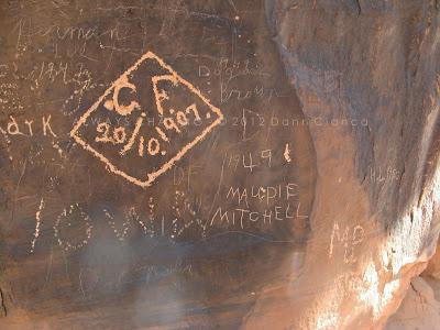
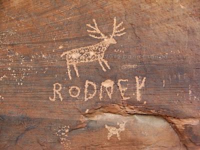 Did Rodney add his name to an existing carving(s)?
After my discover, I was pretty charged up and made haste up-canyon, back through the narrows...
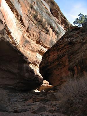
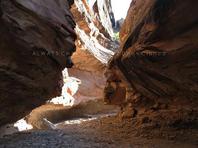
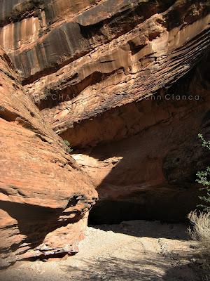
... through a small alcove...
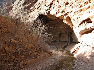
... up a number of small drops...
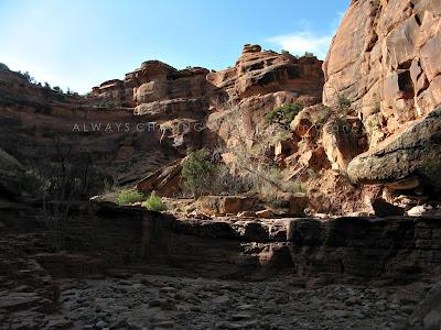
... and sharing the privacy of the area with the wildlife...
... even the sun's low light gave the canyon a bit of extra character...
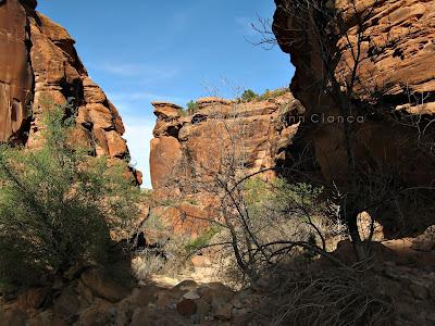
Once I reached the third drop, I realized that there might be a small cairn alongside the wash, indicating the way around. Still, there was no trail or path at all. Back up top, I took a brief moment to admire the hoodoos and decided at that moment to call the canyon "Sand Castle Canyon" since it lacked a name. Who knows, maybe it will catch on?
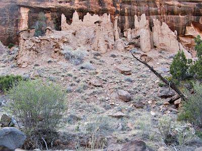 The sand castles of "Sand Castle Canyon"
That was the last image I captured. It started to get dark at that point and I still had several miles of hard terrain to contend with. The fields of boulders were more difficult to climb up than down. My body was already hurting and I was running low on water, despite bringing three large bottles with me.
There were several instances when I would stare at an obstacle, almost unwilling to tackle it, but I kept on. Ascending the first drop was the most difficult. The boulder fields above and below it were very taxing on my legs, which were turning into jello.
At the top, I squeezed the last drops of water out of the bottle and carried on. As I was coming out of the canyon and into Cactus Park, the light was very low. My phone rang to my surprise, my first real contact with anything outside of the wilderness in quite a while. It was Shannon inviting me to a meal with our coworkers at one of the sit-down chains near the mall. I was very hungry and it sounded great, but I couldn't even fathom making it in time, so I declined.
Though the ground was much more level at this point, the last mile to my vehicle was laden with dragging feet. My entire body was stiff and drained of energy. I'm almost embarrassed to admit how tired I was.
Back at my vehicle, I was almost too tired to drive, but felt ambitious enough to get back to town so I could at least have something to drink; I was completely out.
It was almost completely dark as I exited Cactus Park and headed back down into the valley. I stopped at the Dairy Queen in Orchard Mesa for a slushy or some sort, but they were out of "slush" apparently, so I had some ridiculously syrupy strawberry lemonade over ice. It didn't do much to quench my thirst.
At the end of the day, I was exhausted, but the petroglyph discovery and the accomplishment of having tackled this relatively unknown place was very rewarding and it will go down as one of my favorite hikes that I've done. Additionally and much to my astonishment, the only piece of trash that I found in the entire canyon was a popped balloon which had obviously drifted in from somewhere else, some time ago.
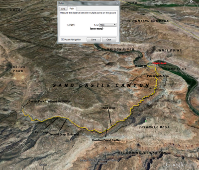
Here's a useful map: (click for a larger version)
Dann.
