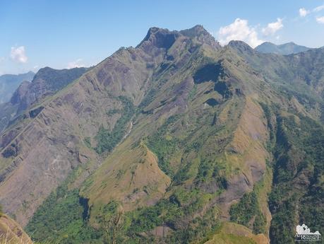
There are times that you don’t want to get off from bed and face the world (who does?). We would rather stay asleep or stay in our comfort zones. But going out of the confines of comfort, safety, and security is what adventure is all about. It is what makes life exciting and worth living. In fact, the best things in life lie outside our shell.
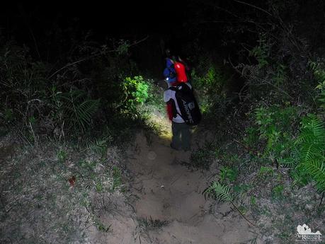
With that notion, we woke up at 3 AM, showered, and had a quick, hot breakfast. By the time we were done, our guide was outside the homestay waiting for us. Putting on our Deuter backpacks, we started our trek to Mt. Tenglawan at 4:30 AM.
As we mentioned in our teaser article, the Bakun Poblacion sits on top of a plateau. To get to Mt. Tenglawan, we had to descend a steep downhill trek towards the riverbed below the plateau in the darkness of dawn. We were the only souls walking on the trail.
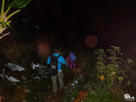
The downhill trek lasted almost an hour. By the time reached a long hanging bridge that spans a deep gorge between the base of the plateau and the base of the Tenglawan range, the sun was already peeking over the horizon.
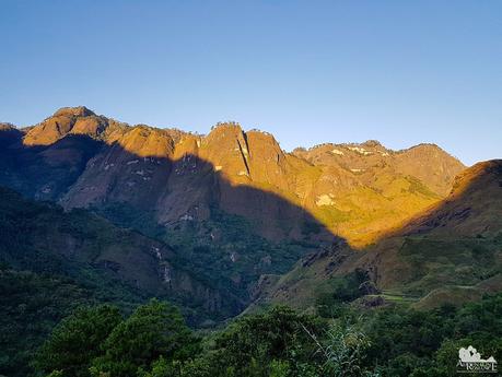
The gentle rays of the morning shone on monstrous cliffs of Mt. Kabunian right across us. And what a sight it was! It is our own version of the cliffs of Yosemite Valley in the Sierra Nevada. We’ve seen lots of spectacular scenery during our trips and adventures, but this is definitely one of our most soul-touching ones. We can’t help it but be humbled, silenced, and awed by this natural beauty.
(Photo credit: Halourd)
With all of us safely across the gorge, we started to climb Mt. Tenglawan, starting at the tip of the range. Even though the ascent was quite steep and seemingly never-ending, the soft forest soil made the trail a joy to walk on.
All around us were fields upon fields of small white wildflowers. They gave off a nice, faint, and fragrant aroma that sent waves of pleasant tingles in our noses.
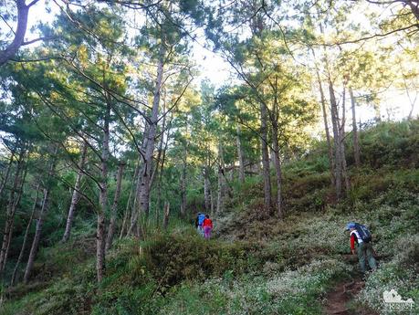
Huge pine trees were all around, seemingly looking at us as we climb. If they could talk, they would have welcomed us. Pine trees are common in this part of the Luzon Highlands. We have never known that our country has beautiful evergreen pine forests until we started climbing the Cordilleras, starting with Mt. Pulag.
If not for the ubiquitous Philippine-ness of the place, we swear we could have been climbing in some other temperate country. Hahaha!
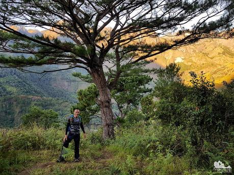
(Photo credit: Halourd)
Sometime later, we reached a small flat clearing that featured something man-made, something out of place in the bosom of Nature. We found a concrete gantry with steel cables tied to some invisible point somewhere in the deep gorge right before us. Our guide said that these are mechanical cable lifts that allow locals to quickly and easily transport goods from the lowlands to the highlands. They don’t have to laboriously climb mountains each time they need to deliver goods.
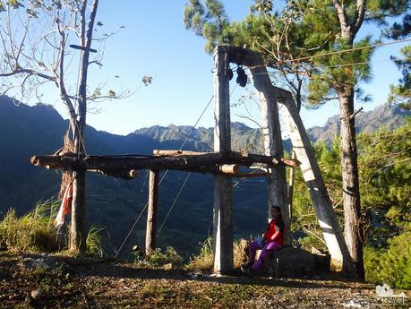
After 15 minutes of climbing, we arrived at the tail of the ridge of the Tenglawan range. From here, we have an encompassing view of the majestic mountains and terraces all around us. That settlement, perched on a plateau a few miles away, is the Bakun Poblacion, our home base for this adventure.
“Did we really walk that far this morning?” we asked ourselves, bewildered at what we just did. Although exhaustion hasn’t set yet, we know that this point was the start of the actual agony.
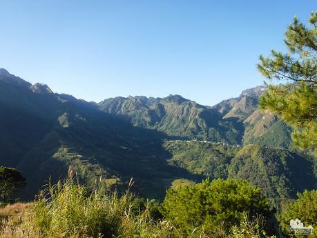
“May your trails be crooked, winding, lonesome, dangerous, leading to the most amazing view. May your mountains rise into and above the clouds.” – Edward Abbey.
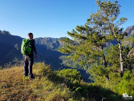
To traverse the Tenglawan range so we could reach Mt. Tenglawan itself, we need to walk at the very edge of this incredibly steep cliff. From the photo below, you can probably tell that climbers should be extremely careful.
The thick grass at the trail’s edge makes it seem like a protective barrier from the abyss. But don’t let those looks deceive you. The grass cannot hold the weight of a person, so if you make the mistake of stepping to the right…
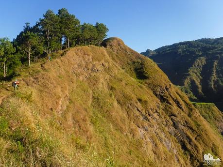
We fought unrelenting waves of vertigo as we climbed the ascending trail. We had to lean towards the left and avoid looking to the right. But that was easier said than done for the picturesque scene beyond the gorge beckoned us to stop and enjoy its majesty.
We also had to cross rotting wooden log bridges along the trail. If the bridge fails, we will surely plummet down that steep cliff.
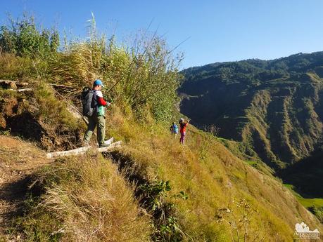
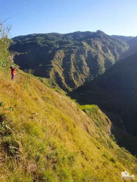
Just to give you an idea of how treacherous this ridge is, check out the photo below. Sweetie is standing at the extreme edge of the trail, taking photos of the massive rice terraces beyond.
Yes, there is an element of danger here. Yet, it is when we face danger that we truly feel alive.
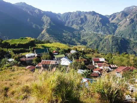
It was such a pleasant and unexpected surprise when we passed by a small, modern mountain community after we successfully traversed the ridge. Does that mean that walking along that deathly dangerous ridge is a daily trip for them?
It was still mid-morning, but we were anxious to quench off our thirst—and the day’s increasing heat—with a bottle of ice-cold Sparkle or Coke. Unfortunately, like many other far-flung communities we’ve visited, no stores were open yet. We had to contend with our lukewarm energy drink. Huhuhu!
As we walked on, we saw the entirety of Mt. Kabunian, our third and final challenge of the trilogy. It looked titanic, easily encompassing all man-made constructs that surround it. It is a visual lesson that tells us just how paltry humans are—with all our misplaced pride—in the face of nature.
Do you want to wake up each morning with a view of these exalted peaks around you? We definitely would!
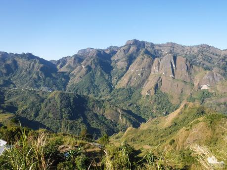
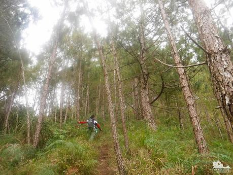
We entered a thick pine forest along the western flank of another ridge. We love walking in these pine forests. The air under the canopy is refreshingly cool and permeates the sweet scent of a gentle Earth.
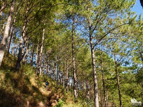
It is difficult to believe that this grassy ridge is all natural although it looks incredibly manicured. We imagined walking in fantastic meadows and peaceful prairies in fairy-tale settings as we trotted onward to the sacred summit of Mt. Tenglawan.
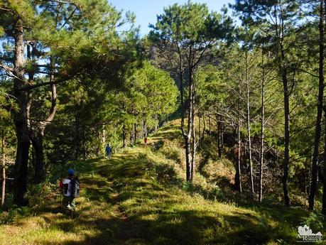
The pine forest opened up to the clear C-shaped slope that served as the gateway to Mt. Tenglawan. Without any natural or man-made obstacle, we could see the rocky slopes of Mt. Tenglawan in all its glory.
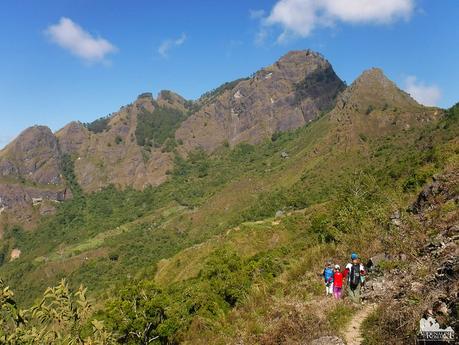
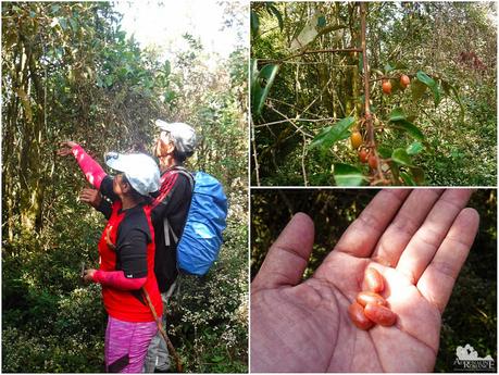
We usually eat GORP (Good Old Raisins and Peanuts) as our trail snack in many of our treks. But no GORP can ever match the subtle/sharp tastes of Mother Nature’s own nourishment. Our guide stopped at this small tree and started to pluck out pale red berries. These are called Milla Milla Vine, (Bolongnanon in Cebuano; Lingaro in Tagalog) and they’re common in Australia. What is it doing here in the Cordilleras?
The fruit has a fleshy pulp surrounding a small seed. The pulp has a pleasant sweet and sour taste, and we could actually feel our energy being replenished as we chewed one berry after the other. We harvested quite a handful and munched on them as we continued our trek.
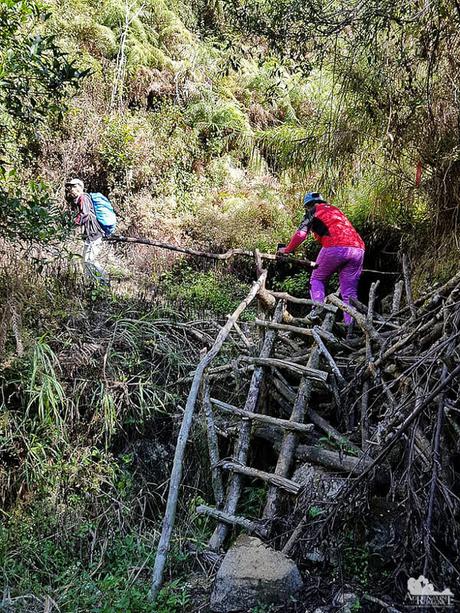
The trail also has deadfalls which we had to climb. We had to be careful because our weight could easily dislodge the pile of woods.
(Photo credit: Halourd)
There are three rules of mountaineering. “It’s always farther than it looks. It’s always taller than it looks. And it’s always harder than it looks.”
The granitic carapace of Mt. Tenglawan seemed to move farther away from us at each step towards it. But after what it seems to be forever, we stood in front of its titanic wall which seems to pierce the sky.
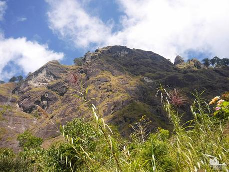
Utterly spent from the steep climb and the long ridge traverses, we decided to stop at a shady nook at the foot of the wall and took our lunch. The lack of sleep the night before took a toll. We ate our lunch without appetite then settled to a much-needed 30-minute nap.
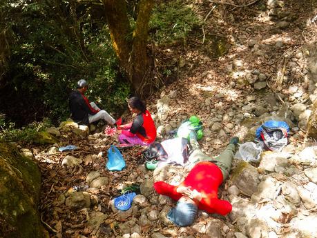
It seemed just 5 minutes since we closed our eyes when our guide woke us up to tell us we should be on our way. Still struggling to shake our weariness and exhaustion, we strapped on our backpacks and continued our way to the summit.
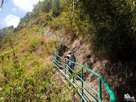
Part of the trail involved walking along a cemented stairs similar to that of Mt. Lubo. It’s ugly, yes, but we also understand that locals need to ensure their safety. Rails help prevent people from toppling over to the cliff just right beside the trail.
A far cry from the pine forests and grasslands, the small patch of mossy woods sit coolly in the depths of the rocky mountain. Strangely enough, there’s a dry stream bed here even at this height. During the rainy season, this stream would come alive, probably ending up as a waterfall that feeds the river way down below in the valley.
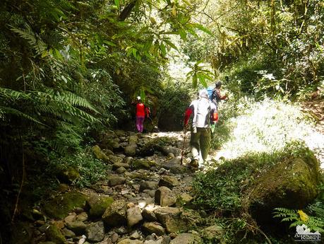
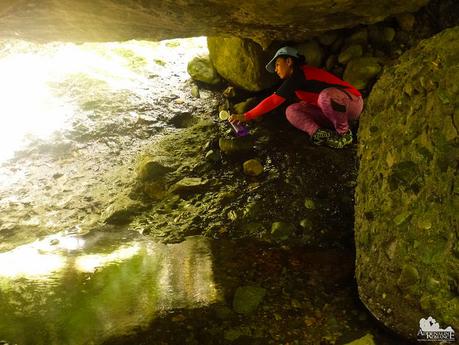
We filled our bottles with fresh water from a hidden mountain spring. The water was deliciously chilled as if it was just taken out of the refrigerator! The life-giving liquid did wonders to our parched lips and throats.
With our Nalgene bottles filled up, we started the final ascent to Mt. Tenglawan’s summit, with the trail snaking behind the rocky wall we saw earlier.
This climb was no smiling matter. The incline was incredibly steep; we reckon at around 60 to 70 degrees. We labored, stopped, caught our breath, and pushed ourselves despite every muscle in our body screaming in agony. Our minds played with us telling us to quit and go back home.
Then we heard something—human. The unmistakable sound of laughter of little kids echoed through the silent woods. Suddenly, from out of nowhere, a squad of energetic children ran and overtook us on the trail. We were flabbergasted by their energy as our guide explained that Mt. Tenglawan is their playground! Those little runts!
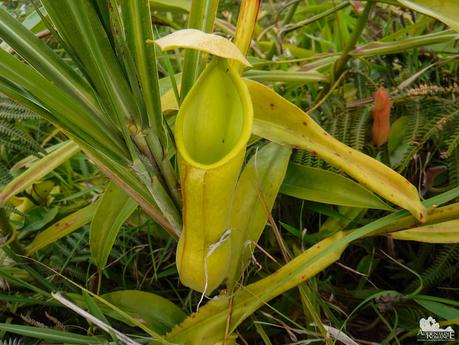
Pitcher plants dot the trail here and there. To our amazement, our guide plucked one and drank the water inside the cup!
It has been nine agonizing hours since we left the poblacion Bakun. But we prevailed as we exited the upper pine forest and stepped into the narrow summit ridge of Mt. Tenglawan at 1,943 MASL! That was one heck of an ascent! Honestly, we were already listening to the little guys inside our heads to cease this exhausting climb (most probably due to the fact that we haven’t had enough sleep the night before). But we turned a blind ear, persevered, and reached the top!
Sir Adonis of the blog Lagataw has an incredibly beautiful cover photo of him camping at the very edge of the summit. Unfortunately, with the railing installed, that photo could never be replicated.
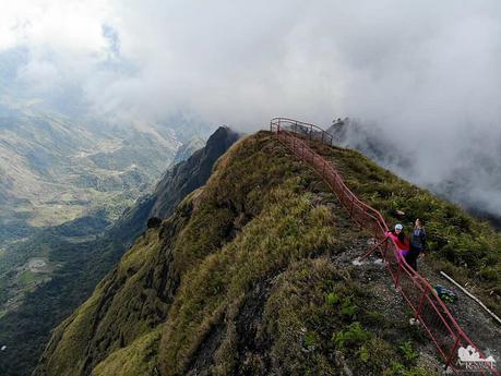
But we understand the rationale behind those ugly railings. It’s for safety purposes. You’ll see why in the next photo.
From up here, one could see the entire valley and the surrounding mountains. Unfortunately, during our climb, fast-moving clouds obscured much of the scenery.
(Photo credit: Halourd)
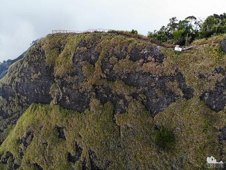
Halourd brought along his Mavic drone, so we were able to see ourselves and where we’re at. And through the eyes of the drone, we know we were right at the edge of no return. The event horizon, so to speak. Now you understand why those railings were installed.
(Photo credit: Halourd)
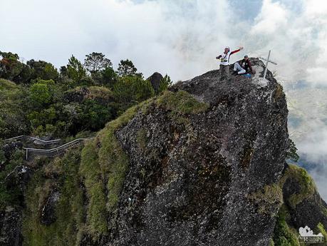
Similar to Pico de Loro, Mt. Tenglawan has a crowning glory—a gigantic monolith that stabs the clouds. Steps have been carved at the blind side so visitors can climb this sacred spot.
Needless to say, extreme care must be exercised when climbing this monolith.
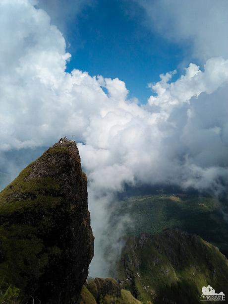
The view of the monolith from the eye of a bird. Now you understand why you should be triple careful if you want to climb here. Watch your footing; don’t play around; don’t tempt fate by standing or sitting on the edge of the promontory. In other words, don’t be stupid. Doing otherwise can be deadly.
(Photo credit: Halourd)
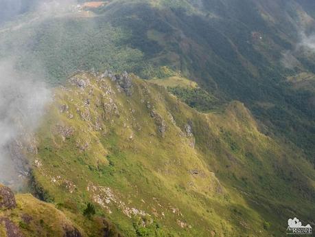
Far below us are karst formations peeking out from grassy hills like horns. They look pretty cool, and they seem to be ideal for rock scrambling.
We spent almost an hour on the summit, enjoying the view while re-energizing ourselves for the long walk back. Then we started a careful descent before our watches struck 2 PM.
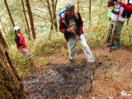
Unlike the excitement (albeit mixed with exhaustion) we felt on our way to the summit, our descent was filled with feelings of worry, trepidation, and anger. Remember the kids who went up with us? Well, they descended the mountain before us. What we didn’t know was that they set fire on the dry, dead pine barks and needles that carpeted the slope of Mt. Tenglawan.
We were extremely fortunate that we were able to exit the mountain. Dry, dead wood and leaves catch fire very easily; a small spark can cause a wildfire and raze entire mountains. The burned patch was still smoking and smoldering when we got there. Good thing we had some water to completely douse the embers.
This is why educating the locals—from schoolchildren to adults—about environmental preservation, safety protocols, and ethics is incredibly important. Most probably, those kids did it for fun, but they didn’t know the potential consequences of their action. Just imagine if the fire went out of control and we’re still at the summit.
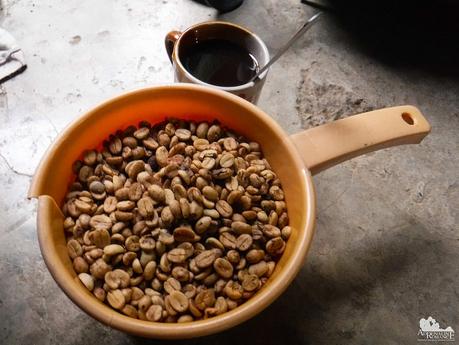
Backtracking to the highland community we passed by earlier this morning took almost 3 hours. We took a short break by stopping over a local who’s known for growing, grinding, and brewing fresh Benguet coffee. Wow! Each of us enjoyed a steaming cup of hot coffee. What a great treat after a successful summit bid. Each of us bought a kilo of coffee beans that we can roast and grind back home.
Let us tell you: properly prepared Benguet coffee is the universe’s answer to everything. If you haven’t tasted Benguet coffee, you haven’t experienced life. Hahaha!
It took us almost three hours, descending rapidly in complete darkness, to reach the Bakun poblacion. Confounding the return leg was the fact that to reach the village, we have to climb the plateau. Yes, returning home meant climbing a mountain. Jeeez!
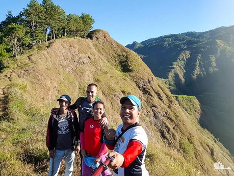
More than 15 hours later, we finally reached our homestay, utterly spent and on our last reserves of energy. Our legs were cramping, our feet were blistered, and our shoulders sagged from carrying our backpacks.
Yet, we still had the energy to smile and celebrate our success of accomplishing the longest day trek/climb we’ve ever done. It was a testament that you really don’t need to listen to the little just-quit devils that are constantly whispering to you. With determination, you can definitely accomplish anything.
(Photo credit: Halourd)
Itinerary
For our itinerary going to Bakun Poblacion from Clark International Airport and Baguio, click our Bakun Trilogy teaser.
Day 3
3:00 AM – wake up, cook and eat breakfast, prepare for the trek
4:30 AM – start trek to Mt. Tenglawan
11:00 AM – lunch
1:00 PM – reach the summit of Mt. Tenglawan, photo, break
2:00 PM – start going down
7:30 PM – reach Bakun Poblacion, dinner, wash up
9:30 PM – lights out
Budget*
For transportation-related rates, click our Bakun Trilogy Teaser.
- P 1,000 per group – guide fee for 6 people**
- P 100 per hour – overtime fee for treks that go beyond 12 hours**
- P 100 per person – environmental fee**
- P 150 per person per night – lodging at Bakun Multi-coop/baranggay house (includes beddings, kitchen, CR, bath)
* Rates are subject to change without further notice. We did not include expenses for food, souvenirs, etc.
Important Note**
Note that each mountain in the Bakun Trilogy is under separate jurisdiction when it comes to guideship. Thus, you cannot have one guide for the entire Bakun Trilogy; it’s one guide per mountain. Guide fees, overtime fees, and environmental fees are different for each mountain.
Tips
1. For contact details, check the info below. You need to get in touch with any of these contacts at least a week before your scheduled climb.
- Mr. Arthur Tolito (Bakun Municipal Tourism Officer) – 0921-211-3687 or 0905-317-2616
- Ms. Nenita Budas (BTC President) – 0918-352-372
- Mr. Peter Diclas (Bakun Trio Tour Guides and Porters Association President) – 0929-621-0448 or 0906-284-7896
2. Be prepared for a long trek. According to the guide, the average duration from Bakun Poblacion to Mt. Tenglawan and back is at least 12 hours.
3. The trek to the summit is marked with narrow and thin ridges. Be extra careful when climbing or walking on ridges or beside steep slopes.
4. Be very careful when climbing Mt. Tenglawan’s rocky promontory as the area is surrounded by deep ravines at all sides.
5. Wear arm guards and trekking pants to protect your skin from the sun and prickly plants. Also, a dry-fit shirt or rash guard will help keep you cool.
6. Wear trekking shoes or sandals with an aggressive tread. You will need a lot of traction since you will be scrambling over loose soil, loam, and slippery rocks.
7. Bring a lot of water because there is no reliable water source anywhere during the ascent.
8. Bring salt tablets or ion-filled beverages such as Gatorade, coconut water, or fruit juice aside from water. The hot sun, multiple ascents, and exposed trails can make you sweat a lot. When you lose enough ions and salts via your sweat, cramps will occur. If cramps happen, rest for awhile, drink a lot of water or ionic drinks. This will replenish the ions in your system.
9. Bring energy-rich trail food such as nuts, crackers, bread, and bananas. Don’t underestimate the mountain.
10. Pack light but do bring the following:
- water (at least 2 liters)
- jacket or windbreaker
- extra clothes
- raincoat, rain jacket, or poncho
- hat, scarf, and sunglasses (to protect yourself from the sun)
- first aid kit
- trail snacks
- hydration salts, table salt, or Gatorade (to avoid and relieve cramps)
- toiletries
- headlamp or flashlight
- whistle
- cellphone
- extra money
11. Don’t forget to waterproof your belongings. You can do this easily by wrapping your stuff inside dry sacks or dry bags.
12. Please mind your trash; do not leave any of your garbage behind.
