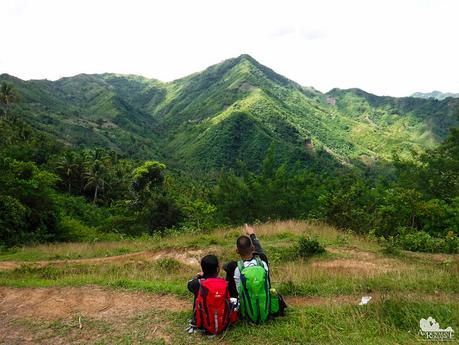
Walking through the highlands of northern Cebu is a journey of discovery. Cebu is not just about the busy city, the lovely beaches, the stunning attractions, the glitzy lifestyle, the boosted economy, the talented people. Cebu is also about rugged mountains, quiet villages, vast farms, and humble locals. The last part of Segment 4 concluded this journey of discovery.
We were in the middle of a valley, thus we couldn’t see the sun rising from the horizon. Nevertheless, we woke up early to prepare a hot breakfast and break camp. Based on the weather forecast, the day was going to be quite hot, and we don’t want to get caught under the full power of the sun.
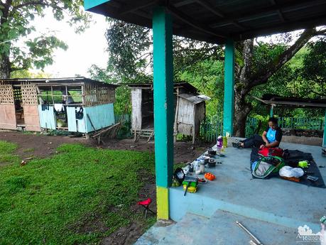
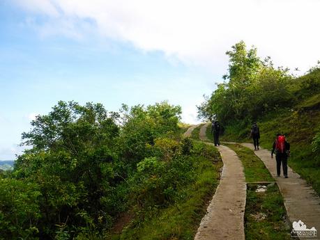
At 7 AM, we strapped on our Deuter backpacks and buckled up. A short and gentle ascent on an unfinished concrete road gave us a good warm-up.
Mountains everywhere! Although equally scenic, the north part of Cebu has a stark contrast with that of the south. The northern highland mountain ranges are still largely undeveloped due to the fear of rebels and raiders lurking in the forests. That fear, however, didn’t stop farmers from cultivating the rich mountain soil.
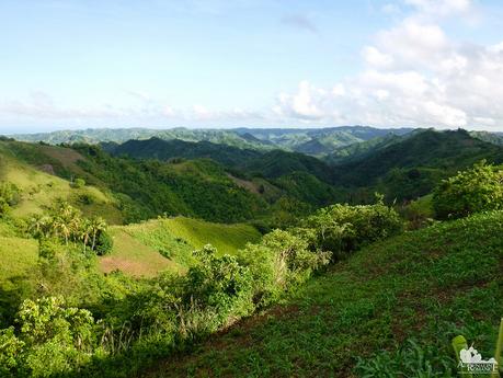
A mountain’s forest cover is extremely important. Not only does it host an uncountable variety of flora and fauna, but it also protects lowlands from landslides. The roots of the trees absorb rainwater, holding the soft soil together.
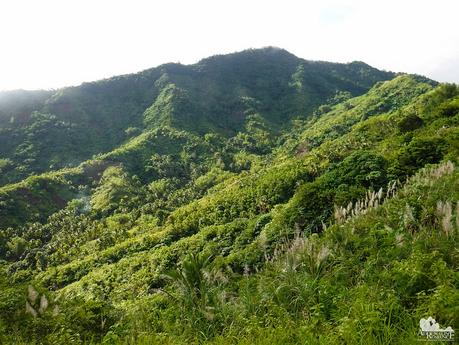
Soon, we found a concealed trail that led to our exit point. This trail was so well hidden that Sir Jing actually missed it if not for a young woman who pointed it out to us. If we followed the unfinished concrete road, it would take us all around the mountain range and cross another one to get to our exit point. And you know how we hate walking on concrete roads, right?
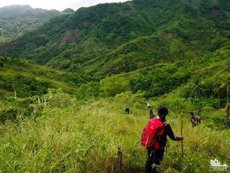
As we went down the steep slope and into the narrow valley, we were accosted by several cows and carabaos who were marking the trail as theirs. We approached the animals slowly, calmly, and cautiously. We didn’t want to startle any of these beasts because if one chooses to charge us, we’ll probably end up in the hospital.
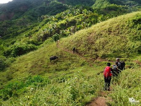
Thankfully, the cattle allowed us to pass although they did keep a baleful eye on our team. We continued on the trail until we got to the bottom of the valley. Sir Jing smiled assuringly as he gradually remembered the way. This lone house was his marker.
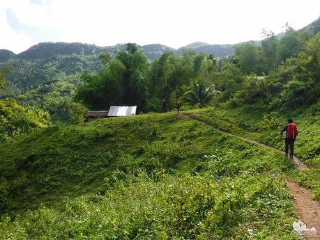
There was a weak but long downpour the night before. As such, the trail was quite muddy. Each step up the mountain threatened to suck the soles out of our shoes. Where people or cattle stepped on, the sections were quite slippery.
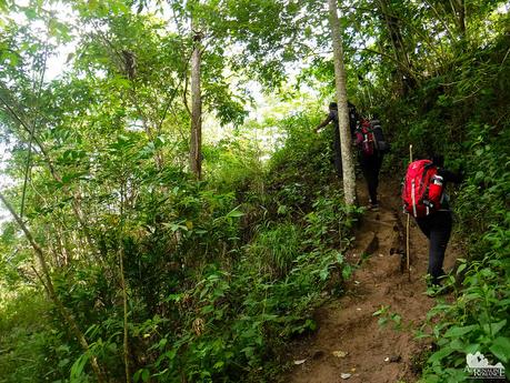
Thankfully though, the ground became less muddy as we climbed up the steep slope. But with fewer trees, we started to feel the sun’s intensifying heat although it was still 9 AM. We sipped some Gatorade to keep our ion levels up.
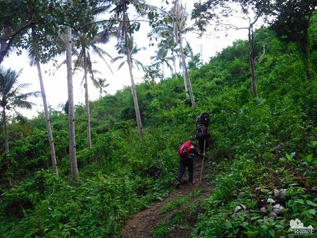
Finally, Sir Jing showed us a well-concealed landmark of Segment 4. Hidden behind a grove of trees is a stream that leads to the secret Anahawan Falls. Part of the Upper Panalipan River, it is deep in the thick jungles of Carmen. Except for locals, virtually no outsiders have ever visited this place.
As geological conduits, streams and rivers are an important part of the ocean. They are sanctuaries, life givers, economic drivers and more. What we put in them eventually end up in the ocean. Thus, it is imperative that we protect and preserve our beautiful and pristine rivers.
With great honor and pride, Team Sweetie wore our Project BLUE shirts, a testament of our commitment to Project BLUE’s advocacies in preserving our environment.
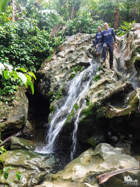
We stayed for a while at the waterfall, washing our faces, feet, and arms with the cool water! Boy, it was absolutely refreshing. If we weren’t for the fact that we have to stick to a schedule, we would have stayed here all morning and have a long shower under that waterfall.
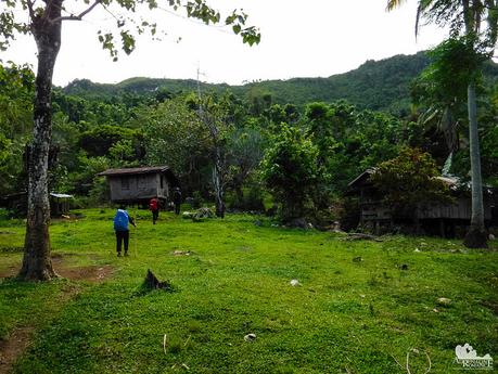
We exited the waterfall and continued on our way. We came across this family-owned plot in the middle of nowhere. Would you like to live in a place like this away from all that stress, noise, and pollution? For us, definitely!
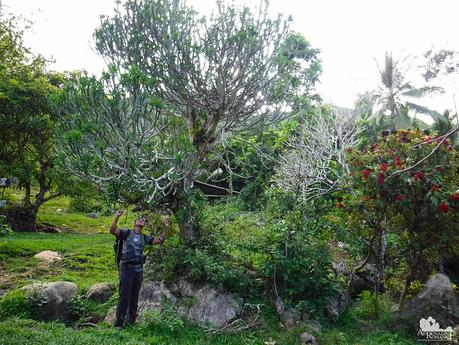
Sir Jing posed at a full-grown Oleander-leafed euphorbia, locally known as soro–soro. It was the first time we saw a soro–soro this big; most are just a couple of feet in height. According to the elderly resident whom we talked to, he said it was already there before the household moved in to live there. And by “elderly,” we mean around 80-plus years old! This soro-soro has been longer than that.
The leaves are commonly used as a spice for dinuguan (pig’s blood stew). They make great stuffing for grilled fish or chicken.
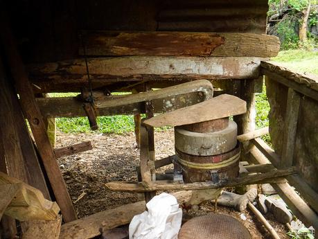
It has been quite some time since we saw a fully functional hand-powered stone mill. Corn is placed in a hole at one side of the stone mill. Then the miller pulls and pushes a handle to make the mill rotate. The ground product pours down from a carved “spigot” at one end of the mill. Yes, it’s hard work.
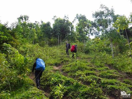
After filling up our Nalgene bottles with fresh water, we continued up the mountain. The climb was steep, but quite pleasant due to the cool wind blowing across the slope.
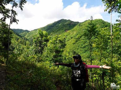
Apol’s signature pose! Hehehe! That’s Mt. Mago at the background. Yes, we came from there and out of that thick forest cover.
Sweetie and I have a different notion when it comes to dates. For us, love is best appreciated as a natural aspect of life. Simple, unobtrusive, and not forced.
It’s easy to understand why mountains, canyons, rivers, caves, and reefs are our dating venues. They are more romantic than the most expensive hotels, resorts, and restaurants in the world.
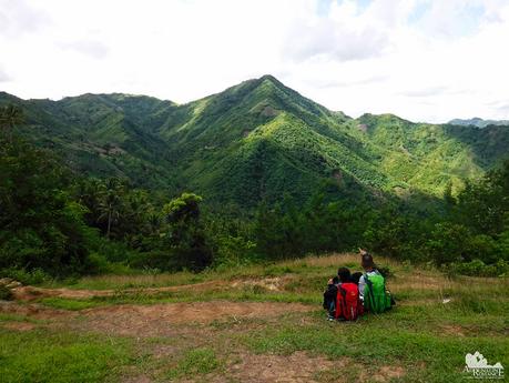
We were walking uphill at a relaxed and leisurely but continued pace. But the absence of long rests enabled us to reach the ridge by mid-morning. By our itinerary, we should have arrived here around an hour or two later!
It’s a nice lesson in life. Don’t be envious of people reaching their goals faster than you are. Each person moves through life at his or her own pace. The most important thing is not to quit. And in time, you will accomplish your dreams.
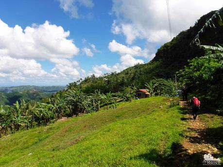
We reached the small mountain barangay of Taguini. Too bad we missed the tabo, a regular weekend event where farmers from neighboring barangays come together to sell or exchange their goods. It’s also time for people to exchange the latest news, meet with friends, or have a drink or two. Don’t miss a tabo; it’s a merry event.
We helped ourselves to some chips, bread, and ice-cold Sparkle!
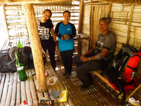
We were supposed to have lunch here. But checking our watches, we realized we still had plenty of time. Thus, we decided to hike all the way to our exit point in Caurasan, Carmen and have lunch there.
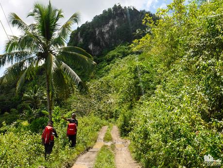
The half-complete road took us to scenic places, including this huge limestone monolith. Rock climbing, anyone? If this wasn’t so remote, this crag could be great for multi-pitch sport climbing.
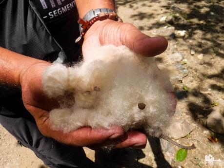
We also found some cotton-like doldol fibers, which come in large “capsules” from silk cotton trees. Doldol fibers are used as stuffing for pillows, quilts, and teddy bears. They catch flame easily, making it an ideal tinder for bushcrafting.
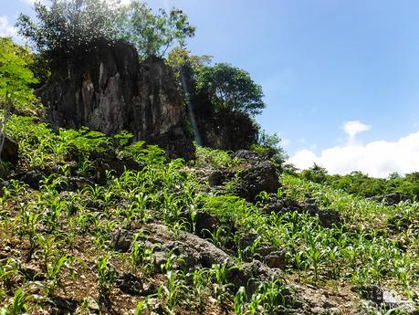
Huge rock outcroppings compete with cornfields and moringa plants for space. Yes, anything can happen here!
Great timing! Half past 12 noon, we reached our exit point in Caurasan, Carmen where we had our lunch. And it is here that we realized just how suspicious and wary people are of strangers.
You see, the barangay asked us for some ID. Accordingly, we produced our IDs—company IDs, government IDs, and a couple of licenses. But no, it has to be a VOTER’S ID! Not a passport, a driver’s license, or an SSS ID, which are the most “powerful” identification documents. It should be a voter’s ID or none at all.
We complained and pointed out that all our IDs are valid. It was not until a contact of Sir Jing came and a more “modern” member of the household pointed out that our IDs are valid when the official “accepted” our IDs and relaxed. And we ate our lunch in peace.
This is also why for the moment, no one should attempt hiking the CHT without Sir Jing as the guide.
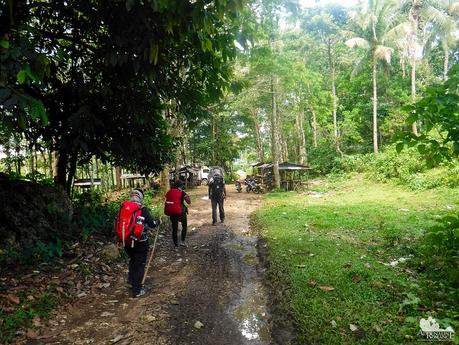
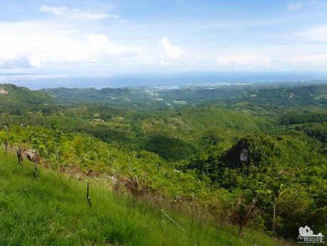
There were a couple of habal-habals around so we were able to get a ride easily. Our driver turned out to be an impromptu guide. He showed us areas where we can see beautiful sceneries of Catmon. We are going to explore more secrets here.
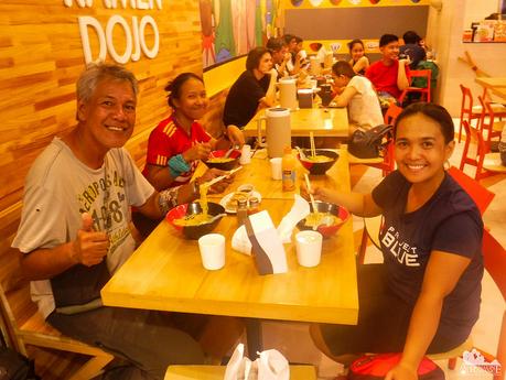
Pleased of having finished an incredibly scenic and wild segment, we celebrated our accomplishment with hot bowls of delicious ramen when we reached SM City Cebu mall.
CHT Segment 4 is a journey of discovery indeed. We had walked across what was known before as no-man’s land. Instead than violence, we saw peace. Instead of rebel-infested jungles, we found fertile forests and vast farmlands. Instead of razed ground, we saw majestic mountain ranges. Instead of hostile locals, we saw shy and humble mountain folks. It was a fantastic journey that gave us the right to call ourselves proud Cebuanos!
Itineraries, budgets, and other information for Day 1 and 2 of the CHT can be found here.
Itinerary
Day 3
5:00 AM – Assemble at Cebu North Bus Terminal
6:00 AM – arrive at Danao City, breakfast, look for Habal-habals
7:15 AM – habal-habal ride to Lawaan, Danao (delayed due to habal-habal breakdown)
8:45 AM – arrival at Lawaan, Danao. Start trek
12:30 PM – arrive at Mt. Mago summit, lunch
1:15 PM – continue trek to Bankito, Tuburan
3:00 PM – arrival at Bankito, set camp, relax
5:00 PM – prepare dinner
6:00 PM – dinner, lights out
Day 4
5:30 AM – wake up call, prepare breakfast and packed lunch, break camp
7:00 AM – start trek to Caurasan
9:00 AM – arrival at Anahawan Falls, relax
10:30 AM – arrival at Taguini
12:30 PM – arrival at Caurasan, lunch
1:30 PM – ride habal-habal to Catmon poblacion
2:30 PM – arrive at Catmon poblacion, ride a bus back to Cebu City
Budget*
- Php 45 per person – bus fare (non-airconditioned) from Cebu North Bus Terminal to Danao City
- Php 80 per person – habal-habal fare from Danao City to Lawaan
- Php 80 per person – habal-habal fare from Caurasan to Catmon Poblacion
- Php 70 per person – minibus fare from Catmon Poblacion to SM Cebu City
- TBN (to be negotiated) – Sir Jing’s professional guideship fee
* Rates can change without prior notice. Note that we didn’t include the budget for meals, snacks, and personal expenses as you may have different sharing schemes or preferences.
Tips
1. For guideship services, contact Mr. Jing Lavilles de Egurrola at 0933-3225005. You can also get in touch with him through his personal Facebook account and through the Camp Red Facebook Group. He and his partner Jonathan Apurado are the only ones who have completed the CHT.
Please have the courtesy to introduce yourself first when contacting him. Let him know that we referred you to him through our blog.
2. Presently, self-guided hikes on the CHT are not yet possible. The trail is not marked, and you could get easily lost. Moreover, locals are wary of strangers, and visiting their place unannounced can make them suspicious of your presence. This could constitute a misunderstanding or worse, a security issue. It’s mandatory to hire Sir Jing as he will get the necessary permissions and arrange the courtesy visits for you.
3. As of this writing, a guided thru-hike is not yet possible. Until the trail is marked and the Cebu Province supports its protection and documentation, only guided segment/sub-segment hikes can be done.
4. Bring a wide-brimmed hat or scarf to protect yourself from the heat. Don’t hesitate to tell the guide to stop if you feel exhausted.
5. Water sources are aplenty on the trail. You can also buy bottled water and resupply at the sari-sari stores along the way.
6. Wear arm guards and trekking pants to protect your skin from the sun and prickly plants. Also, a dry-fit shirt or rash guard will help keep you cool. Se7en makes very comfortable outdoor apparel.
7. Wear trekking shoes or sandals with an aggressive tread. You will need a lot of traction since you will be scrambling over loose soil and slippery rocks.
8. Bring salt tablets or ion-filled beverages such as Gatorade, coconut water, or fruit juice aside from water. The hot sun, multiple ascents, and exposed trails can make you sweat a lot. When you lose enough ions and salts via your sweat, cramps will occur. If cramps happen, rest for a while, drink a lot of water or ionic drinks. This will replenish the ions in your system.
9. Bring energy-rich trail food such as nuts, crackers, bread, and bananas. Don’t underestimate the trail.
10. Pack light but do bring the following:
- water (at least 2 liters)
- good-quality 3-season tent with fly sheet and groundsheet (or hammock)
- cookset (can be shared with the group)
- burner (can be shared with the group)
- cold weather gear (warmer, thermal underwear, fleece
- jacket, windbreaker or winter jacket)
- extra clothes (1 set for climbing, 1 set for sleeping, 1 set for returning home)
- trekking shoes/boots and light flip-flops (for walking around the campsite)
- raincoat, rain jacket, or poncho
- hat, scarf, and sunglasses (to protect yourself from the sun)
- first aid kit
- food for dinner, breakfast, and lunch
- hydration salts, table salt, or Gatorade (to avoid and relieve cramps)
- toiletries
- headlamp or flashlight
- whistle
- cellphone
- extra money
- trail snack
- personal medication
11. Don’t forget to waterproof your belongings. You can do this easily by wrapping your stuff inside dry sacks or plastic bags.
12. Please mind your trash; do not leave any of your garbage behind. Keep your voices low, and avoid unruly behavior.
