Wheelmap – Wheelchair Accessible Maps
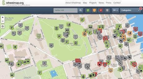
Wheelmap is an online mapping application by a German non-profit association, to help promote wheelchair accessible places (currently more than 550,000 points of interests in eighteen different languages have been added) and allow people to find out if a location is accessible or not. Wheelchair Accessible Maps help provide answers to questions such as:
Can some one in a wheel chair reach a specific restaurant? Does a popular pub have an accessible washroom?
It is a crowd source driven application so anyone can contribute to the project by tagging public places according to their wheelchair accessibility, and add new locations if they know of ones that have not been added yet. The OpenStreetMap based site provides online tools to help people plan their trips more efficiently. Users can use the mapping application to learn about accessible places and share relevant location based information with others. Users can also download wither the Wheelmap iPhone or Wheelmap Android app to use with their smart phones to help them while out and about.
The quality of information on the online mapping application varies from place to place and seems to be more popular in European countries but has been gaining use here in Canada.
It is also hoped that with public awareness raised through the use of Wheelmap, that more owners of public buildings will be encouraged to improve their location’s accessibility.
Visit www.wheelmap.org and help promote wheelchair accessible places in Canada.
Also Check Out ...

Northern Policy Institute, Northern Ontario’s independent research think tank located in Thunder Bay and Sudbury, has launched a new interactive online mapping application called North by Numbers. Their new interactive data tool can be used to display census data from Northern Ontario on an interactive map.

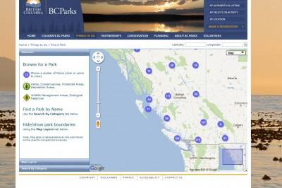
BCParks has created a simple online mapping application with data from the DataBC program to help people in British Columbia find things see and do in British Columbia by identifying the various locations of the Province’s Parks, Protected Areas, Recreation Areas and Ecological Reserves.
The online interactive mapping tool based on the Google Maps platform offers various searching abilities and provides users with some control over the features and map layers that are displayed in the mapping window. This online map application is …

Google has launched a product that they call Map Maker for Canada that provides users with the ability to add and update geographic information for millions of others to see in Google Maps. People can add businesses, create building outlines, move other peoples place markers to the correct locations.
ArcMap Tips, Tricks and Shortcuts

