My original plan for the end of my Encircle Africa expedition was to return to Gibraltar’s southernmost point, Europa Point, where I began. I liked the idea of looking back at Africa with renewed eyes. But all my reserves of energy were spent, and it was consolation enough to know that all that separated me from Africa was nine miles of often still water, after having traveled a distance equivalent to circumnavigating the earth at the equator.
There were too many tourists enjoying the late summer sun in Casemate’s Square for me to be an exception, for anyone to have asked why I might be in Gibraltar, in the way I was asked almost continuously in Africa. Instead I burned my fingers on fish and chips from the same takeaway I visited on the first day of my journey thirteen months ago, eating them on the same end of the same bench.
And so as I stood alone beyond the last bus stop in Europe, facing Africa, with roughly a year of travel ahead of me, I could think of nothing but returning to this spot at journey’s end. Success on my trip would mean returning to where I had begun, a year older, having traveled around Africa’s coastline from Tangier for over 25,000 miles.
I reached Europa Point, through streets that echoed the territory’s continuing close links with the UK. Having left the small Trafalgar cemetery, where many of the British battle dead are buried, I walked over bastions named for members of the royal family until I was trapped by the chain-link fences of land still owned by the British military and had to retrace my steps to follow a different path. The sky was clearing all the time, after a late summer storm that raged in from Africa. Everything that I was to experience there, during my circumnavigation of the continent by public transport, I couldn’t envisage.
It was at Europa Point that I got my first glimpse of Africa, earth’s oldest, and poorest, continent. Beside me stood one of the largest mosques in Europe, a sure sign of the continual flux of communities and seemingly solid frontiers both at land and at sea. My thoughts became preoccupied with worry, a fear of the unknown, a carnal fear of Africa. Safely in Europe – still on British soil – I couldn’t shake the images of a dark continent, the white man’s grave; home to warlords, killer diseases and some of the worst road accident statistics anywhere on the planet.
My journey around Africa’s coast was to be overland, and so it felt right to begin my circumnavigation by reaching Africa with surface transport. In contrast, I arrived into Gibraltar by air like any other tourist. Landing, my plane stopped the traffic; the territory’s runway cutting the only north-south road through the peninsula, the only road that leads to Spain. The name rang out from the road signs north of the tiny terminal building like a warning of imminent danger.
I chose to start in Gibraltar as I saw it as just another part of the UK. As a British Overseas Territory, I had naïvely expected no difference between my departure point at Heathrow airport and my place of arrival. I expected another British town, albeit one with Europe’s only free-living non-human primates, its Barbary macaques.
My expectations during Encircle Africa were almost always defied. Gibraltar was far from being an ordinary part of the UK. It represented in microcosm the mixing cultural identities that I encountered nine miles across the Strait of Gibraltar in Africa. A tanned, bilingual and majority Roman Catholic population bought its pints of Spanish lager, opposite Marks & Spencer, using pounds sterling. The peninsula had also been home to Moors during their push into the Iberian Peninsula, with a hammam baths complex beneath the museum, and a square Moorish castle – the largest in Andalusia – now proudly flying the Union Flag. It was even one of the last outposts for ancient man, a Neanderthal skull on the reverse side of Gibraltar’s one pound coin.
Leaving the tiny airport terminal desperate to save as much money as possible I hauled my kit onto my shoulders and walked south towards the heart of Gibraltar, ignoring the taxis in spite of the storm that nearly forced my plane into landing elsewhere. At Landport gate, a length of tunnel marking entry into Casemates Square and the ancient citadel, African migrants crouched on their ankles. Dressed smartly if cheaply, the men held battered cardboard coffee cups towards me, quietly desperate for change. Their eyes betrayed the same fear of the unknown mine must have. It was an exhilarating fear, fueling my imagination and triggering my heart into racing. But, unlike these men, I knew I could just go home.
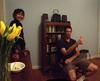
Home for the next 13 months was Africa. Though traveling almost every day, often from one small and insignificant town to another, my limited budget ensured I was reliant on the towns and people I encountered. It meant I was living as much like Africa’s coastal communities as I could as an outsider. My only piece of technology (other than a compact digital camera with which I took these images) was an old Nokia 3100 mobile phone. I had reasoned Africa wasn’t technologically advanced enough to use a smartphone; I was wrong. Business people chatted away on iPhones or used the broadband networks in all but a couple of the 31 countries I traversed.
For me, updating my blog meant finding a local internet café and using their funky, non-qwerty keyboards. It was something I came to enjoy. I had to share the same broken pavements, roads, food, transport and accommodation. The reason many development programmes fail is not from corruption but because of collapsing infrastructure. I’ve been told that one of the biggest costs for firms working in Angola’s oil sector was clean water for their staff.
From Gibraltar Africa looked massive, even half-covered in the candyfloss cloud that hid the upper reaches of Jebel Musa. The low mountain is generally thought to be the southern ancient pillar of Hercules, from where the hero tore Europe and Africa apart. Its coast unravelled ahead of me, sweeping east towards Ceuta, and west to Punta Cires, the promontory on which Tangier sits. It seemed to stretch on indefinitely.
Thinking of Hercules, I realised I shouldn’t leave Gibraltar without visiting the Rock, a nature reserve and historic acropolis. Leaving the cable car that brought me up to its 412 meter height – almost exactly a tenth the height of Mount Cameroon’s peak that I later summited – I was quickly away from the Barbary macaques, the monkeys never moving far from the constantly replenished piles of fruit and vegetables on the roadside of the upper sections of the Rock. I spent several hours, in heat I had to become used to, following the winding paths back to the crowd of buildings around the base of the Rock amid the scent of honeysuckle brought out by the earlier rain. Tired from my walk down the steep gradient, only the knowledge I had no backup team to push me on got me back to Gibraltar’s heart at Casemates Square, as fighter jets arched around the waters of Gibraltar Bay in tandem, practicing the defence of its borders.
The first thing I had to do to get any closer to Africa was walk away from it, past the road signs warning SPAIN SPAIN SPAIN to La Línea, the town on the other side of Gibraltar’s only land border. There are no buses that cross, so my inevitable rendezvous with public transport began on an ordinary side street in Spain. I was soon to discover the term ‘public transport’ was a looser term in Africa than Europe, a catch-all term for bush taxis, coaches, pickups, aging Soviet-built ferries and a van delivering freshly made meat pies: anything that was willing to take me and my backpack anywhere along Africa’s coast. But for now it was a modern single-decker bus that took me to Algeciras, across Gibraltar Bay, for one of the many fast ferries to Tangier, and Africa.