Game of Thrones Maps and GIS Data

George R. R. Martin's series of fantasy novels, known as A Song of Ice and Fire, is a story based in a fictional geography consisting of Seven Kingdoms spread out across the continents of Westeros and Essos. The series chronicles various power struggles among the families to occupy the Iron Throne, while others fight for gain independence from it.
The books have sold over 90 million copies worldwide and was adapted into a popular television series on HBO in 2011. Now going into its eighth season, the series is coming to an end.
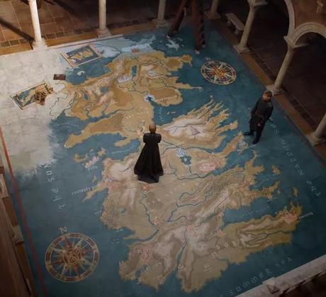
If you have been watching the Game of Thrones series on HBO then you will no doubt have noticed how important maps have been and how often they appear in various episodes, from the opening credits, to the giant hand carved map table of Westeros located at Dragonstone.
The gvSIG Association have provided a pretty neat user guide titled 'Learning GIS with Game of Thrones' themed around Game of Thrones aimed to encourage people to learn their popular user-friendly open source GIS software.
They have also provided free download of the Game of Thrones themed data they use in the guide which can be used with any geospatial based software. We have downloaded the data and started to create some Game of Thrones maps our selves and encourage other geospatial minded fans to do the same.
[page originally published April 2017 & updated in April 2019 ]

