East Hants Open Data
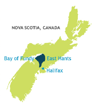
East Hants, Nova Scotia, Canada is a vibrant municipality between Metro Halifax and the Bay of Fundy. East Hants uses GIS technology in all their departments, from sewer, water, and road projects, to regional planning, taxation, and municipal elections. Recently they developed an online portal (Interactive East Hants) to help Nova Scotian’s explore their growing Municipality’s geospatial data sets.
Interactive East Hants is an online mapping and open data site that provides the public with an efficient and useful way to explore the Municipality of East Hants. The website provides free access to geospatial data as a commitment to improving citizen engagement and enhancing transparency to our residents.
You are able to download spatial data to use with your own GIS software or you can create customization maps with data layers using the interactive East Hants online mapping tool. Start exploring Interactive East Hants open data, and create your own custom maps …
Check out these other Canadian Open Data sitesBy canadiangisFiled in: Data & Software, Open DataTags: custom maps, East Hants, Geospatial data, GIS, Nova Scotia, Open Data, opendata
Also Check Out ...

The province of New Brunswick offers a digital High Resolution Wind Resource that they call the New Brunswick Wind Atlas . The wind data set is tiled into smaller higher resolution thematic maps of New Brunswick matching their topographic mapping network grid and depicting “Mean Wind Speeds (m/s) at 80 m AGL. The maps were generated by the Université de Moncton, based on the Canadian Wind Energy Atlas.

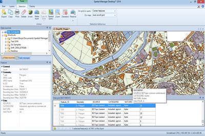
Spatial Manager Desktop™ is a desktop application designed to manage spatial data in a simple, fast and inexpensive way. Developed by a group of professionals working in the areas of GIS, Planning, Infrastructure and Civil Engineering, it provides the user with powerful tools to address the most common tasks of management and operation in the world of spatial information

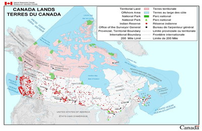
Canada Lands are any federal Crown lands belonging to the Crown, that are situated in Yukon, the Northwest Territories, Nunavut or in any National Park or Indian Reserve, as defined by the Indian Act. Digital cadastral data of Canada Lands depicting the internal and external boundaries is managed by Natural Resources Canada, and is made available for public use in a variety of formats.
Here are links to pre-made mapping products and digital cadastral datasets related to Canada Lands as well as the Canada Lands overlay in Google Earth file and the Canada Lands Survey System online map browser.
Canada Explained in 7 Maps DJI Phantom Drone Ottawa Aerial Footage
