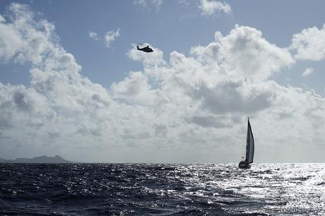
That awful job aside, almost everything else on the passage went very smoothly. Weather variance remained on the pleasant side of the forecast, and factors less easily predicted (namely, katabatic winds) were mild. Totem flew along, averaging over 200 miles per day towards landfall in a little over two days. About the most eventful thing that happened was when we were circled a few times by a very curious and official looking helicopter about 7 miles west of Bonaire… as photographed buzzing Utopia, above.
What did we do well?
- Careful planning, which included a lot more than just a route plan and the right weather window
- Patience to wait for good weather!
- Adapting the plan to suit conditions
- Anticipating sail handling at night or in rough conditions
- Remembering local effects
What could we have done better?
- Fish.
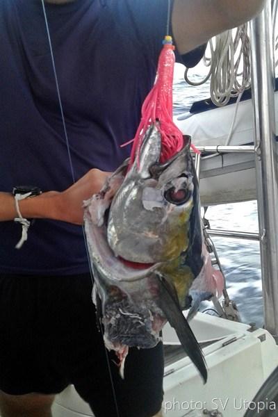
OK, so we did the fishing thing exceptionally poorly by not actually putting any lines out (truth be told). We were going kinda fast for mahi, which I’d have guessed our catch, as we have miserable luck with tuna. On the other hand, Utopia DID catch a tuna: and this is all that was left when they reeled it in… ripped out from the gills back. Oh, that would have been some spectacular sashimi!
Really though, it was great!
The longer route we planned ran about 416 nautical miles from Bonaire’s mooring field in Kralendijk to the Marina Santa Marta in Colombia. Meals were prepped ahead, just in case… it was nice to just heat & eat. Smooth conditions made a lot of reading time… and time to catch shooting stars on night watch, under clear skies. Shooting stars filled my night watch once the waxing moon set and a carpet overhead shone with a brilliance you can only get from the open ocean’s absence of light pollution. As the tall Sierra Nevada range came into view, a gust of wind brought the rich humus smell of landfall with an intensity I’ve rarely felt after a week at sea, much less a couple of days, a hint of the lushness that awaits.
We have the highly unusual tendency to pace very closely to Utopia II on passages. It’s close enough that we actually have to be kind of careful – when you’re in the ocean, two boatlengths is at least a dozen boatlengths too close for comfort, especially at night! Adjusting course to avoid an unwanted encounter with our buddy boat… that’s a first.
Vessel traffic was minimal, but enough to require a close eye on the radar and AIS. Both proved useful when a ship loomed on a course for direct collision that closed remarkably quickly based on boat speeds and the face we were headed directly at each other. Whatever you want to say about the “rules” of the road, mass wins every time; I appreciate the mate of the 117 meter long tanker who altered course to pad our nearest distance with a comfortable mile of separation.
Hindsight, and changes from the plan
The crew of Rhapsody snapped us departing Bonaire the morning of the 26th. (Turns out that means we missed Second Christmas in Bonaire – which is a THING!).
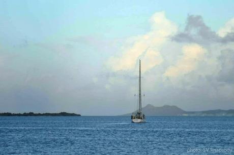
I am REALLY going to miss my morning swims with Sarah & Bob from Rhapsody!
Jamie wrote this summary below on what shifted from our original plan (see the Passage Planning blog post for details), a follow up to the exercise we posed for coaching clients. Pardon the wobbly mouse illustrations annotating this OpenCPN screenshot to help illustrate.
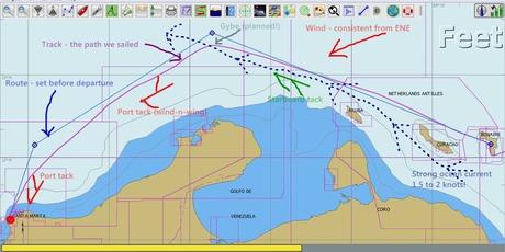
1. Route change
Based on anecdotal info about sea state, I tweaked original plans and set the route to 50 miles offshore instead of 40. Note the thin line that more or less parallels the blue portion of the chart. The line marks the 1000 meter (330 feet) depth contour – outside is 2000 – 3000 meters, this is the continental shelf where significant depth change can contribute to further sea state unpleasantness as water piles up.
2. Conditions
a. Wind: consistently ENE. I expected a slight change to E, but didn’t happen.
b. Ocean current: the Caribbean current was strong, as expected, and very much in align with forecast position.
c. Waves: by reputation, waves were going to define this passage. There were six distinct phases:
- Bonaire to north end of Curacao waves were normal wind driven waves up to 2 meters.
- From north end of Curacao to the northernmost point of continental shelf was SLOPPY! Why? Wind from NNE makes wind waves from the same direction. Strong current is perpendicular to wind waves AND causing bunched up water from islands in the way and huge depth change. This made for 100 miles of confused seas from multiple directions. Fortunately, we were there in good conditions with a full 24 hours since stronger winds and bigger waves – so it was lumpy but manageable.
- Once north of the continental shelf, waves became patterned and regular wind waves again. A route over the continental shelf (close to shore) would be miserable!
- Because sea state was fine, you can see that we cut the gybe corner a little to reduce sailing distance. Good sea state continued after the gybe, so we continued to shave more distance (remaining inside of the planned route).
- We had delightful conditions, wind and waves, all the way to the cape, just 4 miles from destination. I’ll talk about that below.
3. Sailing
a. Leg 1 was 220NM on starboard tack, beam reaching. Very fast sailing and more so with current push. We did 208NM in the first 24 hours.
b. Knowing there was a gybe coming, I tweaked the route some to set timing of gybe to be in daylight. We reached the gybe point at 8AM, furled headsail, eased the preventer, gybed in 20 knots of wind with single reef in the main. Easy.
c. With turn to SW, was clear the sailing angle close to dead-downwind (DDW). So we set up for wind-n-wing. Boom out to starboard with preventer on and single reef; genoa poled out to port.
d. We thought wind would shift to E and we would have to take pole down to be fully on port tack, but the shift didn’t really happen – there was a little change but we managed wind-and-wing just fine with wind angle at 150 degrees (30 degrees from DDW, wind over port side).
e. At about 50 miles to destination, course shifted further S requiring pole down and gybing the genoa to the starboard side. Likely this would happen in the dark, so before sunset, I checked all lines to be sure this would go smoothly (OK, I always check them anyway!). This change happened about 4AM and went easily.
f. At 40 miles out, wind was 20 to 25 so put in second reef.
4. Hello, cape!
Route plan, good weather window forecast, and actual weather was as predicted made this an easy and fast passage. It wasn’t all perfect sailing along at 8.5, surfing to 12 knots sailing–although that describes a lot of the passage! But there was also a cape to go around. Always, always, ALWAYS, expect enhanced conditions at a cape.
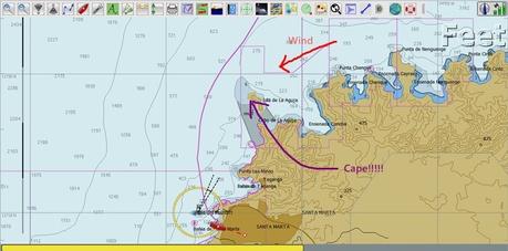
Approaching the cape just after sunrise was perfect timing for visibility. Land here is mountainous–the Sierra Nevada range here, part of the Colombian Andes, is one of the tallest coastal ranges in the world. Conditions were a wall of gray overland, with a pronounced dark gray band extending to the west, with rain below it. No other visible signs of wind or sea state build at the cape, but to repeat, ALWAYS EXPECT ENHANCED CONDITIONS AT A CAPE!! Totem already had two reefs in the main, but I thought it prudent to partially furl the headsail as well. Turns out, this was a good idea!!! How it played out, and what we did:
a. Wind built from low 20s up to 35 – 42 knots. This is not GRIB predicted effect, rather, compression induced wind build because of mountainous land. [If you remember one thing: GRIBs are not Gospel! There can be more dynamics at play in determining wind force.]
b. Wind waves of two meters towards the WSW, also compressed around the cape and bent around to be perpendicular to the land. And they GREW, both confused and bigger, much bigger.
c. From cape to destination was four miles. For two miles, the waves doubled to four meters with four waves of at least five meters, from dead astern. All waves are not created equally. A five meter swell (dying wave) is gentle. These were waves (building, living) and very aggressive. Even though five meters isn’t a huge wave, it’s plenty big enough for catastrophe.
d. Things can happen very quickly when going down the face (front) of waves driven by strong wind such as these. The very real risk is broaching – getting knocked onto your side, beam to the waves. The boat doesn’t want to go straight down the waves; it wants to peel off one way or the other (water friction and balance of sailplan). Steering well is paramount to managing these conditions. Our autopilot was doing OK, but I felt better boosting its turning speed with hands on the wheel. Totem has a big rudder, so bites in nicely. It was a very exciting (hairy) couple of miles before seas eased to three meters and then two meters on approach to Santa Marta.
Hindsight
Once in Santa Marta, several cruisers came by that chat. Common theme: what a great weather window we had! The past several weeks it’s been blowing 35-40 knots, and gusts have reached up to 60 making conditions outside hellish. On one hand, we played it well. But on the other, a lot of what’s felt in the marina we presume to be katabatic winds – not so predictable for anticipating a weather window. Partly lucky, partly smart, glad to be on the other side of this particular stretch of water.
* * *
The first taste of Colombia yesterday is sweet: friendly staff welcoming us into Marina Santa Marta. In town, colonial buildings with faded elegance and colorful street art. Pedestrian malls lined with restaurants spilling out into streetside tables with busy conversations and delicious aromas. But more about that later – I’ll leave you with a few images from passage.
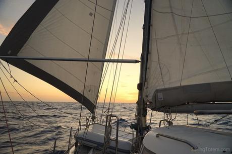
Sailing into the sunset again: this had such great green flash potential!
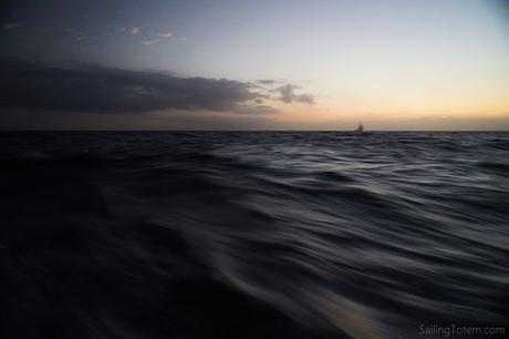
Utopia in the distance at dawn, day two
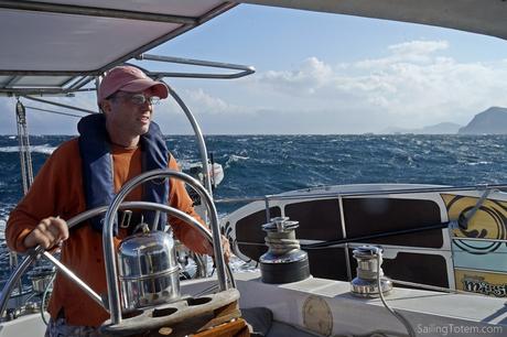
Jamie tethered in at the helm as we get past the cape, while I hide under the dodger – seas NEVER look as big on camera…
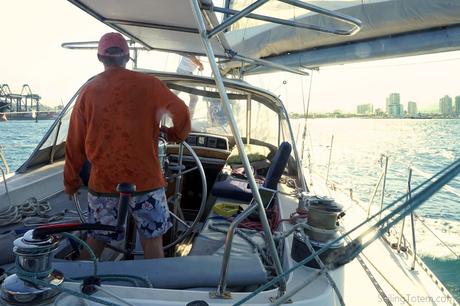
Hello, Santa Marta!

