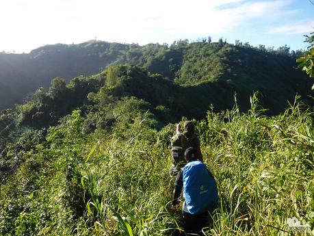
It is really a pleasant surprise to discover something new. Yes, there’s always something new even in a place where you’ve been living all your life. That is the beauty of hiking the Cebu Highlands Trail. By penetrating deep into the mountainous regions and rural highlands of tropical Cebu, Philippines, we uncover more secrets and wonders that make us realize how little we know about our home island. And that makes us even more proud to be Cebuanos!
We woke up to a cool and refreshing morning. Even though the dawn was windy and chilly, we knew that it will be a hot, sunny day as no thick clouds— save for wiry wisps—dotted the sky. Thus, before feeling the warm kiss of the sun, we prepared early, ate breakfast, and broke camp. By 7 AM, we departed Mt. Tongkay, starting with a short climb to its summit.
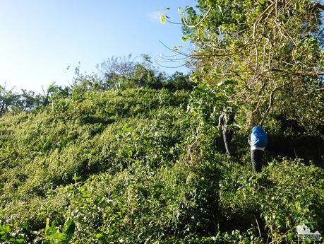
At the summit, we carefully inched our way to peer down into this seemingly moss-covered bottomless hole. Sir Jing said that this is actually an old man-made vent for a defunct underground mine.
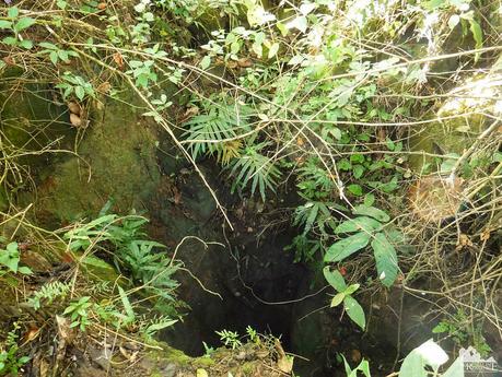
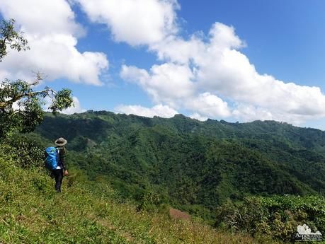
Soon, we exited Mt. Tongkay’s summit and emerged on its other shoulder. Clear of trees, the shoulder treated us to an extraordinarily stunning view of the surrounding areas. Our hearts beat faster with anticipation after knowing that we were going to traverse that knife-edge ridge that leads to another mountain range.
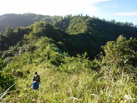
Strangely though, we didn’t really feel that the trail is treacherous as we walked across the knife edge. That’s because the grass, shrubs, and small trees that grow on both sides of the trail mask the view of the deep ravines.
All around us was the splendor of Cebu. It was difficult to shake the feeling of euphoria as we silently admired the simple yet magnificent view around us. In many ways, simplicity speaks louder than complexity. Simple things can be the best of everything!
Sir Jing explained that early morning or early afternoon is the best time to survey the landscape if planning to do an exploration climb. That’s because the highlights and shadows brought about by the sun’s rays show contours and trails that one can use to navigate around the landscape.
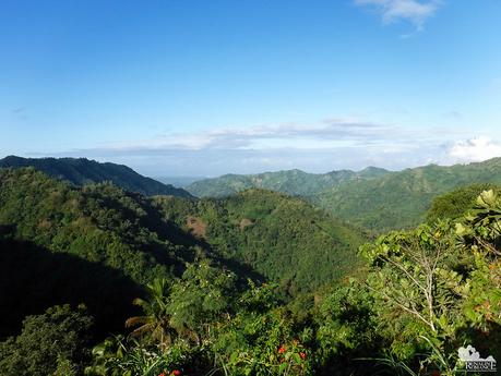
It took us an hour to cross the knife-edge ridge before we reached a paved access road centered on a small community. Huge farms of corn, vegetables, and other produce share the area with natural grasslands and forests. In the highlands, virtually everything is in harmony. The people and the land depend on each other.
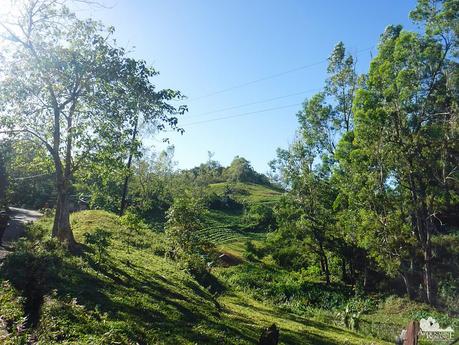
We exited the paved road, made a long descent down a dirt road, and entered the lip of a valley that overlooked the grasslands and forests of Panas. Various farm trails, footpaths, animal pathways, and natural contours make navigating here quite a complex endeavor. Come on, you can’t expect any single person to memorize all these, can you? Let alone a 400-kilometer trail with lots of intersecting trails? A few times, we had to stop or backtrack to get our bearings.
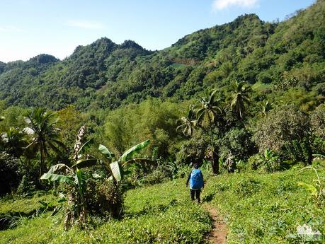
But wherever we go, the beauty of Cebu’s highlands completely surpassed the anxiety of finding the right way or making to our destinations on time. Cebu has a lot of secrets, and many of them may never be discovered in our lifetime. The Cebu Highlands Trail gave us both a glimpse and a deeper appreciation for such secrets.
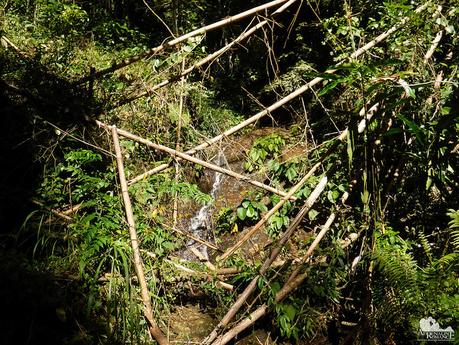
We came across mountain springs like these. Either fresh and clean rainwater or groundwater flow from these springs. The water is cold and sweet, a refreshing liquid that soothed our mouths and throats on a hot day like this.
When filling your Nalgene from mountain springs, make sure your hand, arms, or any part of your body does not touch the flow. Do not drink directly from the spring. If you plan to brush your teeth or wash your face, take the water you need in your water jar and do your business far away from the source.
That’s because people in the lowlands drink the clean water from here. Obviously, you don’t want to contaminate their source of drinking water.
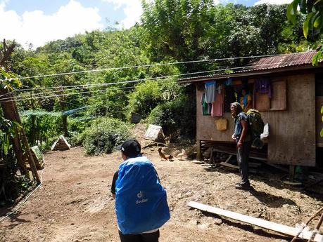
A little over 11 AM, roughly 4 hours after we left Mt. Tongkay, we came across this small house in Panas. The smiling owner permitted us to rest and recuperate in her property, knowing that we’ve just came across a grueling hike under the burning mid-morning sun. She even invited us for lunch, but we politely refused the offer.
We shook off our heavy backpacks, took off our shoes, and ate some of our trail food before continuing our way.
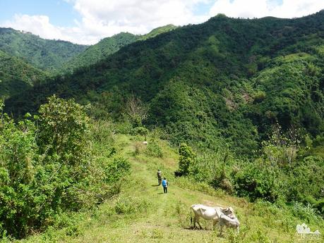
The Biasong River is just an hour away, so we decided to continue our way until we reach the riverbank. We passed through hills and grassy meadows before we re-entered the jungle.
The last stretch to the river involved going down a very steep slope covered with fallen banana leaves and grass. It was so slippery that we have to either slide on our butts or crawl on all fours. I couldn’t even take my camera out to take a photo of the team slipping countless times on the trail. In addition, we can’t just simply grasp the foliage on the trail because they were either rotting or covered with thorns. Oh, the agony of descending!
But our perseverance paid off. At last, near noon, we arrived at the foot of Biasong River, a pristine artery that runs across the municipality of Sudlon 2. Under a burning day like this, even hearing the rushing sound of the river was a comforting balm for us.
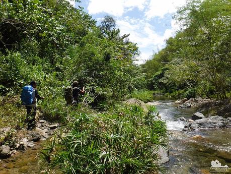
Several times, we crossed the river at specific junctions where the current and depth was manageable. We simply immersed our shoes, feet, and all, not caring about our soaked footwear. We gave in to the temptation of the cool water, which felt so good on our overheated feet.
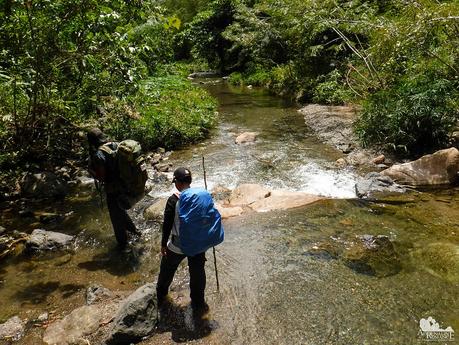
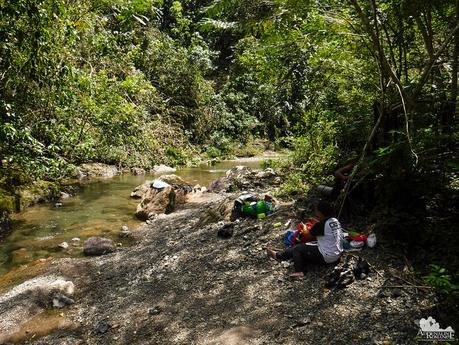
A few minutes past 12 noon, we chanced upon a cool and shady portion of the river, a perfect place to have a lunch break. Gratefully, we laid down our packs, took off our wet socks and shoes, and enjoyed the caress of the river’s flow. Sweetie prepared a quick lunch of fried pork and sausages followed by hot cups of coffee.
A filling lunch by a flowing river all by ourselves. You can’t get any more blissful than that.
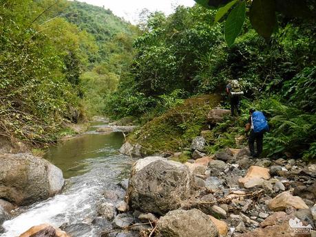
Re-energized after a filling lunch, we continued our way, following the course of the Biasong River. There were several different ways in making our way here. Sometimes, we walked on slightly muddy trails. Sometimes, we clambered over slippery rocks. Sometimes, we sloshed on shallow water.
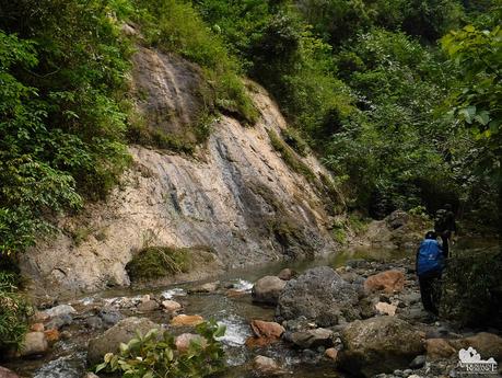
During the rainy season, this glistening, mossy cliff turns into a waterfall. We wonder how it looks like.
The Biasong River was relatively calm; we guess it has a gentle temperament during summer months. However, there were sections where the current forms strong rapids. For safety, we stayed away from these fast-flowing rapids even though we know that they are quite shallow.
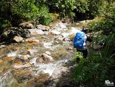
Sir Jing said that there’s a tall and impassable waterfall ahead, so he led us to a detour up a hill that followed the contour of the river. An old grove of trees, seemingly like monsters with lots of bony hands, dotted the blanket of shrubs. The scenery reminded us of Middle Earth in the trilogy “The Lord of the Rings.”
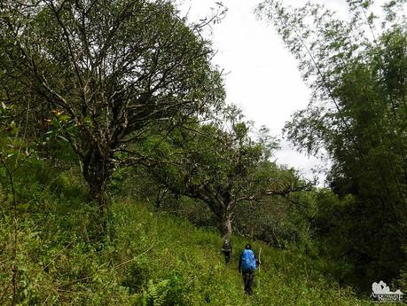
Soon, we reentered Biasong River. We had to be careful on this section because most of the time, we were walking on the riverbed itself. The current was relatively strong, and the riverbed was filled with slippery or loose rocks.
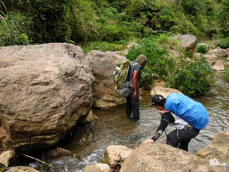
At 3 PM, around two hours after we ate lunch, we arrived at a mountain resort that is popular among the locals here. This place is quite far from the sandy beaches, so this resort serves as a nearer, cheaper, and much closer alternative for them.
See those tubes that run along the riverbank? Those tubes transport fresh, potable water from a spring to the community.
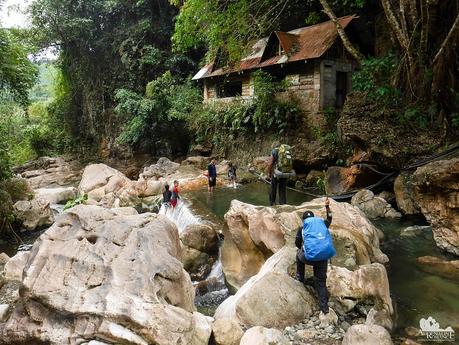
It was quite incredible—and disappointing at the same time—to see locals forced to ford the river to get around the community of Biasong. Yes, it was a proof of Filipino resiliency, with locals riding their motorcycles or walking across the Biasong River. At the same time, it highlighted the lack of infrastructure that is common in the hinterlands around the country.
Communities like Biasong are so far off the economic radar that many Cebuanos don’t even know such a village or town exists.
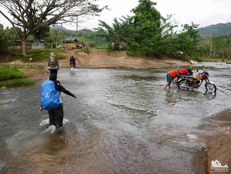
We took a well-deserved half hour break in one of the stores in Biasong. Thank goodness they sold sweet ice-cold Coke, which we gulped quickly. Even simple joys such as an ice-cold soda does an incredible job of lifting up our spirits and energizing our bodies. We snacked on some chips and bread as well.
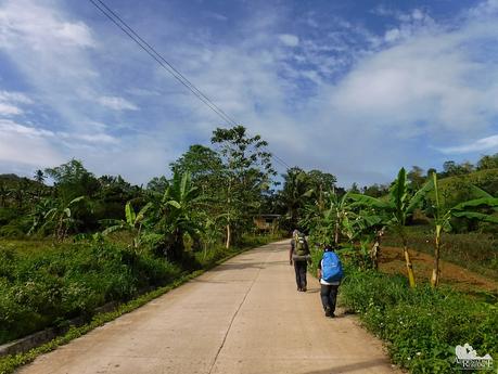
After saying goodbye to the kind store owner, we started the long last stretch to Tugop, an extremely punishing two-hour walk on a paved road. Hiking on cemented or asphalted road is extremely tiring and painful to the feet. Although the presence of a road is usually a welcome sight (knowing that it connects to civilization), it is one of the things that we really don’t look forward to in any of our treks.
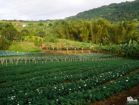
As we neared the last leg of this sub-segment, we passed by immense fields of fresh flowers. Flower farms are abundant here; the blossoms grow strong, vibrant, and healthy due to the extremely fertile mountain soil. In time, the flowers are then harvested and sold to shops and vendors in the city.
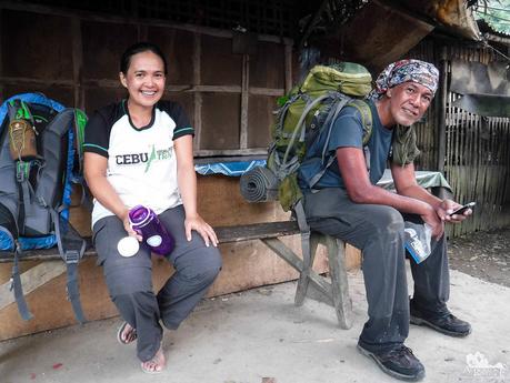
Half past 5 PM, haggard and disheveled after a long, painful, and exhausting ascent on a paved road, we finally arrived at the edge of Barangay Babag at the Transcentral Highway. Just look at our faces—we could barely smile! But smile we did because we have successfully finished half of Segment 1.
What a great weekend, and what an equally great hike! Trekking for another roughly 15 kilometers on the second day, we covered around 30 kilometers for the entire weekend. The exhaustion and pain is absolutely real; but those are just a small price to pay for all the fun, learning, and camaraderie we experienced in this adventure. Moreover, the adventure opened our eyes to Cebu’s hidden secrets that not many have seen.
Check out Part 1 of CHT Segment 1A here. Watch out for Part 1 of CHT Segment 1B next post.
Itinerary
Day 1
5:00 AM – meet at Ayala V-Hire Terminal
6:00 AM – leave Cebu
7:00 AM – arrive at Mt. Manunggal Trailhead, register, ride habal-habal to Mt. Manunggal Campsite
7:30 AM – arrive at Mt. Manunggal campsite, start trek
11:30 AM – arrival at Inalad, lunch, rest
1:00 PM – resume trek
2:00 PM – arrive at Tonkay, courtesy call, water refill, last-minute shopping
2:30 PM – leave Tonkay, start ascent of Mt. Tongkay
4:00 PM – arrive at Mt. Tonkay campsite, set camp, prepare dinner
5:30 PM – early dinner
6:00 PM – lights out
Day 2
5:00 AM – wake up, prepare breakfast
6:00 AM – breakfast, break camp
7:00 AM – leave Mt. Tongkay, trek to Biasong River
11:30 AM – arrival at Biasong River
12:00 PM – lunch, rest
1:00 PM – resume trek
3:00 PM – arrival at Biasong, snack, rest
3:30 PM – leave Biasong, trek to Tugop
5:00 PM – arrive at Tugop, rest
5:30 PM – arrival at Transcentral Highway, ride habal-habal to JY Square
Budget*
- P 120 per person – V-hire fare, Ayala terminal to Mt. Manungal trailhead, Barangay Magsaysay
- P 80 per person** – habal-habal fare per person, trailhead to Mt. Manunggal campsite
- P 80 per person*** – Mt. Manunggal registration
- P 40 per person – habal-habal fare per prerson, Transcentral Highway to JY Square
- TBN (to be negotiated) – Sir Jing’s professional guideship fee
* Rates can change without prior notice. Note that we didn’t include the budget for meals, snacks, and personal expenses as you may have different sharing schemes or preferences.
** Negotiate for a lower fare. Judging from the short distance, we felt that we were ripped off.
*** Ask the caretaker or tourism officer to waive your fee since you won’t be camping in Mt. Manunggal. You will just be passing by.
Tips
1. For guideship services, contact Mr. Jing Lavilles de Egurrola at 0933-3225005. You can also get in touch with him through his personal Facebook account and through the Camp Red Facebook Group. He and his partner Jonathan Apurado are the only ones who have completed the CHT.
Please have the courtesy to introduce yourself first when contacting him.
2. Presently, self-guided hikes on the CHT are not yet possible. The trail is not marked, and you could get easily lost. Moreover, locals are wary of strangers, and visiting their place unannounced can make them suspicious of your presence. This could constitute a misunderstanding or worse, a security issue. It’s mandatory to hire Sir Jing as he will ask the necessary permissions and arrange the courtesy visits for you.
3. As of this writing, a guided thru-hike is not yet possible. Until the trail is marked and the Cebu Province supports its protection and documentation, only guided segment/sub-segment hikes can be done.
4. Bring a wide-brimmed hat or scarf to protect yourself from the heat. Don’t hesitate to tell the guide to stop if you feel exhausted.
5. Water sources are aplenty on the trail. You can also buy water and resupply at the sari-sari stores along the way.
6. Wear arm guards and trekking pants to protect your skin from the sun and prickly plants. Also, a dry-fit shirt or rash guard will help keep you cool. Se7en makes very comfortable outdoor apparel.
7. Wear trekking shoes or sandals with an aggressive tread. You will need a lot of traction since you will be scrambling over loose soil and slippery rocks .
8. Bring salt tablets or ion-filled beverages such as Gatorade, coconut water, or fruit juice aside from water. The hot sun, multiple ascents, and exposed trails can make you sweat a lot. When you lose enough ions and salts via your sweat, cramps will occur. If cramps happen, rest for awhile, drink a lot of water or ionic drinks. This will replenish the ions in your system.
9. Bring energy-rich trail food such as nuts, crackers, bread, and bananas. Don’t underestimate the trail.
10. Pack light but do bring the following:
- water (at least 2 liters)
- good-quality 3-season tent with fly sheet and ground sheet
- cookset (can be shared with the group)
- burner (can be shared with the group)
- cold weather gear (warmer, thermal underwear, fleece jacket, windbreaker or winter jacket)
- extra clothes (1 set for climbing, 1 set for sleeping, 1 set for returning home)
- swimwear (for swimming at Guining Falls)
- trekking shoes/boots
- light flip-flops (for walking around the campsite)
- raincoat, rain jacket, or poncho
- hat, scarf, and sunglasses (to protect yourself from the sun)
- first aid kit
- food for dinner, breakfast, and lunch
- hydration salts, table salt, or Gatorade (to avoid and relieve cramps)
- toiletries
- headlamp or flashlight
- whistle
- cellphone
- extra money
- trail snack
- personal medication
11. Don’t forget to waterproof your belongings. You can do this easily by wrapping your stuff inside dry sacks or plastic bags.
12. Please mind your trash; do not leave any of your garbage behind. Keep your voices low, and avoid unruly behavior. Remember that Mt. Manunggal is a historically and culturally important mountain, thus, it demands utmost respect.
