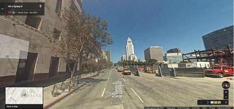
Last week, Google Maps released a new feature to Street View, making it possible to cycle through archived versions of the 360 panoramas. In addition to hours of amusement, this new form of virtual time travel provides an unprecedented way to explore how quickly a city can change at the street level—buildings are built and razed, streets are reconfigured, and the power of a fresh coat of paint gets a jaunty demonstration. The change is most stark in cities like New York, Detroit, and Los Angeles that have had Street View since its launch in 2007, and have a full six years of maps to parse through. Click through the slideshow to see a selection of these urban transformations; then go forth and discover your own.
Slideshow

The view down Spring street to City Hall in Downtown Los Angeles, 2007. All images by Google Maps Street View.

