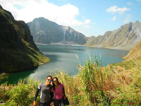
The nation shook, and the world reeled during the cataclysmic event that happened in our country last June 1991. Mt. Pinatubo—a quiet, inconspicuous, and heavily eroded stratovolcano located at the tripoint of Zamales, Tarlac, and Pampanga provinces in the Philippine island of Luzon— suddenly roared to life and released its fury. The force of the eruption was so great that volcanologists categorized the event as one of the most powerful volcanic eruptions in the 20th century, reaching Plinian/Ultra-Plinian levels.
Mt. Pinatubo spewed out 10 billion tons of magma and ash and 20 million tons of sulfur dioxide, ten times the quantity of material that was ejected during the eruption of Mt. St. Helens in Washington, USA. Worse, the eruption happened during the arrival of Typhoon Yunya. The combination of ash, rain, and wind killed more than 800 people. Homes, buildings, and other infrastructure collapsed under the weight of ash deposits falling down the skies. Farms, reforestation areas, and agricultural projects were severely damaged, affecting the livelihood of thousands of farmers.
But the worst was yet to come. Lahar—swift mudflows that consist of water, ash, mud, and rocks—caused by rainwater carried volcanic deposits across the land, causing widespread destruction. Lahar carved canyons, ate mountains, and altered river systems. The lahar flows continued years after the explosion. Finally, Mt. Pinatubo released a huge amount of particulates into the atmosphere, lowering global temperatures by 0.5 degrees Celsius and increased ozone depletion significantly albeit temporarily.
We have long wanted to visit and pay tribute to this historically significant monster that both destroyed the land and created new wonders. So we included a solemn visit to Mt. Pinatubo together with our trip to Capones Island, Anawangin Cove, and Nagsasa Cove in Zambales.
We ate lunch in a Jollibee outlet in Olongapo City (and stayed a while within the establishment’s confines to bask in its air-conditioned coolness) after our visit to Nagsasa Cove. Afer lunch, we hiked to the city’s Victoria Lines Bus Terminal to board a Baguio-bound bus. There were still a few seats left in the 1PM bus trip, thus, to save time, we gladly took it even though our seat assignments did not allow us to seat as a group.
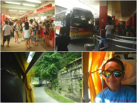
Almost four hours later, we arrived at the city Capas in Tarlac where we took a tricycle to our homestay. The tricycles in Zambales and Tarlac share the same feature: very tiny and low cabs. They’re quite cramped and stuffy, but that’s part of the adventure! Tricycles all over the Philippines differ in design, by the way.

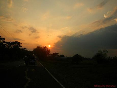
Our homestay was located some 15 to 20 kilometers from the city center—quite a distance, actually. Along the way, we witnessed a dramatic sunset.
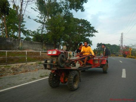
Although modernity has crept into the highlands and interior parts of Tarlac, many areas are still laid back, typical atmosphere in far-flung provinces. Agriculture still stands as a primary industry. This fact was poignantly evidenced by this modified contraption which acts as a farm tractor and a private vehicle.
Filipino ingenuity never fails to amaze us.
Close to 6PM, we arrived at the warm, homey, and cozy Bognot’s Homestay, a popular backpacker’s haven for those who want to step foot on Mt. Pinatubo. A few years ago, Sweetie and Alexa stayed here during their Mt. Pinatubo visit.
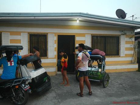
After half a day of riding on a boat under a sweltering sun and salty sea and another half day riding a bus, we were dying to have a shower, change into clean clothes, and relax. Thus, we felt a great sigh of relief as we entered our air-conditioned room.
The rooms in the Bognot Homestay are very well maintained and comfortable without compromising the homey atmosphere. Ours has its very own toilet and bathroom!

After freshening up, we headed to the kitchen where our hot, tasty, home-cooked dinner of chicken adobo and chop suey is waiting for us. We ate with audible gusto after a long ride.
During our hearty dinner, we also made friends a co-guest Richard Aquino (the guy in light blue). Richard, who is taking his masters degree in New Zealand, revealed that he was doing a study on volcano tourism. I was honored to be one of his research’s respondents.

A relaxing and good night’s sleep left us brimming with energy for the next day. While eating a hot breakfast of eggs and sausages, Ms. Sonya engaged us in a lively, information-filled talk. Because she is a traveler/adventurer herself, Ms. Sonya also knows what we want and require as travelers/adventurers.
The homestay is one of the concrete results of that understanding. She is aware that backpackers are always on the hunt for low-cost, comfortable accommodations. Thus, she established the establishment to cater to that market.

At 6 AM, we were ready for our Mt. Pinatubo adventure. Ms. Sonya offered to drive us to the jumpoff point just a few kilometers from the homestay and just before the edge of the vast lahar fields.

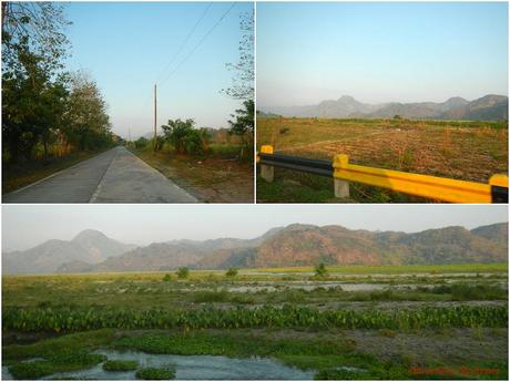
Along the way, we witnessed vast farms and swamps, which, more than a decade ago, were swept away by the immensely strong lahar flows. There were still remnants of lahar, but most of the areas in this part of the land were now rehabilitated, either by man or by nature.
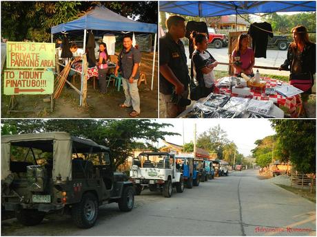
After 15 minutes, we arrived at the jumpoff station where we were given a briefing of the tour and assigned a guide. There was already a Caucasian tourist there, and he joined our group. A line of parked rugged 4X4 off-road trucks stood fueled and ready to take adventurers to Mt. Pinatubo.
Souvenirs and refreshments were also sold at the jumpoff point/staging area.
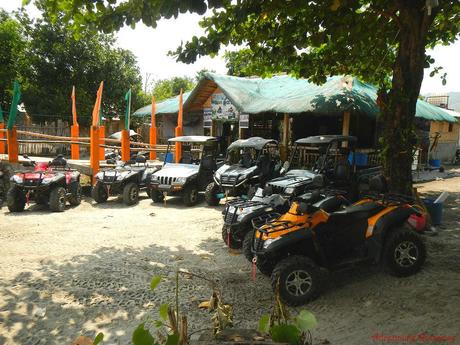
Adventurers may also wish to explore and traverse the lahar field via ATVs (All Terrain Vehicles). You can rent an ATV at an affordable price.
We chose an open-top 4X4 that would take us through the fields. Never mind the dust, heat, and wind; we want to take nice photos. And riding in an off-road trail in an open-top 4X4 seems to be a more “authentic” off-road trip.
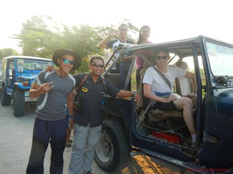
Crossing the Lahar Field
Clinging to the side of the vehicle was Manong Rene, our guide. Manong Rene also worked as a barangay official; thus, he knows a lot about the place and the culture there.
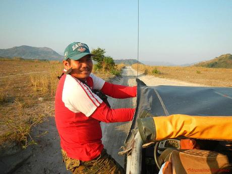
The first hour of this trip involved traversing a seemingly endless field of lahar. Lahar is a kind of mudflow that is made up of a thick mix of rock, sand, pyroclastic material, and water, which flows from a volcano. The flow may be generated by rain, glacial flows, or an existing river. Lahars are very destructive and can wipe out anything in their path.
According to our guide, the plain which we were traversing once contained the massive Clark Air Base.
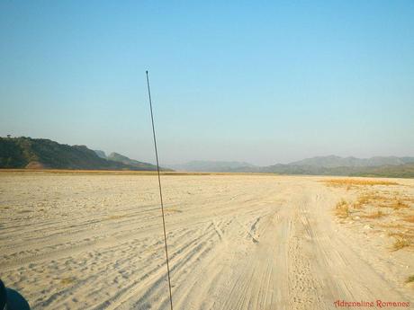
Early morning rains formed rivers in the lahar. It’s quite dangerous to cross here. 4X4s or some other powerful vehicles are needed to traverse the soft and wet ground.
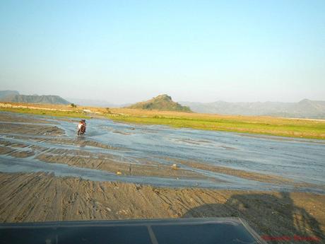
The huge lahar field stretches out for miles. It seemed like a desert of ash-laden sand, but we did saw remarkable features such as streams and ash walls as high as an average human.
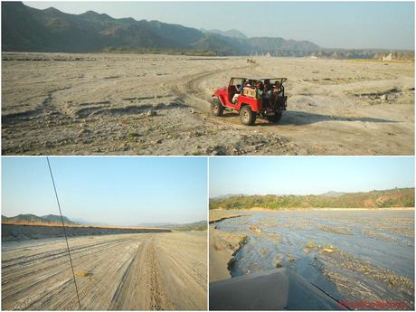
We stopped by for a minute to let our butts rest. Check out the lahar; the texture was like very coarse large grained sand.
That’s our open 4X4 Land Cruiser, a powerful and reliable monster.
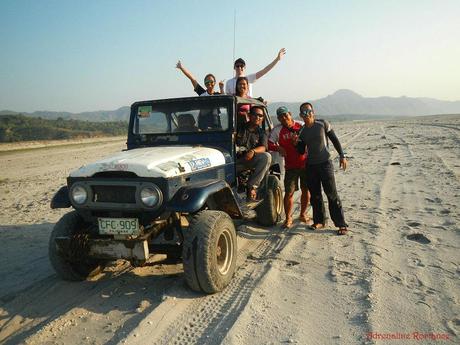
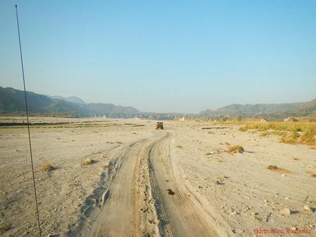
Tire marks from other 4X4s show the way to Mt. Pinatubo. But Manong Rene said that these tracks will be erased come rainy season, and the drivers will have to find a new way into the field.
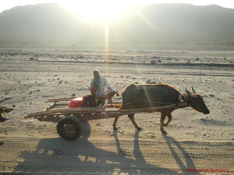
But not all is barren in this desert-like land. Many natives here, particularly Aetas and other indigenous people, traverse the field. In fact, we found this fellow riding along a customized sled pulled by a carabao. Where are they going? We don’t know; this place is in the middle of nowhere.
As we neared the edge of the plain, we began to see remnants of vast hills and mountains being cleaved off by the lahar. The ground became rocky and uneven due to the huge rocks carried by the mudflow.
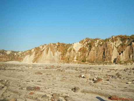
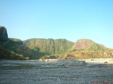
But not all were consumed by the devastating lahar flow. In fact, we could see immense cliffs nearby that were still covered by vegetation. It was quite weird to know that less than a mile away from that cliff is an entire plain that was swept away by a massive mudflow.
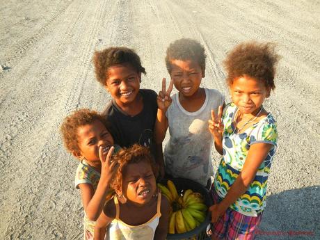
Along the way, we also met these cute Aeta kids plying their trade early in the morning. Playful and mischievous, they tried to sell us a packet of bananas for P100!
Aetas are indigenous people who reside in the mountain ranges of Luzon. They are considered to be among the earliest settlers and inhabitants of the country. Relatively isolated from modern civilization, the Aetas have preserved their ways. We hope that one day, we’ll be able to experience a week living in an Aetan mountain village.
During a break before entering a canyon, we chanced upon these amazing remnants of Mother Nature’s fury. Check out the remnants of mountains behind us. Those were cleaved by the lahar’s powerful flow.
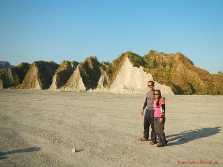
Massive cliffs of sand and ash are continuously being reshaped by wind, rain, and mudflows. In a year, a significant part of this cliff will disappear due to erosion.
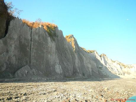
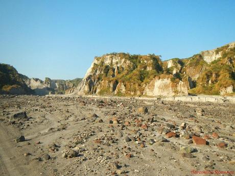
These jagged cliffs look like they’re in an alien world. Years ago before Mt. Pinatubo’s eruption, they were part of the mountains that surround a river valley. Now these are all that’s left of those mountains, which are swept away by the powerful lahar.
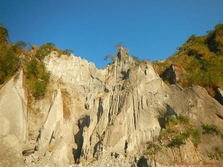
The end of the lahar field is marked by an immensely high wall of jagged cliffs formed by lahar. But somewhere in that wall is a pass that leads to the impressive—and dangerous—lahar canyon.
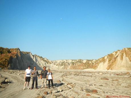
Riding Through the Lahar Canyon
A canyon of destruction! A powerful, massive river of lahar once flowed here and carved this canyon. Lahar can flow tens of meters per second. The flow can range from ten meters to 140 meters in height. Looking at this canyon, it is not difficult to imagine how the lahar that resulted from Mt. Pinatubo’s eruption killed people, affected nature, destroyed infrastructure, and dented the national economy.
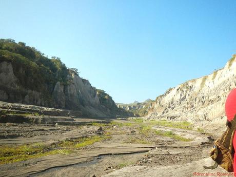
In some areas, the cliffs have stopped eroding, and the soil has started to absorb the nutrients that the lahar brought with it. In these areas, vegetation has started to grow on the eroded cliffs.
Nature heals and finds a way.
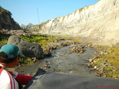
Several times, we had to ride through a fast-flowing stream. Manong Rene said that when it rains, these streams become mighty rivers that can easily sweep away vehicles, structures, and boulders in their way. In the lahar canyons, rains can quickly produce dangerous flash floods that can threaten everything here.
That’s why when it rains, a tour to Mt. Pinatubo is aborted. If the tour is already underway when the weather turns sour, guides and drivers quickly gather the participants and exit the lahar field as quickly as they can.
Trekking to Mt. Pinatubo’s Crater
After almost 2 hours of negotiating the lahar field and canyons, we came to a place where our 4X4 can go no further. It was time to get down, pack up, and get ready for a 1-hour trek.
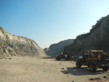
We started the trek at around 8AM. Walking along the rock-strewn canyon bed was like walking back into the past. The place was very quiet, and the only sounds we heard were the rush of the river, the songs of birds, the whisper of the morning breeze, and the crunch of crystalized lahar beneath our feet. In this solemn place, we could imagine the might of the lahar flow, the panic that gripped the souls of residents, and the lamentations of people who lost their loved ones and livelihood during this historic natural catastrophe.
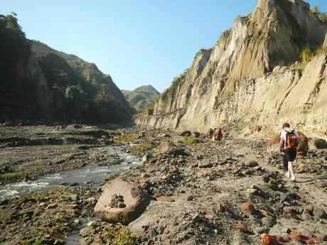
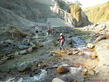
At times, we crossed flowing streams of cool water. The clear streams may seem shallow and tranquil, but they become raging monsters during rainy or stormy season.
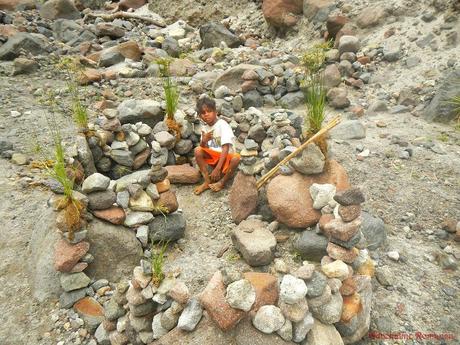
Along the way, we found this Aeta boy building this attractive playhouse with rocks found at the canyon. It’s just amazing how rich imagination inspires these children— cut off from modern conveniences, computers, tablets, video games, and toys—to create something truly wonderful and fun. It reminded us of our childhood years when climbing trees, flying kites, crawling under the bushes, and running under the rain were the best ways to have fun.
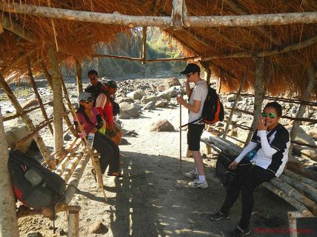
Sheds such as these are erected along the trail. They provide a welcoming rest area for hikers who need to take a break, hydrate, or grab something to eat.
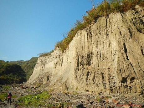
Tall walls of lahar loomed precariously on the canyon. A disturbance, even as simple as a loud shout, could cause the wall to erode and disintegrate, sending massive landslides of rock and ash. During our briefing, Ms. Sonya warned us not to should or touch the walls because they may topple over.
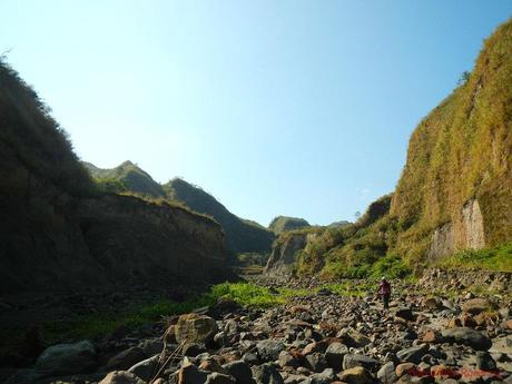
As we neared Mt. Pinatubo’s crater, we passed by a picturesque area filled with volcanic boulders. Also, check out the walls of the canyons; grass and bushes have started to grow. This is exactly Mother Nature’s healing process in action.
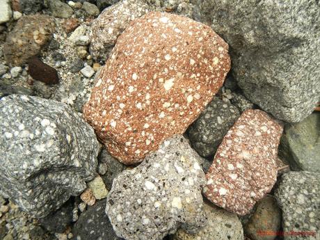
Extreme heat and pressure imbedded quartz crystals on these volcanic rocks. The stones sparkle when the sun strikes the rocks at the right angle.
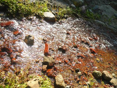
Red water? No, not really. The color comes from the reddish volcanic rocks that form the stream bed. The water is not hot; it’s surprisingly cool to the touch.
After an hour and a half of trekking, we arrived at Mt. Pinatubo’s tree-bordered rest station where we enjoyed a short rest after walking under the increasingly hot morning sun.
A word of advice: don’t buy beverages here because they’re ridiculously expensive. A bottle of water or a can of Coke costs P100, or four times the regular price. Better bring your own beverages.
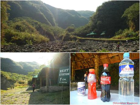
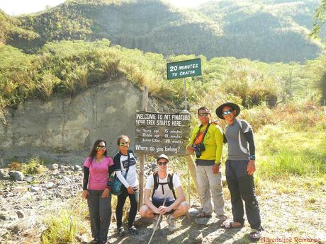
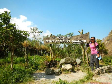
Of course, there’s that obligatory pose in front of a welcome sign! Hehe! We wanted to prove ourselves that we’re still at a “young age,” so we timed ourselves as we started the last leg of the trek.
Well, it took us 17 minutes. Guess we’re not as young as we believed we are.
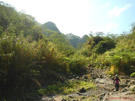
We started the short trek by walking along what appeared to be a stream that was almost drained with water. Along the way, we were treated to lovely vista of green hills, rich vegetation, and rocky trails and breathed cool, fresh mountain air that was a balm to our senses.
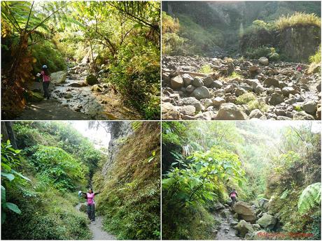
The trail to Mt. Pinatubo’s crater has a lot of features: huge boulders of sedimentary and volcanic rocks, rushing streams of crystal clear water, and hidden paths inside light woods.
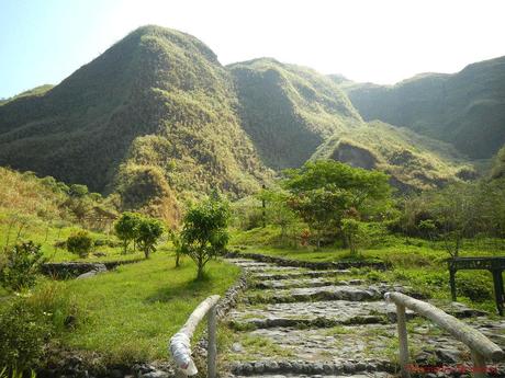
At last, we reached the bottom of the stairs that leads to the crater. Sweetie kept teasing me, telling that we had to climb 1,000 steps to reach the summit. Damn, a final grueling climb?
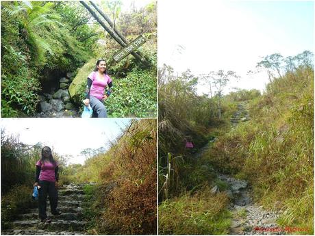
Thankfully, it was not. After climbing 25 to 30 steps, we saw Mt. Pinatubo’s welcome sign.
Mt. Pinatubo’s Caldera and Crater Lake
A large, elevated part of the caldera now acts as a staging area/garden park for the guests. Stone walkways allow guests to comfortably stroll around the area. Simple roofed structure offer visitors shelter from the sun and rain.
As we walked along the paths, we saw a large cross that now serves as a monument to the hundreds of people who lost their lives during the volcano’s cataclysmic eruption last June 1991.
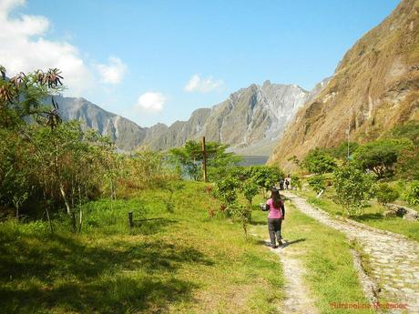
At the back of the park where we came from, green hills form a protective wall around the craterlake, hiding Mt. Pinatubo’s beauty from the world.
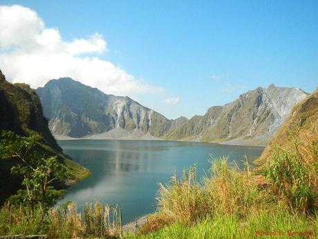
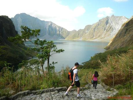
Words and even the photo below are not enough to describe the immeasurable beauty of Mt. Pinatubo’s caldera and crater lake. The tranquil view of this can best be described as out of this world. Seeing the entirety of the caldera, which is 2.5 kilometers in diameter, and the crater lake the eruption left behind left us a deep sense of awe. We realized just how beautiful and terrifying Mother Nature is after looking at the caldera.
Let’s go down to have a closer look at that aquamarine lake. Don’t worry if you’re a non-hiker; the way down is marked by a stone path.
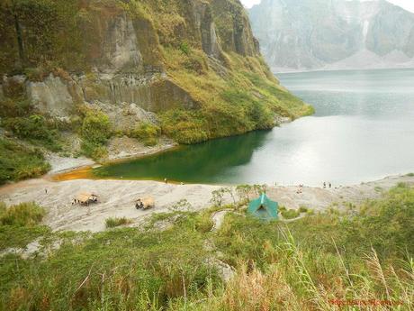
Natives and local guides built a number of these native bamboo-and-nipa cottages that serve as rest stations for hikers.
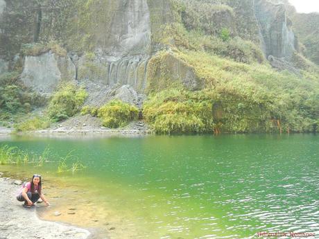
Upon reaching the sandy shore, Sweetie checked out the water of Mt. Pinatubo’s crater lake; it’s not hot.
Water from monsoon rains filled up the caldera soon after the volcano’s eruption, eventually forming a crater lake now known as Lake Pinatubo. Lake Pinatubo is considered to be one of the deepest and most beautiful lakes in the Philippines.
At first, the water in the lake was hot and extremely acidic. In time, subsequent rainfall cooled down and diluted the lake.
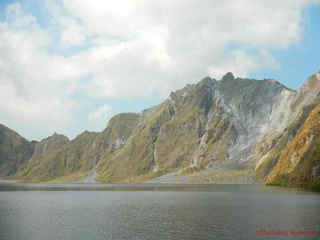
That is one of the walls that make up the caldera. The gradual erosion of the caldera caused by winds, rains, and other natural causes may lead to the ultimate collapse of one of the caldera’s walls. When that happens, Pinatubo Lake will drain out in a huge deluge and will be destroyed.
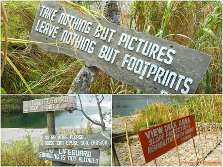
For safety and to protect Mt. Pinatubo, please take heed of the rules written on the signs.
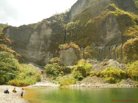
A high cliff borders the shore. Although it appears mighty, it is actually made up of compact lahar. Anything can set it off crumbling on the ground: the rains, loud noise, or a careless bump. Thus, be vigilant of the surroundings and don’t do anything stupid.
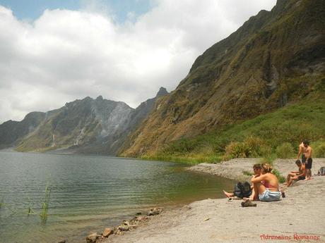
Several foreigners relaxed and enjoyed the vista of Mt. Pinatubo’s caldera. No, they didn’t swim even though the water is definitely inviting. Swimming or kayaking in the lake is now prohibited although they allowed these activities some years back.
Lake Pinatubo posed a threat to nearby residents last September 2001 when geologists discovered that the walls of the caldera were becoming unstable. If left unchecked, the wall could collapse, sending a deluge of mud of water. To remedy such a catastrophe, the government ordered workers to dig a 5-meter wide channel at the thinnest edge of the crater to initiate a controlled flooding.
The move was successful, draining a one-fourth of the lake’s volume and averting a massive disaster.
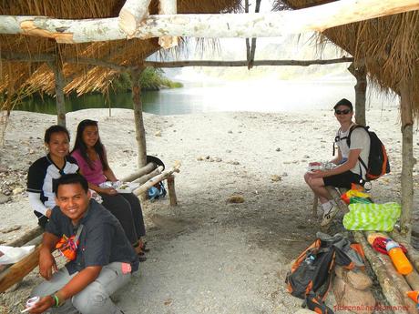
At 11:00 AM, we ate the packed lunch that Ms. Sonya provided. The nipa-and-bamboo cottages shielded us from the hot sun.
Then, it was time to go back. Just check out those green, beautiful cliffs. They’re definitely mind-blowing!
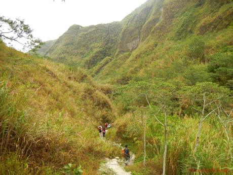
As we walked back towards the last parking area through the lahar canyon, we realized just how powerful Mother Nature can be as we stared at the lahar-eaten walls. It took just a few months to leave a huge swath of destruction such as this.
During bad weather, trekking in these canyons is strictly prohibited.
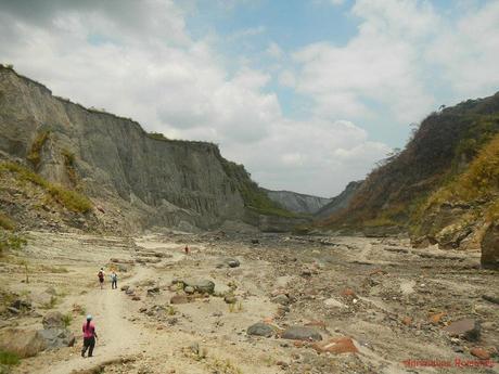
See how unstable that wall of sand is? That’s why trekkers are advised to keep voices down. Loud voices could hasten erosion and can cause the walls to fall down, endangering anyone below them.
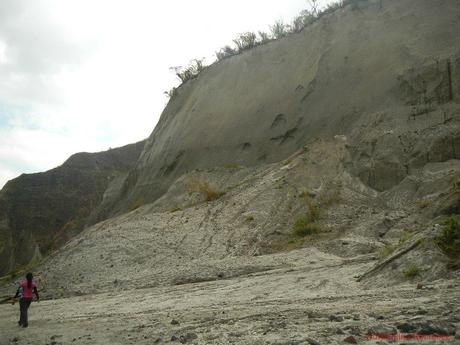
That jagged wall of sand is the remnant of a once powerful mountain that was devoured by the lahar. Soon during the rainy season, this remnant may forever disappear from the face of the earth.
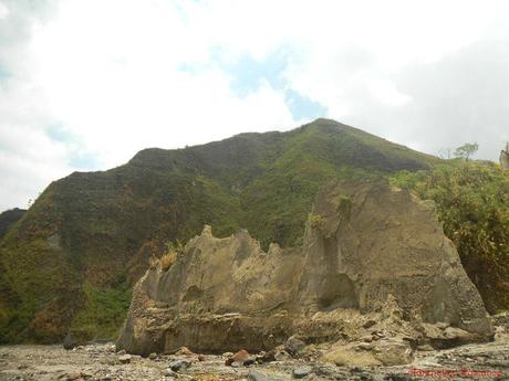
After an hour and a half of trekking, we finally reached the parking area where our driver patiently waited for us. We shot the photo below, then boarded the 4X4 quickly. Why quickly, you might wonder? Well, there was a thick, ominous, gray cloud approaching. You do know what happens to this place when it rains, right?
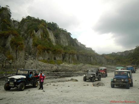
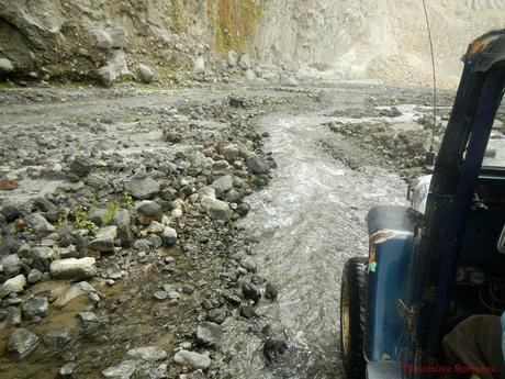
On the way back to civilization, we discovered the streams which we crossed earlier that morning were getting stronger and deeper. That means, rain has started to fall somewhere.
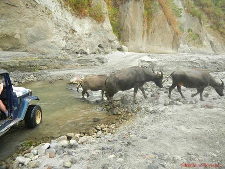
However, it was still quite warm and humid in the canyon. So much so that when we encountered this small herd of carabaos (water buffalos), they were almost fully submerged in the water, enjoying the liquid’s coolness. Of course, they moved out as we invaded their spa.
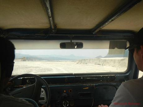
Before long, we exited the canyon and entered the vast lahar field. Now, this was an unpleasant part of the trip. You see, the wind was blowing hard behind us. Thus, we didn’t have any protection from the dust, ash, and sand that was churned out by the vehicle’s wheels.
Now we know what it feels like inside a sandstorm!
After an hour, we were back at the jumpoff point and enjoyed some glasses of ice-cold halo-halo while waiting for Ms. Sonya to pick us up. She then brought us back to her wonderful homestay where we can take a shower, pack our things up, and check out. Ms. Sonya is such a beautiful, wonderful guide and host.
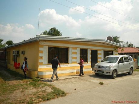
She didn’t just take care of us. Knowing that it’s Easter Sunday and people are now returning to Manila to get ready for Monday (thus the really heavy traffic), she drove us all the way from Tarlac to the NAIA 3 Terminal! Now, that’s what you call “going out of the way!”
Thank you so much for the warm hospitality and exceptional service, Ms. Sonya! Rest assured that we will avail of your services again for many of our upcoming Luzon adventures!
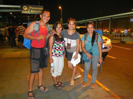
Thank you to Sir Jigz Santiago and his partner Efrylle Marcial for accompanying us for this trip. We had so much fun together doing these adventures. Let’s do another one during our anniversary next year, shall we?
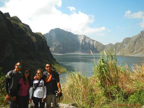
Our Zambales escapade was a complete success and a truly fun adventure. But most importantly, we were able to do what we actually came for: a solemn, reflective visit to the mighty volcano that once utterly destroyed the land but is now reshaping it into something wonderful.
Tips to follow


