RJ Hamer Arboretum, Dandenong Ranges National Park
I guess it's time for a day hike? The walk in this post is one I've wanted to do for the past few months. A circuit walk up in the Dandenongs east of Melbourne always sounded like a nice stroll, but for me it's on the other side of town and driving there always makes me feel a little suicidal. If I was going to go through some driving pain then I think it's best to share it, so I managed to drag Anon along.
You'll find this walk in the Glenn Tempest book 'Daywalks Around Victoria' (where else?!) and I'm slowly working my way through the walks in this book. He doesn't make things easy though as Open Spaces Books are pumping out new hiking books regularly. What's he trying to do? Kill me? Anyway, the Dandenong Ranges National Park is a nice place to go walking, but you must be prepared to share it with millions of others as the whole area is pretty popular on weekends.
We'd attempted this hike a couple of months back, but ended up getting into the hills too late in the day, so we abandoned and elected to do the 1000 steps walk instead. What's that walk? Well, simply put, it's a stack of steps up a hillside and there are memorial plaques along the way giving a write up on the Kokoda campaign in World War Two. The main reason I'm mentioning this is I've just worked out that I can embed my Garmin GPS readings on the blog page instead of attaching links. Why didn't I work this out about 25 posts ago? I'll show you what I mean as the 1000 steps walk from the GPS is below.
See what I mean? You can click on it and do all sorts of things. Oh well, you'll see them more often from now on. You might be asking, "What's the 1000 Steps walk like?" Well, I don't have any photos at all as I think the walk should be renamed the '1000 people'. It was like rush-hour and I was glad to get it over and done with. It might be okay mid-week, mid-winter, mid-night time and mid-hailstorm. Only then would the crowds be a little reduced and I can't say I'm interested in returning to rub shoulders with half of Melbourne on a walk again.
This time we allowed ourselves plenty of time to finish the walk although this was the first day in which daylight savings had finished. The walk begins in Olinda and the first port of call was the nearest bakery. The only problem with this method is that all the prices in the Dandenongs seem to be geared to slugging the tourist. I guess my mistake was to order a small homemade apple pie which cost a lazy $10, but although I was now destitute and I'd have to skip a few meals during the week I at least had a snack for the walk.
So, with the wallet lighter we were off on the well formed Rock Track. In fact nearly all the tracks for the day were wide and provided easy walking.

Rock Track
A few weeks back, the Goat introduced me to what at first glance, appears to be a completely daft topic on Wikipedia titled, 'Buffalo buffalo Buffalo buffalo buffalo buffalo Buffalo buffalo'. It's a grammatical mind-bender, but Anon decided to weigh in with an alternative where the word 'buffalo' is substituted with 'badger'. I think the first 30 minutes of the walk were spent analysing the word 'badger'. It's just about perfect. There's a town called 'Badger', to annoy someone could be to 'badger' them, but the only thing that trips it up is that unlike 'buffalo', more than one 'badger' would be 'badgers' I believe. Mm... Blast.
Whilst the word 'badger' was being dissected we almost missed a group of balloons stuck in a tree. Not really the greatest sight to see and no doubt they'll end up in Port Phillip Bay at some point in which a toll will be taken on the wildlife there.

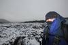
I was feeling a little risqué when it came to photographs for this walk. Instead of taking an 18-105mm zoom lens, I decided to just make do with a 35mm F1.8 prime on the camera. This can be a little restrictive and intimidating as I would be forced to move around for any composition. It's pretty easy work with a zoom, but with the 35mm not being wide angle I'd have my work cut out a little. Oh well, that's the sort of first-world wild man I can be.
It was easy going to the first place of interest being the R.J. Hamer Arboretum which is an area of colourful Japanese maple and silver birch trees. It was my first chance at having to move around in order to capture the scene, but having a wide-angle makes photographing trees so much easier. I was bending backwards until my hair was touching my heels, lying on the ground and stepping through the bush to get some sort of decent shot.


Whew. This is hard work. Just as in the Judas Priest song, 'Hot Bokeh', a big advantage of the F1.8 is I was starting to get some depth of field blur happening in the pictures.

'Bringing Back the Balls to Bokeh' - Lordi

'Let There Be Bokeh - AC/DC'
We continued on making good time, but it's always a worry when it seems as if the first hour is spent going downhill. Surely there's a pay off later for this casual descending? It was all pretty much standard Dandenong Ranges fare which is beautiful tall trees and plenty of ferns.

Mathias Track
Do you see what's going on the photo above? I was forced to resort to extreme measures for that photo by actually lying on the ground. I can do that, but with my creaky knees it takes me as long to get up as a supertanker takes to stop in the ocean. What sort of analogy is that? Well, it's the best I can come up with right now. The trouble is I'm writing this before 6 pm. After six is when my better analogies are written.

'Cites on Flame with Bokeh - Blue Öyster Cult'
We slowly strolled up Mathias Track passing a feather on the ground which had me lying in the dirt again to photograph it.

Lying on the ground isn't too bad as one gets to see the surrounding trees from a new angle.

You know what else was brought to my attention last week? Ben informed me that the words 'hot dog' doesn't make sense. He went into quite a detailed description of how a 'sausage roll' should be the name of what a 'hot dog' sausage is now. Why? Well, it's a sausage that goes into a roll. My question to that is, "Okay, if that's the case, what do you call that's currently a sausage roll now?" Ben answered confidently, "The names should just be swapped. The hot dog is no more a hot dog than a sausage roll". See what I have to deal with?
Back to the walk. We reached Falls Road which is followed a short distance to guess where? Yes, Olinda Falls of course.

Falls Road
We strolled down to Doreys Bridge which took us by surprise as it's not really a bridge at all. Okay, it sort of is as the road goes over a huge concrete pipe which water flows through. There's no traditional looking bridge though. Actually, this is getting too difficult to describe, so I'll just show you a picture instead.

Doreys Bridge
See what I mean? If you didn't hear the water you would think you've missed it. Now, the stroll to Olinda Falls is a side-trip from here. Anon wasn't very enthused about doing any side-trips, but I have a problem with that. The falls were in the walk notes and if I don't do everything as described in the notes then I can't classify the hike as completed. Without the falls, the walk will be filed as a 'Did Not Finish' (DNF) which means I might as well have not done the walk at all. I'd also have to come back and re-do it for the sake of completion. Yes, I'm aware that it's a mental condition, but that's the way it goes, so we were off on a fern covered track to the falls.
There were plenty of sights to see on the way which forced me to enable F1.8 on the camera. Firstly there was a reasonable group of fungi...

...then a small fern leaf swinging by a cobweb in the breeze...

'Raised on Bokeh - Elvis Presley'
...and a curled up fern frond.

The fungi kept coming as well which is not surprising as this section was a closed in fern-fest. The whole area was damp and I could imagine it would remain that way even in warm weather.

Now, I wasn't expecting that these falls would stop the world from turning, as the notes say, ..."don't expect anything too dramatic..." and upon reaching them I realised those words were quite prophetic. They really are an extremely casual looking falls. Actually, is there a required drop for something to be named a waterfall? I would think there has to be some sort of rule as Olinda Falls just struck me as a largish rock with water pouring over it. Mind you the largish rock is about my height. It didn't help that there were at least 20 people yelling, screaming, videotaping, taking clothes off (yes, seriously) and running around as if they'd just stumbled across the Niagara Falls. Anyway, this was a hit-run mission due to the racket and I'd have better photos if the people taking their clothes off didn't get in the way.

Olinda Falls (The top of the falls are at my eye level)
There will be no half naked people flashing skin in this blog as it's 'family friendly' and I can't afford to upset my readers. I mean, only last week I said 'fuck' in a tweet on Twitter and immediately lost two followers. Egads! Criminy! Jumping Jehoshaphat!
So, we left
There was a trade off to having this apple pie though and that is I broke the GPS. What? Yes, somehow in showing off my incredible athleticism I leapt to my feet and the cord of the GPS which was around my neck became caught on the slats of the picnic table. As I accelerated to near supersonic speed upwards the table wedged GPS just snapped off the mount to the neck strap. Is this possible? Did Garmin just go head to head with an apple pie and lost? So, I was left with a cord around my neck and a GPS lying on the ground. Grrr... In order to save the day I had to utilise some of my 'Bear Greggz' skills and rethreaded the neck strap to the back cover of the GPS. It's not perfect, but at least it's sort of how it used to look.

Rethreaded strap...
It was time to head off and return to Doreys Bridge with the next section being a long slow climb up Mechanics Track. This was probably the only uneven path for the day as it weaved amongst ferns.

Mechanics Track
This damp forest was perfect fungi territory...

'Disco Nights (Bokeh-Freak) - GQ'
...and for spare car parts. Car parts?


Okay, I had better get moving as I've just noticed this post in which not a lot happened is getting massive. The next target was Mount Dandenong itself which is the highest point of the range at 633 metres. Before getting there though we passed through Mount Dandenong Arboretum which was full of colourful trees and fallen leaves.


'Bokeh - Primal Scream'

Not to mention flowers...

There was a shortish climb to the top of Mount Dandenong which usually has nice views of Melbourne. On this day though, the sky was white with cloud and glare which reduced visibility through the haze. So, I didn't take any photos at the top and also the fact there had to be about two hundred people around didn't help. The place was going nuts with barbecues and functions and about the only picture I took was of this statue in one of the gardens.

This walk was over half way now and we were quite keen to escape the hordes on top of the mountain. The next track to walk on took us to the 'Kyeema Memorial'. What's that? Well, I didn't know what it was and had never visited it before, but in 1938 a DC-2 plane called the 'Kyeema' flew into the side of Mount Dandenong in bad weather, killing 18 people. The appropriately called Kyeema Track led to that spot as it hugged the side of Mount Dandenong.
There were some nice views here, but with the glare it was an exposure nightmare. I spent about 20 minutes on Lightroom trying to resurrect this picture from a complete white-out. It's not perfect, but you should see the original untouched image!

The track from now until the end of the walk was generally nice and wide which made for comfortable strolling.

We reached the Kyeema Memorial which consisted of a plaque and information board. I was going to take some pictures here, but unfortunately three of the stupidest people in the history of mankind were there. One insisted in sitting on top of the memorial and wouldn't budge for the ten minutes we spent there whilst uttering complete idiotic crap. There was stuff like, "Whoa! Dude! Look at the size of that ant!!" and then a convoluted conversation which consisted of, "Why would it crash here, when this isn't the top?" In the short time I listened to these bozos I could feel my brain turning into blancmange. In the end I managed to take a photo of a small plane symbol on the memorial, but it's a pity the whole thing has been scratched and engraved by a million dickheads over the years.

Oh well, it was nice to see the memorial, but unfortunately that's the problem of walking in areas that are insanely popular.
On we continued whilst passing a massive television tower. The Dandenongs are actually full of transmission towers and the one we passed happened to be the biggest at 204 metres.

We didn't spend long at the barbed wire fenced compound of the huge tower. There was a quick descent down into a fern lined path again which was ringed with some enormous trees.


We were well and truly on the home straight now until we came across this...


This just happened to be exactly where we needed to go, so I looked at the sign for about 0.5 of a second and walked around it. It seems every walk I go on I come across a sign like this and if I obey every one I'll never get any strolling done. I was interested to see what the problem was and after a kilometer or so we came across a section of the track which had been washed away.

Guess how long it took to negotiate that hole in the picture above? How does 20 seconds grab you? We stepped down into the hole and walked up the side before continuing on although there was a toll in doing this. I got some dirt on a couple of my fingers.
It was getting a bit late in the day now and with the light a little dim we were rushing along. There was a few more hills to come with one lined by trees...

...before coming to the final track for the day. The setting sun was putting a nice glow through the trees and this happened to be the largest hill for the day. It was about 500 metres long and after a day of walking I was suddenly feeling a little stuffed.


We slowly chugged up to the top where a residential street appeared and it was only a few hundred metres more to the car. Oh yeah, by the way it was bin night (recyclable).

A short stroll on this road and we were back at the car just as it was getting dark which was pretty good timing in the end. So, that was another walk done and it was quite nice. The only thing that bugs me about the Dandenongs is their popularity which I admit is my problem and not others. We saw lots of people during the day and you know what else was a little annoying? The constant sound of motorbikes, both road and trail bikes. I saw barely any, but the noise was more or less constant all day. An infernal buzzing sound reverberating of the hills around us. I've no idea where they were, but they were out there somewhere.
Hey, remember the Garmin thing at the start? Well, here it is for this walk.
There you go. A 17 km walk with total elevation climbed of 548 metres. It's a bit more strenuous than the coastal walks I've done lately, but still not too hard. What about the pictures? Well, using only a prime lens can be hard work, but that was the idea. It also gave me a chance to get some bokeh going. Did I mention the word 'bokeh' earlier at all? I think I did. I might give it a go on my next walk, but hopefully next time it's clear and sunny as even my prime lens has a nice, new polarizer that's waiting to be abused. Okay, until next time...