In 2013 Alpaca Expeditions had a trekker on the Classic Inca Trail Trek named Rusty Rayner. Rusty has a website development and graphic design company in based in Rockledge, Florida in the USA. Rusty had traveled to over 30 countries prior to his trip to Peru, but he felt that his Inca Trail trek was one of the most memorable adventures he had ever experienced.
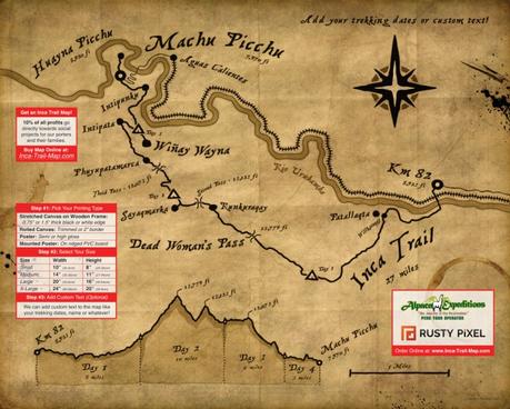
When he returned back home, he became fascinated by researching the old Inca Trail maps. With his talents and abilities, he decided to create a customized map of the Classic Inca Trail he had just trekked. This stylized map was designed to look old, hand-drawn and heavily worn, as if it accompanied Hiram Bingham when he first rediscovered Machu Picchu in 1911.

We suggested to Rusty that he consider sharing his maps with our other clients by offering the maps for sale. He agreed to donate 10% of the profits to our Social Program to help the families of the porters who made his Inca Trail trek possible in the first place! Having been on the trek with Alpaca, Rusty knew just how hard the porters worked and their importance to the overall experience and enjoyment of the trip. So he agreed and this website is the result of this partnership.

Hiking the Classic Inca Trail to Machu Picchu is a once-in-a-lifetime experience that you will remember and treasure for years to come. This unique map makes the perfect souvenir that you can proudly display anywhere. We hope you enjoy this Classic Inca Trail map for many years to come!
