
Smuffin reflects on what had happened this day.
I'm putting the warning out early. This post will be long and nasty, with the possibility of freestyle profanity combined with gnashing of teeth, as I reflect on this days hike from Five Mile Track to the Cape Liptrap Lighthouse. So, fasten your seatbelts, tighten your suspenders and hitch up your underpants until you're holding the waistband with your teeth.
Right now at the computer, I've adopted the traditional Howard Hughes position of complete nudity and blinds pulled shut, whilst flagrantly disregarding the cold, darkened room, which has caused ballistic shrinkage to the point that it feels like I'm packing a Tic-Tac. I might even have to divulge every detail to my psychologist whilst in his Stalinist era, austere consulting room (it's the western suburbs after all. There's no chesterfield couches out west) so that I'm no longer haunted by the eight hours spent in the Cape Liptrap Coastal Park.
The night spent at Five Mile camp was quite pleasant. Not too cold, but there was a problem in the morning. The natural windbreak from the surrounding trees only amplified the feeling that it was going to be hot. How hot? Well, little did we know that what was to come, just happened to be the hottest day so late in the season since 1940, with temperatures varying between 31 and 35 °C. Heat is the nemesis of the big bloke, but we'd set out from the Venus Bay with seven litres each and I'd be starting this day with five. Surely that would last me? Mind you, as a spoiler, later in the day I was cursing the mouthful of water I'd used when brushing my teeth.
Anyway, down towards the beach we went, whilst following Five Mile Track...

...and hit the sand with the days walk in front of us.

There was a brief bit of fanfare with a bug that'd landed on Smuffin's backpack. You know how it goes. The traditional, "Oh my god! There's a huge bug on your back!!!!" which creates complete fear, but really it's nothing at all. It's a tired old joke, but there's still a bit of mileage left in it...

The sand walking was initially quite comfortable, with the traditional Pacific Gulls whizzing by...

...before the beach began to change. Rocks began appearing in ones and twos, before becoming a complete rock-fest. Remember in my previous post? How the sand was pristine with no driftwood whatsoever? Well, as soon as the rocks were reached it began to change. The odd fishing tub...

Hey Jack, I've found the tub you lost.
...and then suddenly the strangest sight. Dozens of salt water and sun bleached timber pieces, piled high amongst the rocks. It's strange how the sea dumps its refuse. Why was it all here? Where did it come from? Why am I in this room without my pants on?

It was disappointing to leave such smooth, weathered timber behind, as they do make quite nice features in the lounge room. It wasn't just a shame about the timber, as there was some rope washed up which would also be handy. It lay like a sea serpent, wrapped around the rocks, pining for its supertanker...

Moving on, the first of the rocky headlands to negotiate for the day appeared. Remember it was more or less high tide, as we were aiming for the low on the rock shelves of Cape Liptrap late in the day. A spot called 'Little Point', just happened to be...guess what? What's interesting, was the cliffs that surrounded it. Striking looking stone, that appeared to have been layered and then tilted, before another layer had formed on top, with the process repeated...

Little Point was easily negotiated by heading across a short inland section...

...before immediately descending to the beach again.
Continuing on, we passed Ten Mile Creek. I was expecting some sort of pathetic, dribbling little stream, but it was surprisingly full. In hindsight, I think it would've been better to camp at this creek the previous evening. It was more remote and we could have boiled some water for use. Remember, I'd forgotten the water purification tablets, so the water available now was of little use. Oh yeah, the other bonus of this spot is that it appears to be motorcycle-access free.

This is pretty relaxing isn't it? Are you wondering what happened to the rant at the start of this post? Well, things slowly started to change. It was a little ominous when we passed the washed up remains of a hardy pufferfish, who had clearly seen better days...

...and shortly nearby, this...

I swore we'd found a dinosaur. Well I was hoping, but deep down I was pretty certain we hadn't come across something that'd casually washed up on the beach after dying 65 million years ago. I turned to the wise man of reason, the 'Guru of Hops', the Smuffin, who declared it to be the jawbone of a whale. Do you think that's it? Well, I'll let you know that I'm not just any old wanker on a keyboard who's satisfied with a guess. I'm here, to both enlighten and annoy you at the same time.
I sent the photo to the 'Discovery Centre', Melbourne Museum hoping to get some clarification. I received an 'auto reply' that my request may take up to six weeks for processing, so promptly forgot about it, until suddenly receiving a reply four days later. Yes, Wayne at the Discovery Centre had flexed his muscles causing his shirt buttons to pop off at speeds approaching the sound barrier, taken names and kicked arse to hunt down the identification of our jawbone. This is his reply...
"...I have examined the skull in the image you have provided, and I have also conferred with expert staff from our Mammalogy department, and our consensus on the skull is that is an incomplete (that is, partial) skull from a juvenile Sperm whale (Physeter Macrocephalus). This distinctive species is cosmopolitan in distribution, and whilst your record is of note due to its location, the apparent condition of the skull is such that it is not a priority for the Museum to acquire for our research collections at present. The specimen lacks a lot of useful scientific data, and furthermore we do have several sperm whale specimens already in our collections. Our advice, therefore, would be for the skull to remain in situ..."
How's that? What a great response and service! Yet there's people who want to slash these public institutions remorselessly. I wonder who they'd be?
We left the whale bone behind...

...and now reached a section called the 'Arch'. There isn't an arch shaped rock platform here, but apparently there was one, so it's the non-arch now. Anyway, this is where the inland walking starts, as the beach is impassable. "What about at low tide?" you say. Mm... Not sure, but I think the answer is no, no matter what the tide is doing. I guess the bones of the dead should have been a warning of what was to come?
Oh yeah, in order to give you the full effect of the next few hours, there will be profanity. I'm very reserved about this on the blog, which is a fine effort, as I usually swear as much as a sailor (it's alleged they swear a lot) who's just been abducted by a bus-load of Yeti's (just think of the Venga bus, but it's Yeti's inside instead) for the purposes of sex slavery.
A track climbing from the beach was clearly visible...

...and it was a rewarding view from the top, looking back at our mornings strolling.

Now, I'd downloaded the track from the Open Spaces Books website and put it on my GPS. I didn't really think I'd need it though, as the concept would be fairly simple. 'Keep the water on the right and walk' was the idea. What could possibly go wrong?
Well, as soon as we hit the top of the cliffs any semblance of track vanished into annoyingly, difficult scrub to walk through. I pushed through the bush initially, before proclaiming,
"What the fuck?? These muthafuckin' trees are fucking ripping me to fucking shreds!!!! Fucking fuck, big bunch of fuck!!!"
(Ed. There's been a number of reports from wildlife in the vicinity that what's just been written is not a word-perfect account of this particular tirade. It's alleged the word 'booyah' was also shouted, but it's location within those sentences is subject to conjecture.)
Smuffin was distinctly unimpressed with what lay ahead, so he headed straight for the cliff edge. It was touch and go whether he was about to jump, but instead he hugged the cliff-line as it's easier walking. In the next picture, I'm standing on the GPS track and Smuffin is at the far right with a more sensible idea...

Another mistake I made is that a partial track could be seen through the trees and I elected to bash my way to it, thinking it'd be clear sailing after that. Little did I know that the 'track' I followed, descended into a gully and there's one thing which is quickly learned. Don't enter any gullies in this terrain, as the trees are above head high and your entire body begins to get cut, instead of just your legs.
I crashed through and hit a large tree which had wall-like properties and with ankle high branches slicing my bare legs, I elected to halt proceedings. I considered my predicament and elected to belt myself around this green monster, but the only reward for this effort was falling into a
"What the fucking hell is this fucking fiasco fucking crap???!!! Fuck the fucking GPS fucking track!!!!"
(Ed. Again there's conjecture regarding the last statement. A sleeping wombat reports being awoken and hearing profanities being shouted regarding the Opposition Leader Tony Abbott. Unfortunately the sound of breaking branches blocked the entire tirade, but the words, 'hope', 'speedos', 'cock bitten off by bull shark' are alleged to have been said. Hopefully other disturbed wildlife will make reports to clarify this.)
Somehow I reversed and headed straight for Smuffin territory. It was a lot easier and the pattern was set. Don't even bother looking for the track. It fades in and out and by far the easiest walking is to hug the cliff edge. Oh yeah, hug and not fall off, as at times the edge was soft and vertical looking...

Whilst inching our way along the cliff-tops, the wind began to pick up and it was an ugly beast of a thing. A stinking hot, mouth drying, north-westerly began to cook us and it became clear what one problem this walk has on a roasting day. There's no shade. At all. You've just got to stand up and take it. Also, something else to heap upon your misery is there's nowhere to sit. There are rocks of course, but this particular landscape is jagged and sharp. I stopped for a moment to catch my breath, sat down and immediately felt as if I was being violated. It was like being back in the Army again.
We managed to clear one ugly set of scrub and a brief stop was required to take in the results. Mind you, we were about 100 metres apart due to different route guesses. Oh yeah, I forgot to mention at the start of this post that I'd donned the white socks for this rock section. I figured they'd come in handy on rocks instead of plain sandals. So, here's a picture of the outfit after the first bloody bush assault. Just remember, I'm bringing sexy back to hiking, so hold yourself back ladies. I don't want you swooning too physically...

Hiking like a BOSS.
I did find a seat amongst this sandy patch and the coastline looked pretty good from the cliffs...

...but, unfortunately whilst resting I had unwanted company. It was annoying having flies festering on my open sores...

Smuffin was also counting the cost and as he arrived it was noted he was bleeding. He bleeds for no reason anyway, so he was always going to be spurting blood during this section. There was still some positive mojo going on though, as he indicated with a solid thumbs up...

We also had a look at the GPS which indicated that as the 'crow flies', it was only four kilometres to the end of the walk. Make note of that sentence, as I'll return to it later. What now? Well, there was plenty of cliff-top walking to go, so we set off and it was remarkably clear. There was good in the world again...


The arch which isn't an arch sat offshore. Well, I think it's in the next picture? It's quite difficult looking for an arch that isn't one, but what's more interesting to me is the small shapes of the cliff in the foreground which seem to replicate the non-arch in the background (If that's the arch. By the way, how long can I run with this joke...?)
(Ed. Not long. That joke is wearing thin.)

The coastline looked great as well...

Looking towards the Cape Liptrap Lighthouse.
...and the beaches of course...

...but we had to keep an eye on the erosion. Our cliff-top strolling revealed loose edges where the vegetation had given way and taken a plummet...

It was whilst edging along here I noticed a small, flat section at the cliff edge. Something odd caught me eye, so I braved it by going down for a closer look. It was a tragic scene though, with the sun-bleached remains of another hiker who hadn't made it through this stinkin', scrub covered section...


Around the corpse the beaches looked lovely though...

There were still pockets of scrub and we were avoiding it, but man, the sun was starting to burn. It was hovering around 32 °C for a lot of the time. You may be wondering how I know this? Well, I just happened to be carrying a Kestrel 4000 weather meter and that's what it kept telling me. Don't forget, besides the heat, the dry wind was killing us and I'd drunk a lot of water. I noticed in this section that I was down to my last liter after starting with five for the day, and was rationing it. All I wanted to do was gulp down a jug of water like a complete bastard, but was forced to sip instead.
The release valve from the cliffs was Morgan Beach and it could be seen a short distance ahead. We were both feeling confident until this happened...

Morgan Beach ahead...
Are you joking? It may look lovely and pretty, but looking at this photo I've suddenly started to shiver in fear. The trees were as thick as any before and the way ahead was problematic. After a bit of head scratching, we descended into this sandy hollow...

...and Smuffin went left. His declaration that from his position it was 'as good as any' didn't inspire me too much, so I went up that sandy path to the right. I'm telling you now, that photos deceive, as that little sandy-looking opening, took me about five minutes to climb. The sand was biblically soft and any vegetation I grabbed for some leverage came off in my hand, so I was resorted to the pathetic method of hauling my blubbering body up on hands and knees. Eventually I made it to the top to be confronted with, well... scrub.
In my only stroke of luck for the day (other than waking up. That's always a bonus.) I noted an opening to the right which descended briefly and then suddenly opened up to clear ground. Powering towards the descent to Morgan Beach I'd lost sight of Smuffin, but I could hear him. There were a number of obscenities emanating from randomly shaking trees which I assumed was him 'walking' through the bush.
I raced down to a sandy utopia, with scrub free walking at last...

...and stood on the sand praising evolution, but there was something missing. Where was Smuffin? The minutes ticked by and I considered whether he may need some assistance. Looking at my watch, I allowed him 15 minutes to arrive, before downing the pack and heading up for a possible rescue attempt.
Eventually at about the 14 minute mark (Phew. I didn't want to walk back up the hill) he appeared, still on top of the cliff, but in the clear. As he stumbled down I observed that he was bleeding, well... everywhere. His legs were shredded and he was borderline hysterical/violent/not happy. I thought I could cheer him up with what the GPS was telling me. He said,
"How far to go?"
"As the crow flies...?"
"Yeah"
"Four kilometres".
"What the fucking hell? You fucking said that two fucking hours ago!!! How the fuck can it fucking be still four fucking kilometres. For fucking fucks sake. Fuck!!"
"That's what it's indicating at this stage."
(Ed. When faced with expletives every millisecond, witness accounts regarding an outburst of this nature are notoriously unreliable. There's most likely more profanities, but under an expletive assault the brain can only process so many. The agreed thought at this stage, indicates that Smuffin wasn't happy.)
We were now on the wonderfully hard sand of Morgan Beach where the walking was easy. Don't worry, I've got something to whinge about though. I was down to my last dregs of water and every swig was rotated around my cheeks to just wet them. My mouth was insanely dry, but there was just the rock hopping section to go after the sand, so the end was in sight. Mind you, the wind was howling through here and it was whipping up sheets of sand that stung the backs of my sunburnt legs. Luckily it was behind us though, as walking into that crap would've been disappointing...

Wind whipped sand on Morgan Beach
This is another lovely beach, but it's interesting that the walk notes state, "...Morgan Beach is as lonely as it is wild..." I'm not whole-heartedly convinced by this statement. I guess it was the clearly visible houses on the cliffs nearby which caused my suspicion? I certainly didn't feel any isolation. I was feeling extreme, dehydrated pain, but no isolation.
We'd timed our low tide run across the rocks near Cape Liptrap Lighthouse perfectly. I guess the word 'run' was not exactly accurate, as we stumbled and groaned over the uneven surface. I will declare now, that the photos in this section are 'stock standard'. I was so rooted, that all I did was hold the camera up and blast away at different points. I didn't compose, frame, check settings or anything. It was set to 'landscape' option and left there, as my brain was no longer capable of rational thought.
The tide may have been out, but there were still a few interesting bits where tired, frazzled brains were struggling not to fall over...


I was hoping the rock shelves would be relatively flattish to walk on. They weren't. In keeping with the whole area, huge layers of rock were tilted at angles such as the photo above. They'd be a tilted section with a gully of water between, before the next tilt and so on. It looked weird and was hard to walk on at times.

Many rocky sections on the coasts I've walked are relatively wave-worn smooth. Not these ones. In spots they were sharply angled likes sharks teeth, which didn't do my feet any favours. Then there were the coves. I had a vision in my mind that I'd be able to see the Cape Liptrap Lighthouse at some point, so as we rounded every headland I'd scan the cliffs above hoping to see the beacon which signalled the end of the days walk. We never saw it though, and each cove had its own form of pain.
I even named them all. This particular one was soft to walk on, with the pebbles giving way under every step and being angled, it formerly announced itself as 'Purgatory Beach'.

Purgatory Beach
At around this point, I actually ran out of water. There wasn't a drop left and my mouth felt as if I'd been held down by those amorous Yeti's who were mentioned earlier and they'd stuck a hair-dryer in my mouth whilst turning it on to full napalm setting. Huh? You thought I was going to write that the Yeti's were going to put something else in my mouth other than the hair-dryer? You should be ashamed of yourselves.
Anyway, before I got sidetracked, Smuffin gave me 600 ml of water which was very appreciated by my wilting frame. It was a classic moment of Australian values, mateship and giving the down and out a fair go, like a couple of Diggers standing tough through hardships and...
(Ed. The last sentence had to be stopped, as it was never going to conclude and the values listed are not unique to Australia and can be found in many countries and cultures around the world. Plus, it had to end as it was entering homoerotic territory.)
Continuing on, there were some easier rocks...

...before more clambering into a new cove...

Is the lighthouse around the corner?? The anticipation is rising! What's there...?!

Kick to the Testicles Beach
Nope. Just another cove of soft, angled pebbles which is known by its rarely used name, 'Kick to the Testicles Beach'. This was slow going and the sun was getting low in the sky. It gave a nice glow to the reddish rocks around us, but unfortunately I wasn't appreciating the natural beauty at this stage.


We reached the end of this cove and turned the headland. Smuffin was absolutely convinced he'd see that shining light on the cliff-top. He raced around the headland, ignoring the small abandoned backpack lying in bushes, that'd been left by another hiker who had perished long ago (lucky bastard)...

Umm... There was no lighthouse and it created quite a storm, as Smuffin in technical terms, 'lost his shit'. As a result of this, there was always going to be some consequences. He proclaimed,
"What the fucking hell is the fuck going on??!! Where the fuck is the fucking lighthouse, for fucks sake??!!. What's that fucking G-fucking-P-fucking-S saying fucking now, fo...
(Ed. Unfortunately, this tirade has had to be stopped. There were still another five solid minutes of this and it continued into various descriptions of genitalia, Glenn Tempest, electronic devices (namely the GPS) and the universe. That's not all, as it's believed to have exceeded all known outbursts of expletives in such a short time-frame. Neither the intensity, sheer number or derring-do of the profanities uttered at this point, have been bettered by previously known records world-wide.)
As Smuffin trooped off into the next cove, I made a point of checking the much maligned GPS and it indicated that the way out was via the position I was already in. Straight up the cliffs next to me. Breaking the bad news to Smuffin wasn't easy, as he was rapidly vanishing in the distance. In these desperate times, an extra 100 metres walked for no apparent reason was a killer.
Looking at the cliff in front, there didn't seem to be a defined path (of course). Smuffin found something that looked like a goer and I found another, so we headed up our respective 'tracks'. Mine was surrounded by beer bottles, so I was feeling confident it was the correct way up. It was bloody steep though, so there were frequent stops to re-mojo and take the odd photo...
")
Guess what? The words I didn't want to hear were uttered by Smuffin, who was about 50 metres away, but not visible due to a solid band of bush between us. He said,
"Hey. Where are you? The path is here!"
Upon hearing this, I immediately suffered the little understood phenomenon which is medically termed, 'died in the arse feeling'. Literally. As I suddenly found myself sliding down the hillside on my arse.
After all of the days dramas, I hadn't fallen over, yet on the last climb a foothold gave way and I slid down about ten feet, knocking a scab clean off from a cut on my wrist that has been healing since my bicycle crash a few weeks. Mmm... Don't you love that feeling...?
Smuffin was gone and I was left to bush-bash to reach the path, before heading up and finally hitting the road. Lady Smuffin was on hand as medical orderly handing out fluids.
My legs had some new cuts, but something was missing...

Initially, Smuffin was nowhere to be seen. That's because he was lying flat on his back on the gravel road with all limbs outstretched, eyes shut and was mumbling,
"My balls... My balls..."
No one's still quite sure what that was meant to mean, but he's exonerated from any strange statements, as he looked like a corpse.
There's no way to describe the day and how I felt, other than.
I. Was. Fucked.
(Ed. This is a very accurate explanation of the outcome for these two individuals.)
Well, one more thing before this roller-coaster of an epic begins to wrap up. What about the Cape Liptrap Lighthouse? Why couldn't we see it? I believe the main reason is because it's about the height of a standard public mailbox.
Where is it...? Is that it, around the corner, behind the tree that comes up to my knee...?

Umm... So much pain, for possibly the smallest lighthouse I've ever seen...?

What advice do I have for you, if you're planning the walk?
Firstly, don't do it when it's boiling hot. I kid you not, there's no shade whatsoever.
Walk it as the notes indicate. Having the rocks at the end of the second day was traumatic. Best to do them first and then on the second day, it's a cinch on the sand to Venus Bay.
During the inland section, don't look for a track. It's there, but in dribs and drabs. Best to stick to the cliff-edge. The bonus is that it it's too hard, you can at least jump off and end it all.
Carry buckets of water.
New backpacks? The new Aarn Featherlite Freedom packs felt good as could be on a first trip. The weight of carrying seven litres of water didn't feel too bad.
Lastly? No idea.
Do you want the GPS track we did for the day? The statistics don't reflect the agony...
If you don't know by now, I'd love it if you voted for me in the sidebar for the blog competition. You probably know the palava by now though...
Finally, how about some photos taken near Cape Liptrap lighthouse...?

Moon rising above Wilsons Promontory

Looking towards Wilsons Promontory. Moon, threatening clouds and windblown sea.

Sunset as rain clouds gather.

The end.
(Ed. Correct. This is the end.)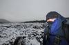

posted on 07 April at 01:15
OMG, this was the best article. Terrific photography. But oh what a trek.