Hopefully I didn't press the friendship too much regarding the last post. Truly, it was a tale about nothing. Don't panic though, there's walking and stuff in this entry.
Before starting, I must mention, Smuffin has complained about swearing, which has been used more frequently in the blog. He noted, "It's starting to lower the overall tone and standard". It's a tough crowd when the bloke who swears like a drunken sailor with a stubbed toe starts to complain about my writing. All I can say is reference to a defendant I saw in court once. He had a limited vocabulary and overused one word (guess what word it was) so frequently it became meaningless. As the magistrate delivered his finding the exasperated defendant paused and then pronounced, "this is just a big bunch of fuck". Not quite Ned Kelly's 'such is life', but a lot more entertaining and it sort of sums up what's happening within the infernal walls of this blog.
So, to the start of the walk. March might be autumn, but recently it feels no different to summer. Continual hot days had me wondering what to expect on this hike. I figured we'd get baked and the first day of the hike fitted the bill. A forecast top of 30 °C would make for a steamy beginning, but at least I knew the strolling wasn't going to be too taxing.
That's until I was making arrangements to leave my car at a caravan park for the week and the proprietor gleefully exclaimed, "Hot one today, but there's rain tonight!" Rain had been a rare event for the previous months, but somehow, starting day one, we were going to get cooked and soaked. All at once.
Anyway, we made it to Apollo Bay and dismounted the Smuffin transport vehicle. Looking around the start line I scanned the sky. Dark clouds hovered inland, but a Jackson Pollock style confusion of floating water vapour hung over the ocean. It could only mean one thing. It was polariser weather.

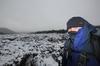
The official start line at Apollo Bay.
Throwing on the backpacks, we powered off into the wilderness and wide blue yonder. The main street of Apollo Bay. I used all my bush skills to avoid a BBQ pavilion without stealing a sausage and the occasional parking vehicle. I kept my head down, whilst bystanders stopped in their tracks and stared. One exclaimed, "Look Mavis! Am I seeing things? I thought they were extinct, but no goddammit, they're hikers!"*
I must say, the opening salvo of this hike is remarkably dull. A stroll next to the road is never much fun, but even more so when there's no shade on a hot day. Our first target was the sleepy hamlet of Marengo a few kilometres up the road.
Guess what? I'm not sure why, but the extraordinarily light backpack was killing my shoulders. You've never heard so much moaning, as I wrestled with the shoulder straps. Not to mention after approximately 375 metres my feet were killing me. I was feeling confused by the amount of agony I was enduring and ended up uttering, "Well, it looks like I'm going to pull the pin at Marengo". If this was to occur, it may have been the most pathetic attempt at a hike ever witnessed and I could see the following conversation occurring.
"The Great Ocean Walk is 110 km. How many did you do?"
"Well, I dug deep, but couldn't go on. I did a solid 2.7 km though".
Maybe it was the 'haven't-walked-in-yonks-blues'? I did have one trick up my sleeve to take my mind off the torture. The polariser. It's glare cutting and contrast enhancing was almost at arousal level. I warn you. Don't be looking at these pictures on the train whilst wearing fine cotton trousers. You may get arrested. The defence, "But Sir! It wasn't my fault! It was the big blokes polariser photos!!" won't get you anywhere. You're better off saying, "this is just a big bunch of fuck!" At least you'll get a laugh from the blokes arresting you.

Passing Barham River with Marengo in sight.
Slogging along the footpath (yes, footpath) it was a matter of keeping eyes left. At least there was the ocean and sights to take my mind off things. The expansive clubrooms of the Apollo Bay Pony Club...

...and an intrepid kite flying pair struggling in the breezy conditions...

...whilst a ship passed through some showers out at sea.

Eventually, we performed frenzied back-slapping, as the first target of the day was reached. If only we had some champagne to celebrate with, whilst exclaiming we were now officially the 'Masters of Marengo'. It took a lot of sweat and toil, but by digging into our genetic 'true Aussie grit', we'd successfully walked 3 km since Apollo Bay. Amundsen, eat your heart out.

Marengo beach.
Some delicate navigation was now required to avoid kids on bicycles, overweight blokes in thongs (Australian thongs) and a shop selling ice-creams, as the track goes directly through the Marengo caravan park.
Finally, exiting the raucous caravanners, the track entered a coastal area and for the first time it felt like I was on a hike, rather than going down to the shops in the suburbs.

There were some impressive looking big grassy things...

...but there were also dark clouds looming.

Now, what else do you need to know? As I've done this hike about a million times, I reckon I can actually offer advice to any punter wanting to do this walk. For a first, I'll include a tips list at the end of each post. It'll be full of wisdom and crap jokes, which is a rarity for this highbrow blog.
The main toss-up for the day though, was do we stick to the beach or take the high tide options? The entire walk has a few of these decisions, but I'll mention more of that later. I can't be giving you tips too soon, can I? We stuck to the beach initially, whilst wondering if we could get all the way to Elliot River without heading inland. The trouble was, on some of the headlands we couldn't see exactly what was to come, especially near Bald Hill.
Smuffin was ahead and powered along the rocks. The thing is, could we stick to these rocks or would we have to backtrack at some point? It may have been the heat, but Smuffin took on a dazed look and continued, whilst ignoring my calls as I became concerned about the way ahead. It went exactly like this.

"Smiranda..."

"Smiranda...Don't go up there! Come back!"

"AAAARRRGGGGHHHHH!!"
If you don't know what's just happened there or what it alludes to, then I pity you. Maybe I'll give you a hint later. Smuffin was now gone and never to be seen again.
As he'd vanished into thin air, I decided to backtrack a little and go inland over Bald Hill. An elevated view might also be quite good for a few photos. It's a pity it took me about three decades to climb this hill, which is about five feet tall. Eventually though, the marker from previous summit attempts was in sight...

...and I crossed the top without using any supplemental oxygen. In front of me the coast unfolded.

As the track plummeted right back to where I started, the beach, as dark clouds began spitting the odd drop of rain.

It was easy going on the beach...

...but there's a problem. As the first light shower arrived, I put my camera away. Normally I also carry a compact as a back-up, but not on this occasion. I couldn't see the point of risking drowning my only camera on the first day, as it would make trip write-ups problematic without any photos.
Smuffin remained vanished, so I followed the beach until taking an inland section called the 'Three Creek Circuit', which avoids Shelly Beach. Mind you, this was not a solo crowd pleaser. See my tips for what I mean.
Under the trees, the return of the sun allowed the camera to come out again, as I did a little inland strolling.

...before the track again plummets back to sea level and crosses Elliot River. I really should have more photos, but for some reason I don't. I think it may have something to do with steep climb immediately after the river crossing. Rising up with not a zig-zag in sight, was a bit of a ball-breaker in my supremely unfit condition.
I think I was the happiest man alive, when I stumbled across the sign indicating Elliot Ridge campsite. Who should already be there, lounging around? Well, Smuffin of course, complaining why it took me so long. After his vanishment, I assumed he'd gone the same way as Flight 19, but in reality, I must have climbed so slowly up Bald Hill (I did), he'd simply gone out of visual range.
It was all pretty good timing. We were well and truly set up when heavy rain arrived. The hike has a shelter at each camp, so it was pretty casual fare relaxing under cover. As it was getting late in the day, Smuffin was feeling confident no one else would be arriving, so we'd have the walk to ourselves. My previous experience of this hike though, was someone always lobs up late in the day and on this occasion it was no different.
Out of the gloom arrived a couple who would end up accompanying us for the entire week. Their names were a bit too complicated for us Aussie speech mangling clowns, so they became known as 'Harold and Maude'. Why those names? Well, there is some semblance to their real names in that moniker. Mind you, some, but not much. As in none.
Anyway, they introduced themselves as the 'Rockets from Rotterdam' and proceeded to unfurl their gear, which appeared to be brand new. It was also the first appearance of the Steripen. Rain water tanks are at each camp, but a cautionary sign proclaims, 'untreated rain water'. Yep, that rain water will kill you if you're not careful. Harold was perturbed though. After filling up from the tank, he spotted a wriggler in the water. Us yokels know a wriggler in a rain water tank is just a mosquito, but 'Big H' yelled, "There's a fish in the water!!"
Luckily for him, the Steripen was able to work its glowing magic...

...and that my friends, is the first day done. It was a day of heat, rain, vanishing men and uncalled for fish. What's next? Well, of course it's the inaugural...
Big Greg's GOW Tips of the Day.
This is easy. On my first GOW I parked my car near the end at Princetown and caught the V/Line bus back to the beginning. During the hour journey, the driver informed me he was going to drop me off at Marengo, rather than 3 km further to the official starting point of Apollo Bay. I asked him why he would do this and he replied, "Because the start is crap. Walking along the road. Trust me, it's better to start at Marengo." Listening to the locals sounded like a good plan, but I didn't really have an option. At Marengo he stopped and threw me out.
On my second trip, I began from the official kick-off point at the Apollo Bay Information Centre. What I discovered was the bus driver is quite correct. It's only a few kilometres, but it really is kinda crap and annoying. So, if a bus driver wants to throw you out at Marengo, just relax and let him toss you to the side of the road like a Christmas tree in January.
Next up, the map. There is an official GOW map. I bought one in 2010, plus the latest updated version. Along the entire walk there are numbered 'Decision Point' signs at various points. You know, if the tide is dodgy, take a high-tide route. No problem, but it seems a little weird the current map no longer has the numbered 'Decision Points' on it. My 2010 map does though. Mm...
This leads me to this entire first leg. If the tide is out, follow the beach. The rock shelves aren't too gnarly, there's little sand to get bogged down in and it's a lot more cruisy. No more so than the section which avoids Shelly Beach. I kid you not, but if you stick to the rocks you'll walk about 300 metres, but the inland avoidance section will take you on a 1.5 km stroll up and down hills before finally returning a minuscule distance from where you started. If you want views, then take Bald Hill, as that will give you the best elevated look of the coast. Don't bother to look for it on the map though. It's not marked, but on the actual walk it's signposted. Supplemental oxygen is your choice though.
Here's the GPS route for the day. Mind you, Garmin Connect revamped their website and it's thrown up some bizarro results. As per usual, it appears Garmin have replaced a quite functional website, with something a little odd. Mainly to do with elevation corrections. So, what you're looking at may be correct or it could be complete crap. I'm sorry, but it's all care, but no responsibility in this place.
I think that's it? Next up. The terrifying slog to Blanket Bay. Oh yeah, maybe you're still a little confused by the earlier 'Smuffin vanishing' sequence? Hopefully this will help you out.

* - The character depicted in this work is fictitious. Any resemblance to a real person is purely coincidental. Even though it's mighty believable.