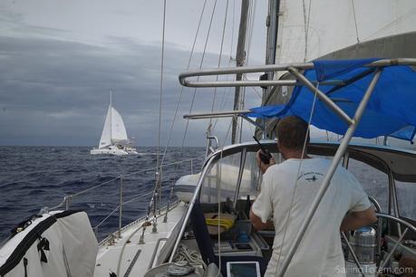
Changing plans, unexpected events, and making the most of where you are: this may just be the definition of cruising. From the Bahamas, our intention was to pass through the various Virgin islands (Spanish, US, British) where we had places to go and people to see. From the BVIs, the focus would shift to a southbound track towards Grenada.
Unfortunately getting east from the Bahamas at this time of year is, in a word, unpleasant! We ran out of patience to wait for a system that would disrupt the prevailing easterlies. Ideally, that would allow us to take “I-65” (make easting to 65 degrees longitude, then drop south). But there was no reprieve, and bashing into tradewinds isn’t very fun.
Enter Bruce Van Zant’s “Thornless” approach to routing from the Bahamas to the Caribbean. His alternative is to work along the coast of Hispaniola in daily hops, playing katabatic winds. Transit is made at night, when cooling air rushes out from the land and dampens trades to make easting easier. The trades pick up again by 10:00 in the morning: we’d aim to be settled in an anchorage by then, and rest until the evening settles the breeze again. In company with the family on their Manta 42, Akira, after the washing-machine seas south of Great Inauga it was a pleasant reprieve to follow this method along the north coast of the Dominican Republic—making progress at night, and tucking into anchor when the winds piped up during the day.
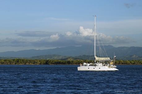
Akira anchored off the lush coast of the Dominican Republic
Lush green hills of Haiti and the glorious aromas of tropical flora drifting to Totem were the first signs of a changing landscape. Balm to our parched souls after months in the flat, arid Bahamas, we watched longingly from the water. It wasn’t our plan to clear into the Dominican Republic at all, but remain on our boats during the brief stops and request safe harbor if pressed by officialdom. It stung to skip what is clearly a beautiful, fascinating place. It’s just the wrong time of year: in hurricane zone, during the season. As we watched a succession of early tropical storms marching across the Atlantic it was easy enough to be reminded that we needed to work towards safer water.
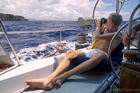
Niall scans the Dominican Republic coast from Totem’s cockpit.
Steady progress across the top of Hispaniola was interrupted when Akira’s engines started giving them trouble. The cause was indefinite—a bad connection, probably, but definitely dirty fuel as well. Totem could well be next to suffer since we topped up diesel from the same source in Great Inagua. The prudent choice was to take shelter, polish fuel, and figure out the root cause of engine troubles. So much for our perfect weather window to cross the notorious Mona passage to Puerto Rico! A squall slammed through during the entry to Samana bay, a timely reminder of our fragility with engine troubles on a lee shore. Tracking the squall with eyeballs and radar, we avoided it as best we could, and safely anchored a short time later off the town of Santa Barbara.
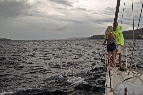
Mairen and Niall, dolphin spotting in Samana bay after the squall rolled by
If there was an MVP prize for gear that afternoon, it went to the radar. I’ve seen the question often enough: do you use radar? Or a variation: with AIS, why is radar really important? Not only is radar an essential tool, but it’s an entirely different one from AIS: here’s why.
Squall tracking
Our situation off the coast of the Dominican Republic is an excellent example of radar use for squall tracking. Even in daylight, where we can see the location and approximate progress of a squall, radar provides valuable insight into a squall’s course and speed, how it expands and contracts, the better to prepare and evade. That squall ended up packing 50 knots, and we wanted to be out of it ASAP for a host of reasons! Tracking squalls so we can try to avoid or minimize our exposure to them is our #1 use of radar. AIS has zero function here.
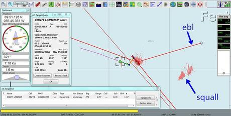
Using EBL on radar to track a squall
This snapshot shows a squall to the southeast of Totem’s position as we sailed up the Atlantic last year. Placing an EBL (electronic bearing line) on the squall’s radar footprint made it easy to track: was approaching or retreating? With the EBL holding a fixed position relative to Totem, this shows we’re moving away on our course to the northwest. Eyeballing the footprint shows how it’s growing (or not), but additional marks can be laid on the squall’s footprint as well.
Per the cruiser version of Murphy’s law, all this action (hello cargo ship at speed!) is happening at two o’clock in the morning: it was probably challenging pick out the squall at that hour with eyeballs alone.
Chart accuracy
Radar can help validate that your charts for remote-country-of-the-moment are reasonably accurate. Charts are fallible (witness the recent tragic, avoidable loss of the catamaranTanda Malaika on a reef in French Polynesia). We’ve had errors of up to a mile in countries from Mexico to Tonga. Whether you overlay radar on your chartplotter or compare ship-to-shore distances on different screens, this is a great safety aid. Again, AIS has zero role here. I’m trying to think of where we have seen aids to navigation with an AIS signal outside the USA… there were some oil rigs off Brunei… others probably exist but I can’t recall them. Such aids may be present and growing in developed countries, but not most of the places we’ve been cruising. The bamboo stick on a coral head is more likely to suggest the pass in an atoll.
This snapshot of the south coast of Phuket, Thailand, shows radar overlay on OpenCPN helping validate the accuracy of our charts. The Thai coastline lines up well, as do the blips that match with boats and buoys.
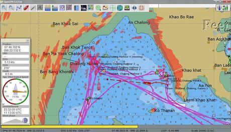
Radar testing off Phuket
Spotting vessels
Using radar to see other boats, in particular for collision avoidance, the why most people confuse the value add of radar compared to AIS. And yes, both radar and AIS are very helpful tools for identifying and avoiding other boats.
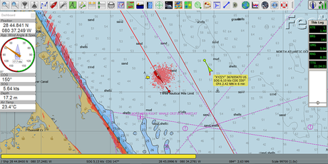
Florida coast: a radar blip and AIS data show the yacht XYZZY passing offshore from Totem during an overnight coastal transit.
Leave the USA, and how many boats use AIS? The further from the developed world you go, the less it is used, up to the point where it’s a surprise to see a boat that actually is using AIS. AIS is mainly useful for big ship avoidance at sea, and has pretty much nothing do to with avoiding coastal traffic… which, it turns out, is where most of the boats you’re trying not to hit are located. Case in point: most of those blips on the radar screenshot of Thailand are other boats. Only four have an AIS signal.
Sailing through Sri Lanka, Totem skirted coastwise around the south of the island in the dark night of a new moon. One fleet of fishing boats after another dotted the radar. The smaller boats were difficult for our radar to pick up, but careful tuning and a watchful eye usually tipped us of. They DEFINITELY didn’t have AIS, however… the boats were inconsistently lit, if they were lit at all, and had probably never heard of COLREGS. This situation repeats itself all over the world! Radar was a meaningful help; even more important, though, was eyes on watch all the time to avoid fishing boats and their nets.
Radar vs AIS
For boaters in North America with relatively limited experience, I can see how they may confuse the radar/AIS case. AIS is so common on boats! Charts are accurate now! What, squalls? They have a lot of safety nets, and not a lot of squalls. But spend any time in the tropical belt, and squalls rule: tracking them is key. I think that’s hard to appreciate when you haven’t experience this, just as it’s harder to appreciate trying to navigate an obstacle course of small fishing boats (or FADs, fish aggregating devices) on a moonless night. There is nothing at all interchangeable about radar and AIS. They are different tools: different sources of information to help clarify some navigation situations.
Would you go without?
There was a stretch in Southeast Asia where Totem didn’t have a working radar. A near lightning strike was the likely culprit in failure of the installed unit. Between being remote, and low on funds, it took a couple of years to replace. This was particularly stressful at times as the incidence of lightning is high in the Malaysian waters we subsequently sailed through: a radar to assist with squall tracking was sorely missed!
Around the same time as we finally replaced the radar, a new AIS unit was put in. When we left the USA in 2008, only receivers were available for private boats: we could see commercial ships, but couldn’t send our own signal. Receiving AIS is great, but since installing the transponder we’ve noticed commercial ships alter course a tiny bit, from miles away, to ensure sufficient sea room. It’s tremendous peace of mind.
I’d prefer to never to go without either of these very useful tools on board, but if I had to choose one, we’d have radar instead of AIS.
Meanwhile on Totem
So…. our path has meandered more than hoped. It’s been nearly a month in Puerto Rico already! That’s another story.
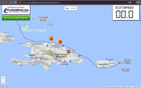
Our Totem’s track from the Bahamas through Puerto Rico
Slow though our progress may be, the unexpected is to be anticipated in the cruising life. Stopping in Samana Bay introduced us to people, flavors, experiences that have added to our world.
The agent Chicho, who made himself invaluable during our whirlwind stay: interpreting to ease our rusty Spanish, greasing the skids for us to go ashore (despite not clearing in officially, something he also facilitated), pointing us to some truly spectacular barbecued chicken (the same that the Trio Travels crew sent us to, oh wow, it was SO good!), helping us with a side fuel purchase (again, not cleared in!), and talking story (he worked on the wreck of a pirate ship just yards from where we anchored and was full of fascinating information). Boats going to Samana: if you anchor out, this is your guy.
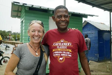
Our intrepid, gregarious self-starter agent in Samana. Thanks Traci for the pic!
The opportunity to pick up fresh fruit and vegetables, and a pack of kids to help carry it all back to Totem (not to mention, make it more fun! Our girls loved especially loved hanging out with Emma from Akira).

Our first grocery since the Bahamas: yay fresh produce! Kids a big help to carry it all back to Totem.
Soaking in the bustle of the local market, and slowly remembering how to stumble along in Spanish.
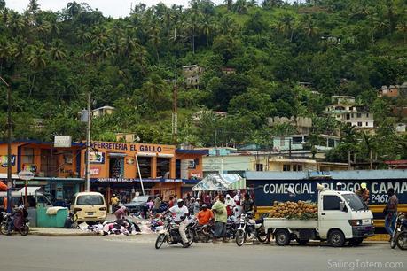
Sweeeeeet sweet pinapples at the Santa Barbara market
Above it all, the kindness of our fellow humans.
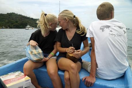
Ferried back to Totem by a helpful panga, with BBQ takeout for Jamie coco frio in hand

