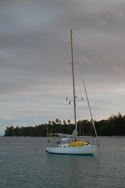
Totem at rest off Mios Mangwandi, in the Padaido Islands
Our first goal is to get from Jayapura to the Padaido Islands, just southeast of Biak. We know our speed will be slow, whether as a result of the wind/current or a deliberate action based on logs, so expect it will take a few days if we can press straight through- but easily more than a week if we determine we can move during daylight hours only.
After the bright lights, floating garbage, and mosque megaphones of Jayapura- the coastline to the west is almost eerily wild. Once again, there are no lights- just the occasional firelight flickering, although soon enough we're not close enough to see even those. In fading evening light, the coastline screams upward into mountains, lush and densely green. Clouds obscure the top, reaching with misty fingers towards the sea. We crack bad jokes about returning to Jurassic Park, but still half expect to see a pterodactyl overhead.
Most of our worries do not play out. We bump into three logs in the first hours out of Jayapura, where a relatively confused sea state makes it difficult to see and anticipate any impact. But conditions soon mellow out, fewer logs are seen, and ultimately we decide we feel entirely comfortable continuing overnight. Every day we watch conditions and re-evaluate. The current is generally neutral, with periods of a slightly foul flow. The debris in the water isn’t significant, even as we cross in front of rivers. There’s a considerable amount of large boat traffic, but it’s all four to five miles offshore- we stay about eight miles out and have a clear path. Unfortunately there’s no wind for sailing, and the passage is almost entirely a motorboat ride. We get just enough to motorsail a few times. It’s a big help for fuel efficiency, but we’d rather just be sailing.
We experience an anomaly: at one point, our transducer reads a water temperature that suddenly dips from around 90 degrees down to a cool 68. It lingers there for a few minutes, then pops back up to near 90 again. We’re near a trench and assume it’s part of an upwelling. Ideally this would translate into a great place for fishing, but our lines are empty.
It’s not until the last morning- our fourth calendar day out- that we get some truly snotty weather. Ironically it is just as we in the final 15 or so miles coming into the islands where we hope to anchor. This has been something of a theme for us in recent months: squalls that hit just as we are in the home stretch or entering a harbor. Not the best timing, but it’s all fine, and Totem soon rests peacefully in the lee of a sweet looking island.

